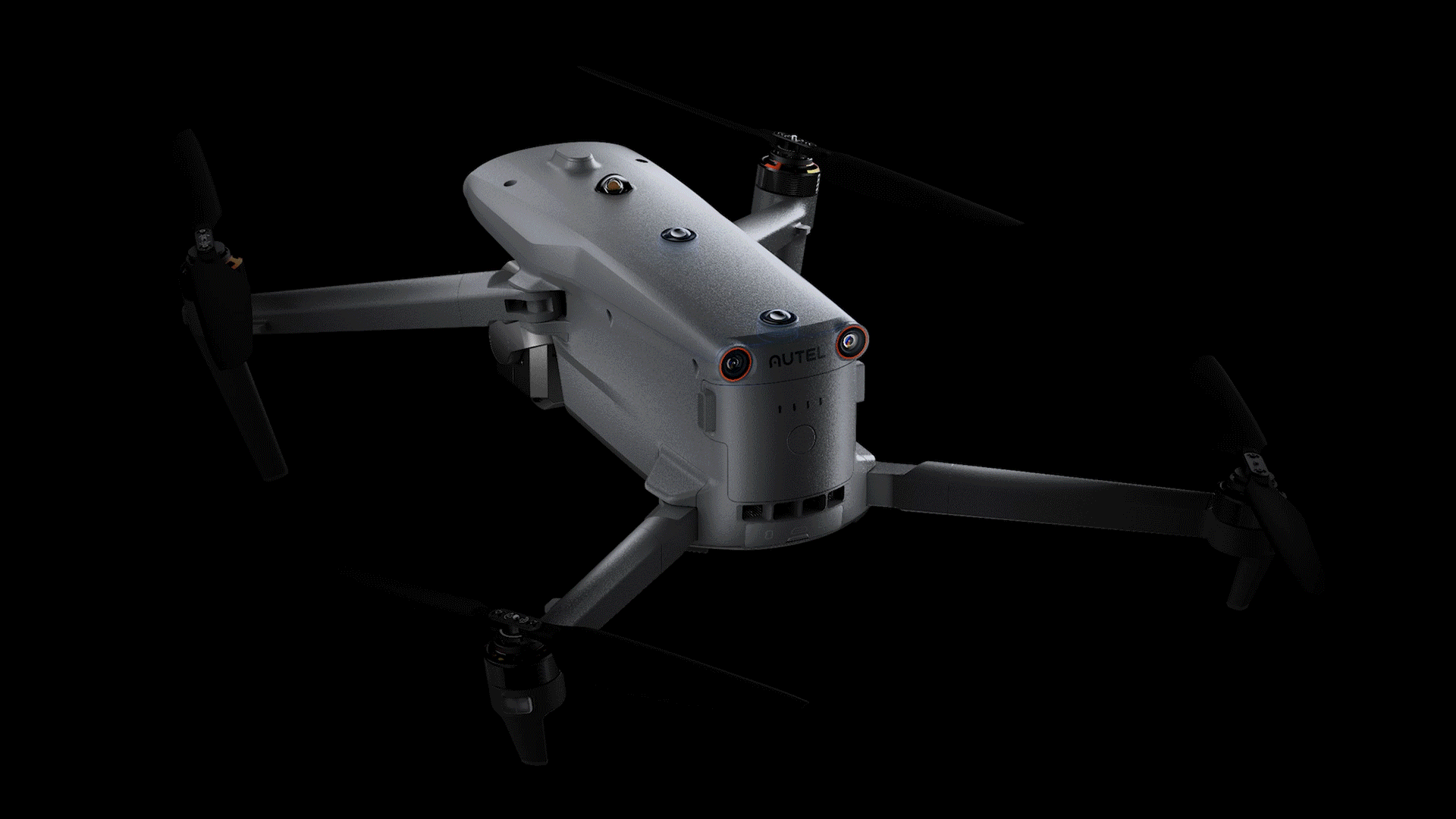
EVO Max Series


Reach New Frontiers

Reach New Frontiers

No Blind Spots
Anti Interference
Reach New Frontiers
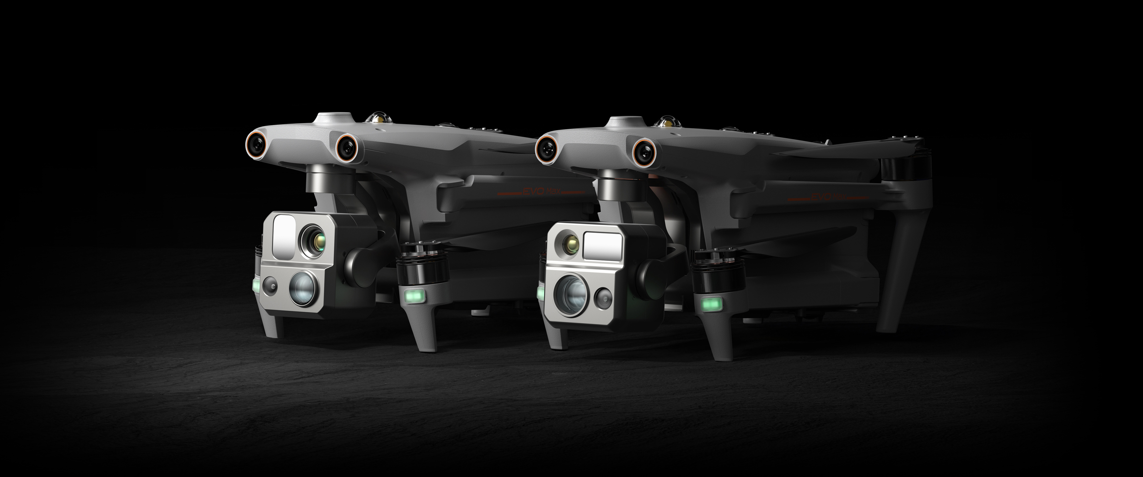
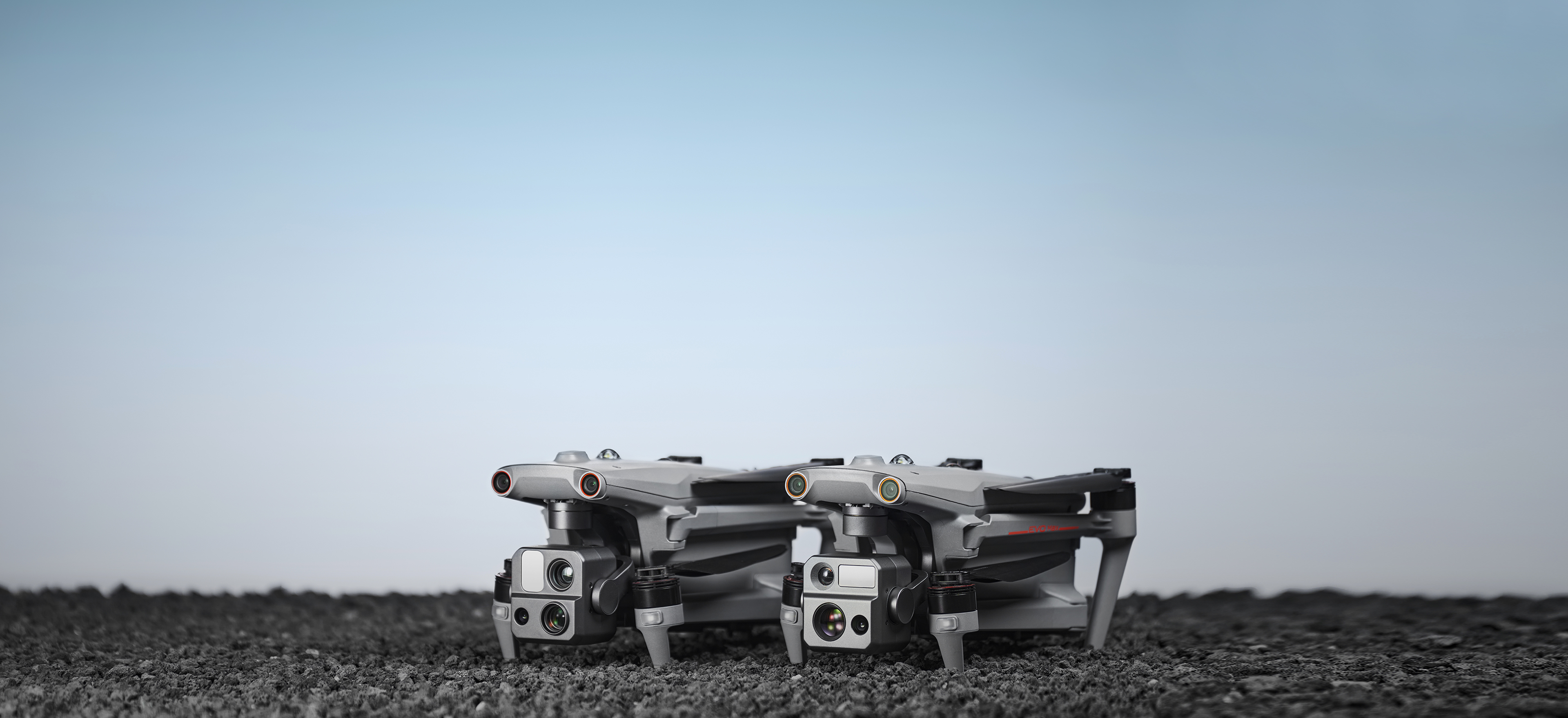
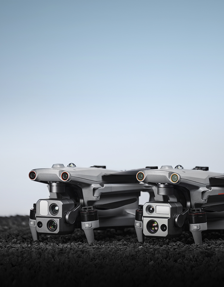
The EVO Max series adopts Autel Autonomy's autonomous flight technology, achieving global path planning, 3D scene reconstruction, autonomous obstacle avoidance, and return-to-home in complex environments. With the capability of precise navigation without GNSS, it offers high-precision visual navigation in scenarios where GNSS signals are blocked, weak, or heavily interfered with, ensuring stable and reliable flight with high accuracy and low latency. The industry's first A-Mesh networking technology supports the free networking of multiple devices, achieving integrated air-ground network coverage. Featuring a "dual fisheye vision + millimeter-wave radar" multi-sensor fusion perception technology, it has 720° omnidirectional sensing and obstacle avoidance capabilities, enabling all-weather operations. The EVO Max series is equipped with the FusionLight camera 4T and FusionLight camera 4N, integrating a zoom camera, an ultra-starlight level night vision camera, an ultra-sensitive wide-angle camera, a thermal imaging camera, and a laser rangefinder. It efficiently empowers public safety, energy inspection, emergency management, and other fields, setting a new benchmark for industry applications of drones.
 720° Obstacle Avoidance
 Superior Anti-Interference Capability
 High-Precision Visual Navigation
 A-Mesh Self-Organizing Network
 8K 10x Optical Zoom Camera
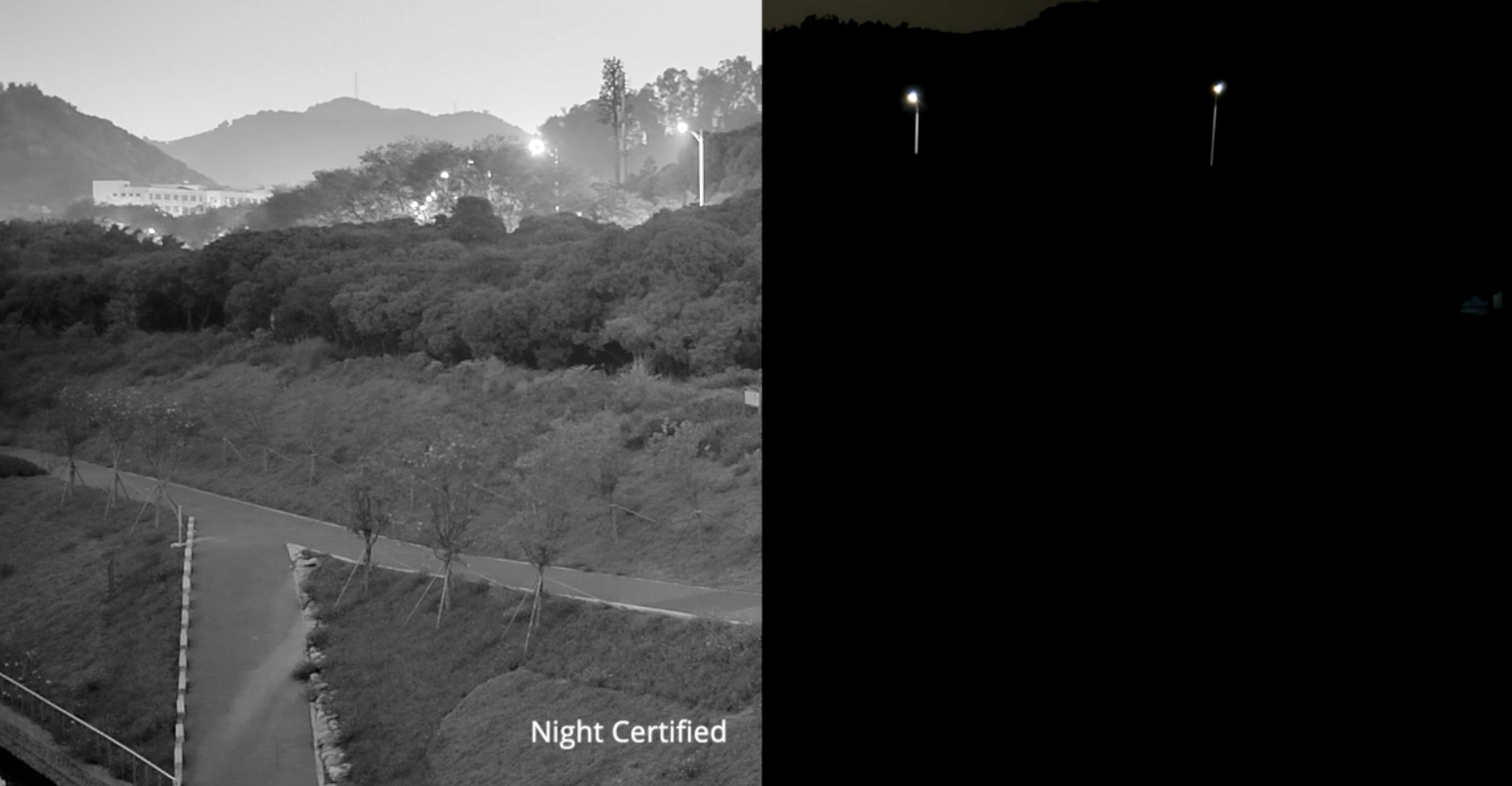
 Superstarlight-Grade Night Vision Camera
 Hot-Swappable Battery
 20-Kilometer HD Video Transmission
- 42 Minutes of Enduring Endurance
- IP43 Protection Rating
-
Autonomous Flight PlanningUtilizing Autel Autonomy autonomous flight technology, the system gathers real-time environmental data to achieve global path planning, 3D scene reconstruction, autonomous obstacle avoidance, and return-to-home capabilities in complex environments such as mountains, forests, and urban areas. This empowers industries such as security, inspection, and mapping.
-
High-precision visual navigationIn scenarios where satellite signals are obstructed or weakened between urban buildings, high-precision and low-latency distance and coordinate information can still be obtained. This is achieved through SLAM (Simultaneous Localization and Mapping) visual navigation technology to enable stable flight with high-precision indoor and outdoor navigation positioning capabilities.
-
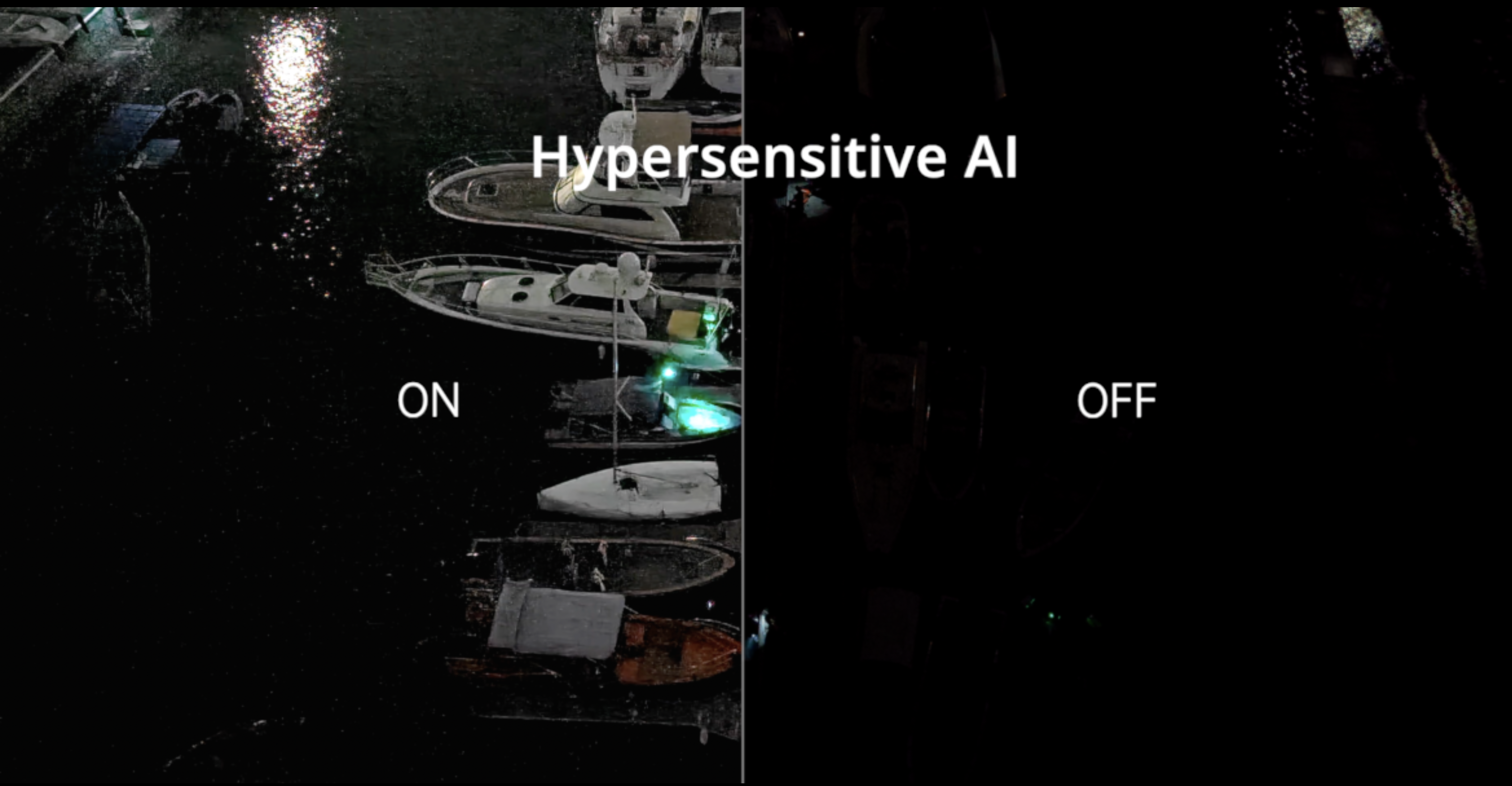
Accurate Object Identification and TrackingFlexibly accommodating various payloads, based on AI image recognition technology, the system automatically identifies and precisely locks onto different types of targets within the observation area, such as heat sources, moving individuals, and vehicles, enabling high-altitude tracking and data collection.
720° Omni-directional Obstacle Avoidance
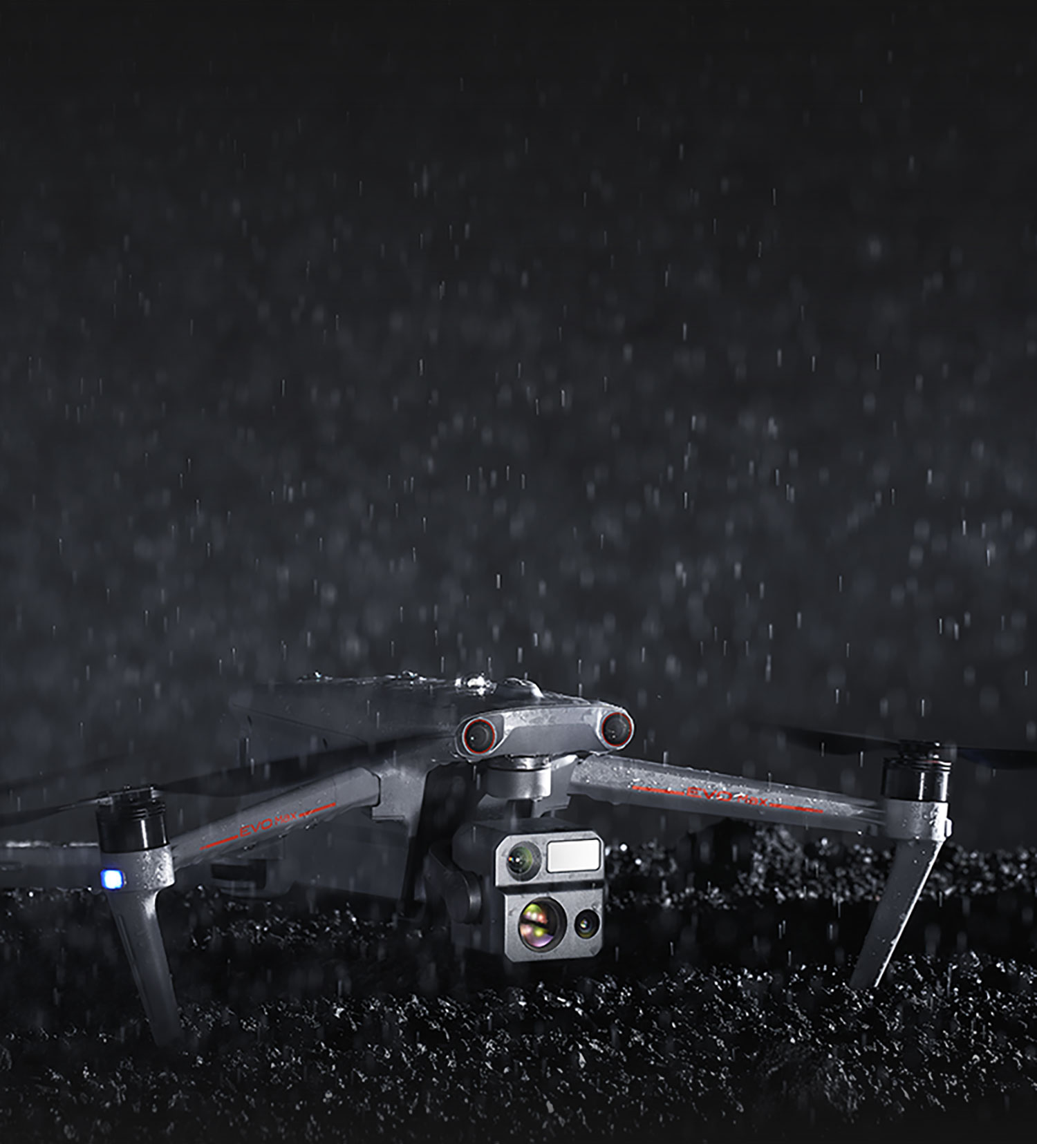
All-weather Operation
The EVO Max series adopts a multi-source sensor fusion perception technology combining "binocular fisheye vision + millimeter-wave radar", providing 720° omni-directional perception and obstacle avoidance capabilities. It supports all-weather operations, overcoming complex working environments such as water surfaces and high-voltage power lines. It can penetrate dust, fog, rain, and snow, remaining unaffected by harsh weather conditions. Even at night, it ensures flight safety.
Superior Anti-interference
More Stable Flight
Superior Anti-interference
More Stable Flight
The built-in flight control computing unit, GPS receiver module, and image transmission module enable the EVO Max series to identify flight control interference signals and satellite positioning interference signals, providing outstanding anti-interference capabilities. This equips the EVO Max series with reliable flight stability.


Industry-First Integrated Air-Ground
A-Mesh Networking Solution
The EVO Max series features the industry-first A-Mesh networking technology, enabling multiple devices to form a free network between drones, drones and ground terminals. It supports various modes such as "one control, multiple drones" and "master-slave dual control". Even in scenarios involving long-distance flights, obstacle traversal, flying around mountains or buildings, or even in areas with no network coverage, it can establish a free network among multiple devices within the network, enabling collaborative operations. This breaks through the operational boundaries of conventional drones, achieving integrated air-ground network coverage and confidently dealing with complex terrains.

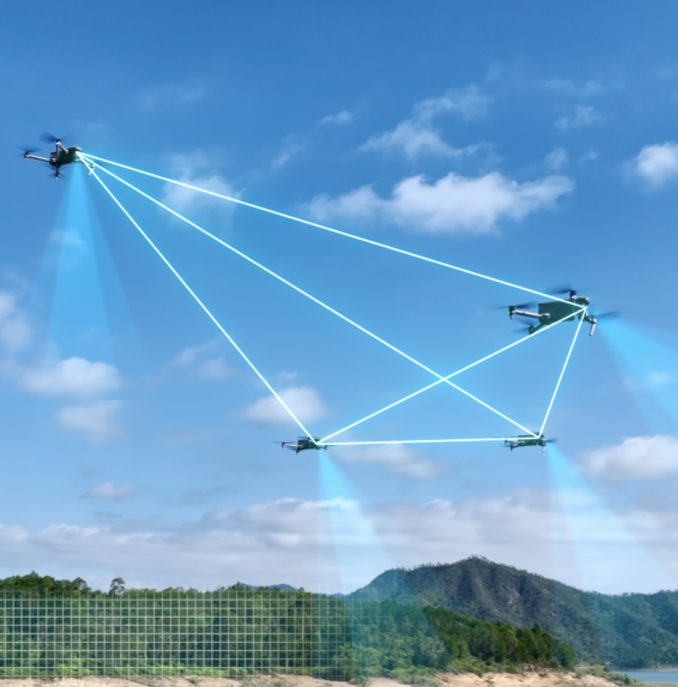

Long Communication Distance
The drones in the A-Mesh network serve as both relays and task units, participating in data transmission, command forwarding, and task execution. The communication distance between them and the ground control station can extend from 50 kilometers to 100 kilometers.

Beyond-Line-of-Sight Applications
During the execution of tasks by a single drone, there is a problem of communication links being obstructed by physical barriers. In the A-Mesh network, each drone can serve as a relay, facilitating relay operations in beyond-line-of-sight scenarios.

Enhanced Anti-Interference
The drones in the A-Mesh network adopt a decentralized structure, meaning the failure or temporary exit of any node does not lead to the collapse of the entire system, significantly enhancing the system's anti-interference capability.

Diverse Functionalities
The A-Mesh network possesses the functionalities of all terminals, with drones complementing each other's advantages and cooperating in multi-drone operations, making it suitable for sectors such as public security, firefighting, electricity, water resources, forestry, broadcasting, medical services, and maritime affairs.
Autel SkyLink 3.0
Upgraded Performance

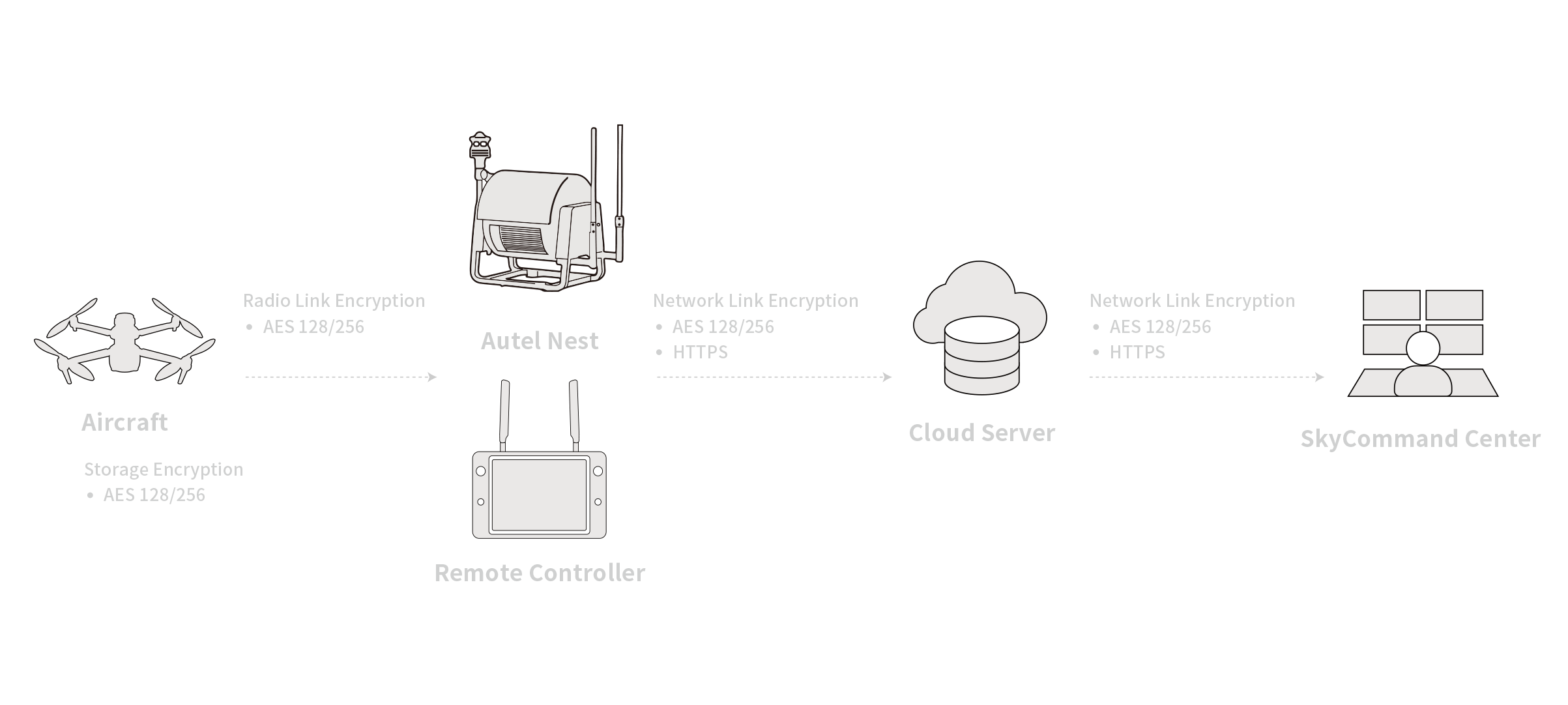
Equipped with four image transmission antennas, capable of two-way signal transmission and four-way signal reception, the EVO Max series achieves a communication distance of up to 20 kilometers between the drones and ground control station. It supports adaptive frequency hopping transmission in four frequency bands: 900MHz, 2.4GHz, 5.2GHz, and 5.8GHz, automatically selecting the optimal channel based on electromagnetic interference conditions, demonstrating strong anti-interference capabilities. Real-time transmission quality reaches 1080P@60FPS, with a high transmission rate of 64Mbps and low latency transmission of less than 150 milliseconds. Both image transmission data transmission and storage utilize AES-256 encryption to ensure that communication data between end points is not intercepted.
Equipped with four image transmission antennas, capable of two-way signal transmission and four-way signal reception, the EVO Max series achieves a communication distance of up to 20 kilometers between the drones and ground control station. It supports adaptive frequency hopping transmission in four frequency bands: 900MHz, 2.4GHz, 5.2GHz, and 5.8GHz, automatically selecting the optimal channel based on electromagnetic interference conditions, demonstrating strong anti-interference capabilities. Real-time transmission quality reaches 1080P@60FPS, with a high transmission rate of 64Mbps and low latency transmission of less than 150 milliseconds. Both image transmission data transmission and storage utilize AES-256 encryption to ensure that communication data between end points is not intercepted.
-
20 Kilometers
Image Transmission Distance
-
<150ms
Latency
-
1080P@30FPS
Real-Time Image Quality
900MHz/2.4GHz
/5.2GHz/5.8GHz*
Frequency Bands
*While 900 MHz only to FCC regions,
5.2 GHz is
applicable only to FCC, CE, and UKCA regions.
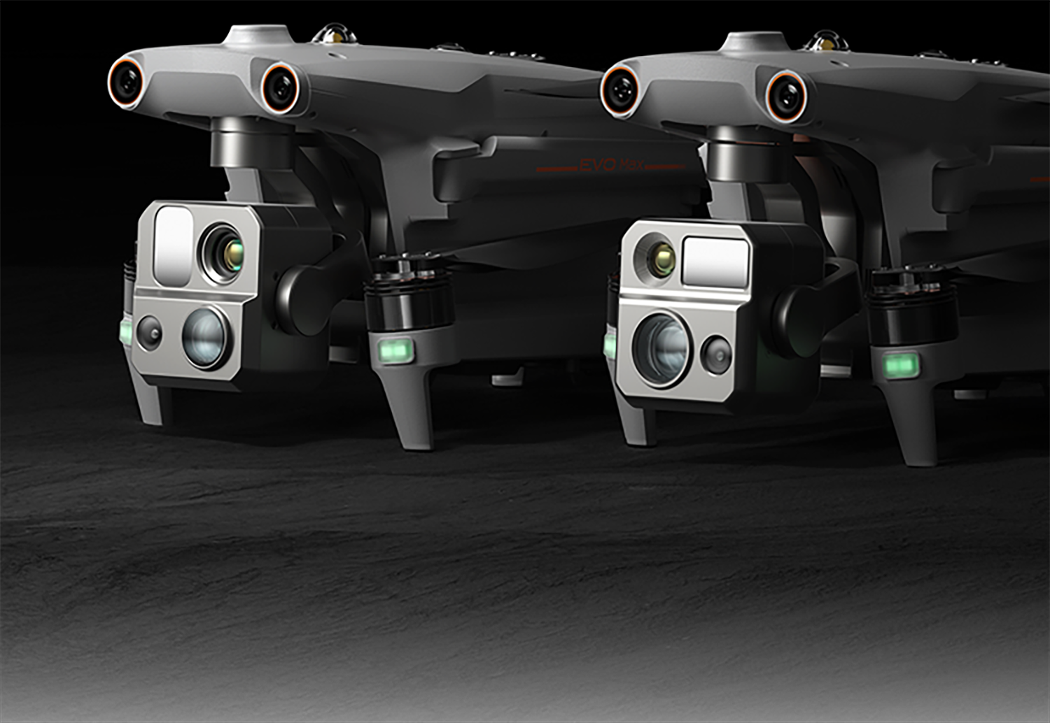
Mission Ready Payload
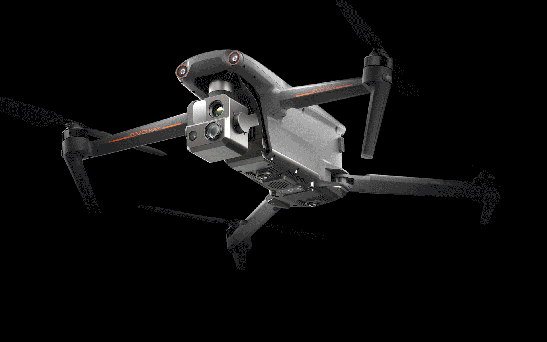
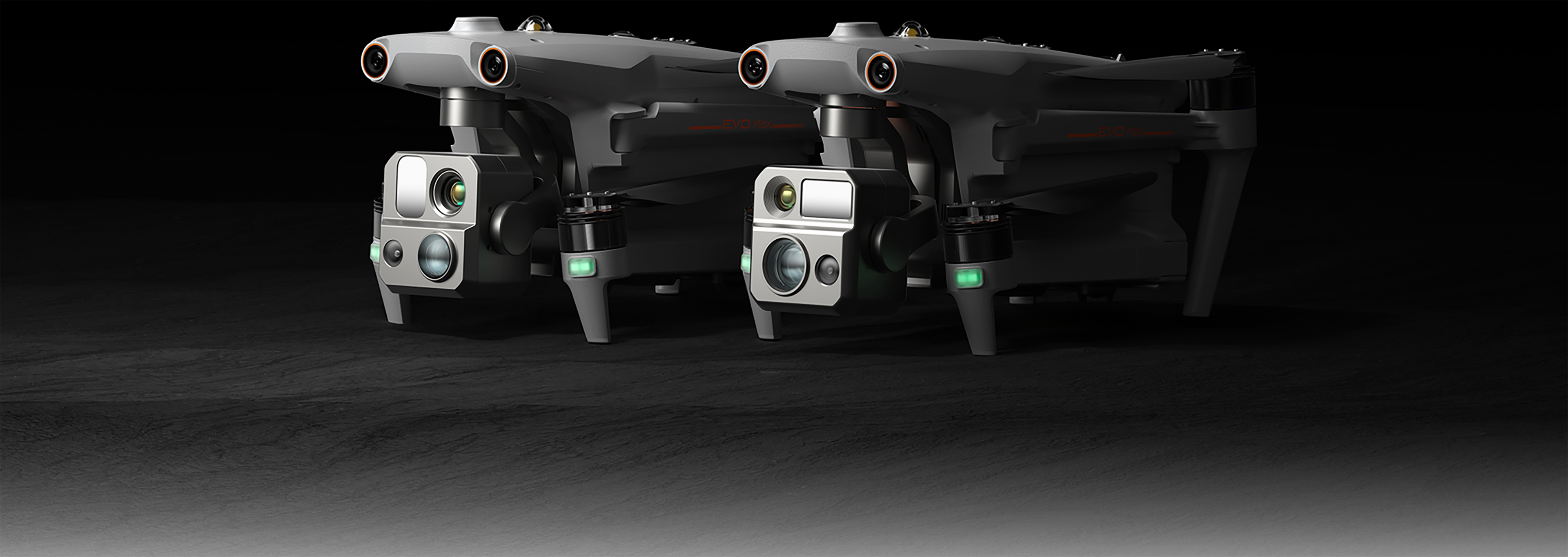
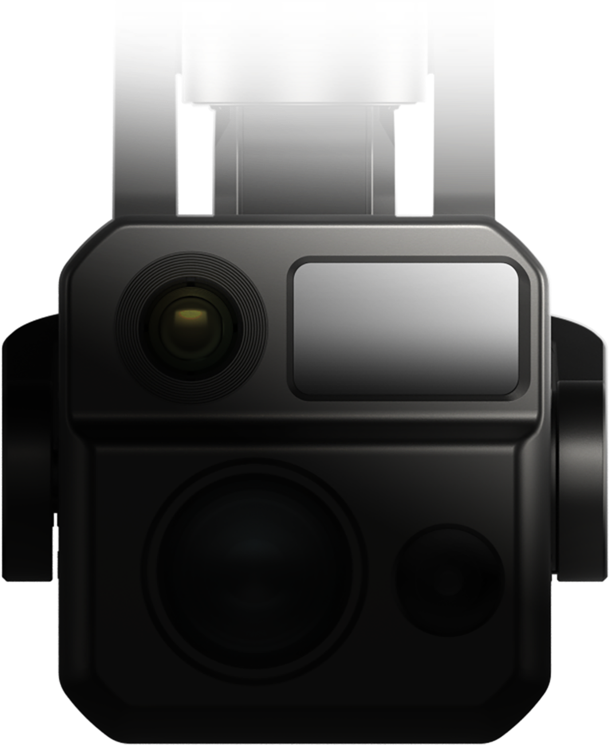
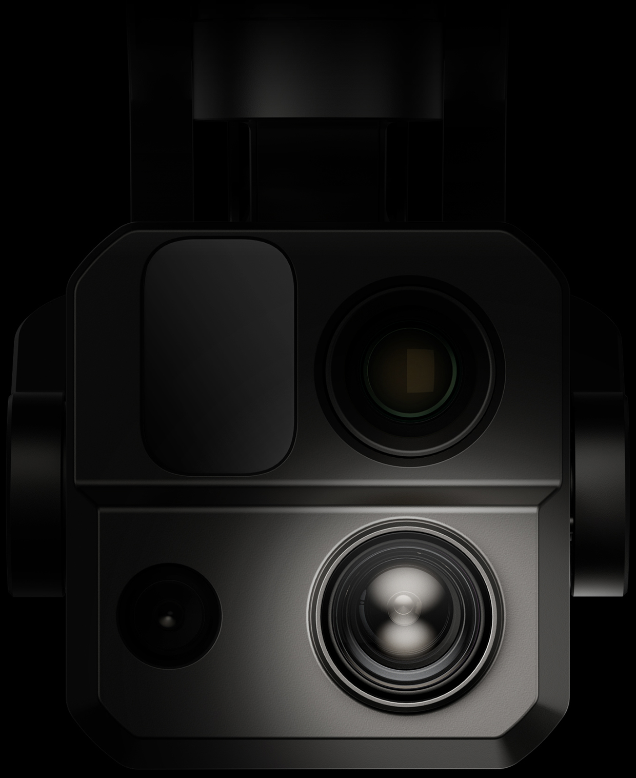
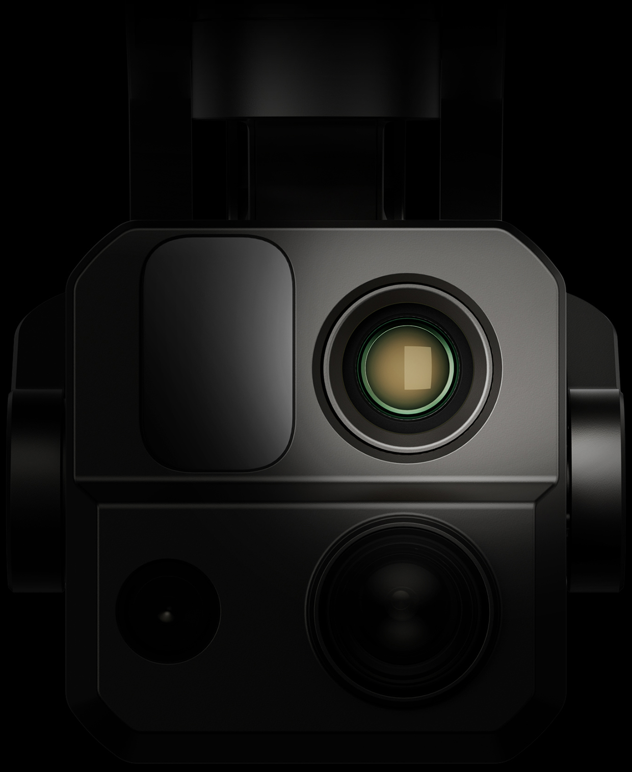
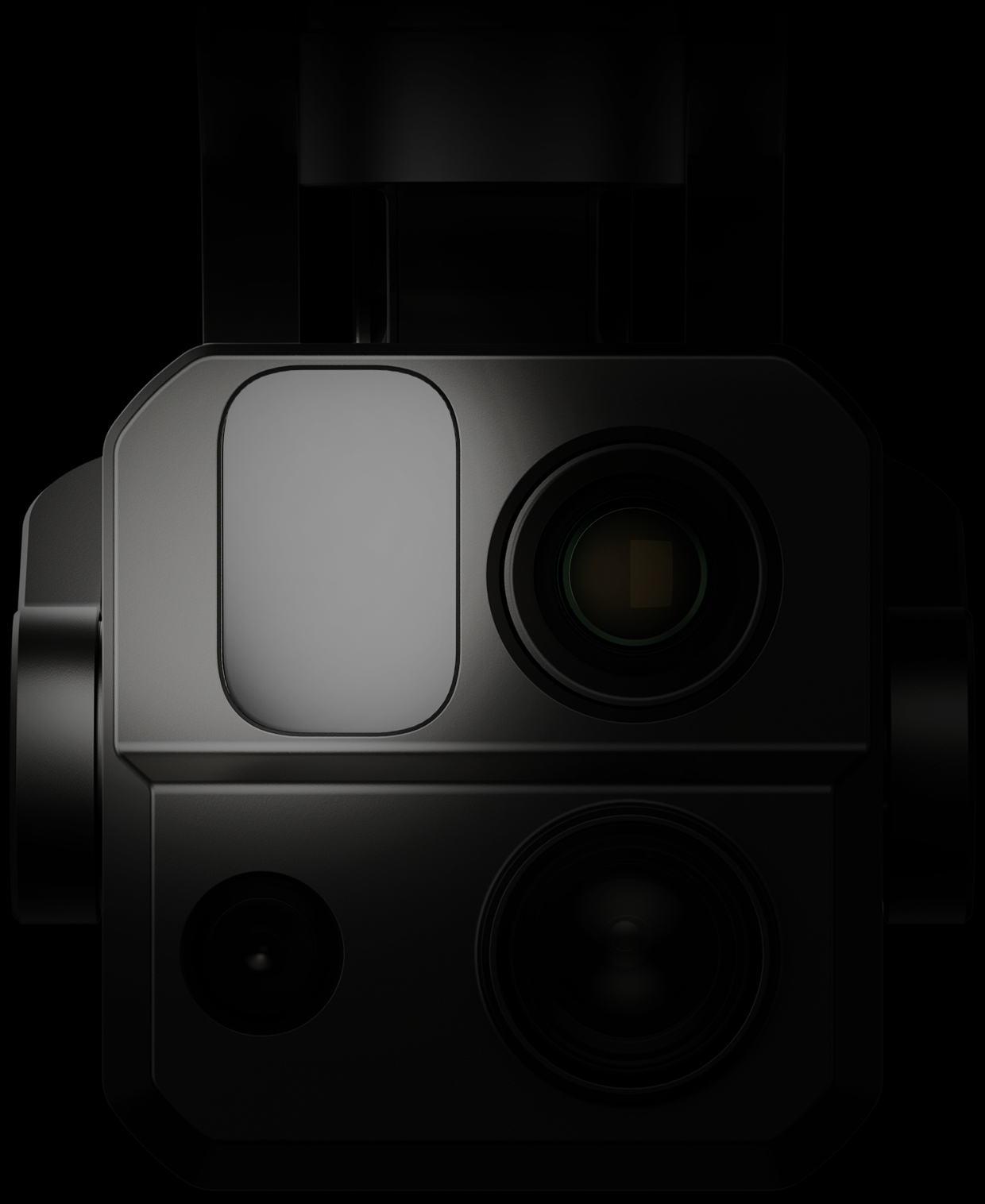
The EVO Max 4T integrates a 160x zoom camera, a super-sensitive wide-angle camera, a thermal imaging camera, and a laser rangefinder. Additionally, the EVO Max 4N, equipped with a super-starlight-grade gimbal camera, integrates a super-starlight-grade night vision camera, a super-sensitive wide-angle camera, a thermal imaging camera, and a laser rangefinder. Intelligent coordination between multiple sensors enables seamless all-weather operations like never before.
-
Explore the Night
EVO Max 4N
Super-Starlight Night Vision Camera
2.3MP
LUX: 0.0001, ISO: 450000
Equivalent: 41.4 mm -
Super-Sensitive Wide-Angle Camera
50MP
1/1.28" CMOS
Aperture: f/1.9
DFOV: 85°
Equivalent: 23 mm -
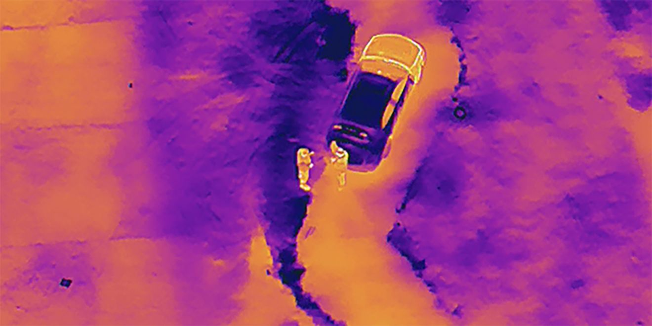
Thermal Camera
640×512, Focal Length: 9.1 mm
16x Digital Zoom
Range: -4 ℉ to 1022 ℉ -
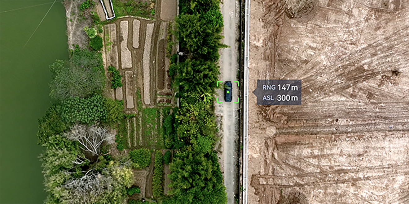
Laser Rangefinder
Measuring Range: 16.4–3737 ft
Measurement Accuracy: ± (1 m +D×0.15%)
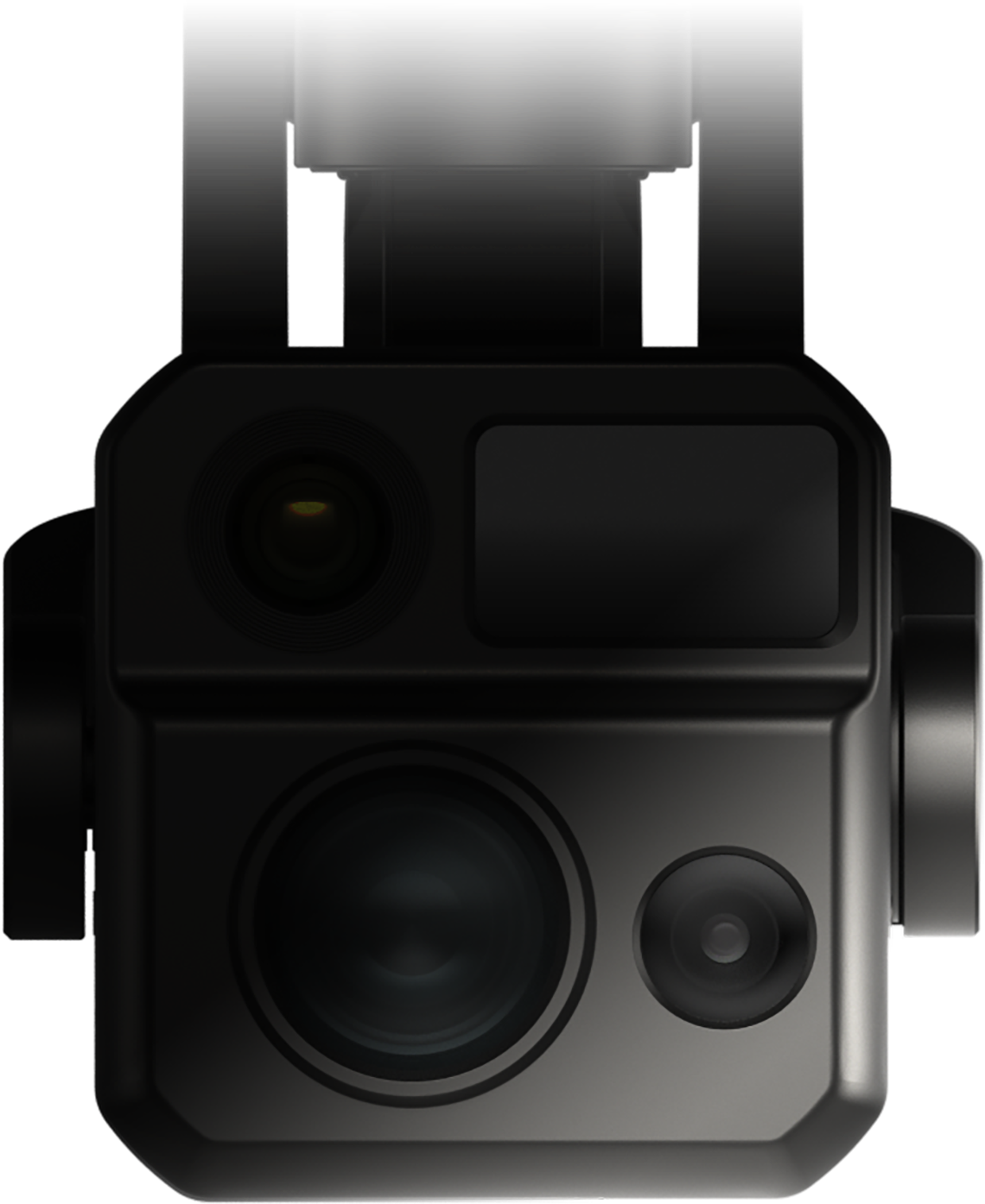
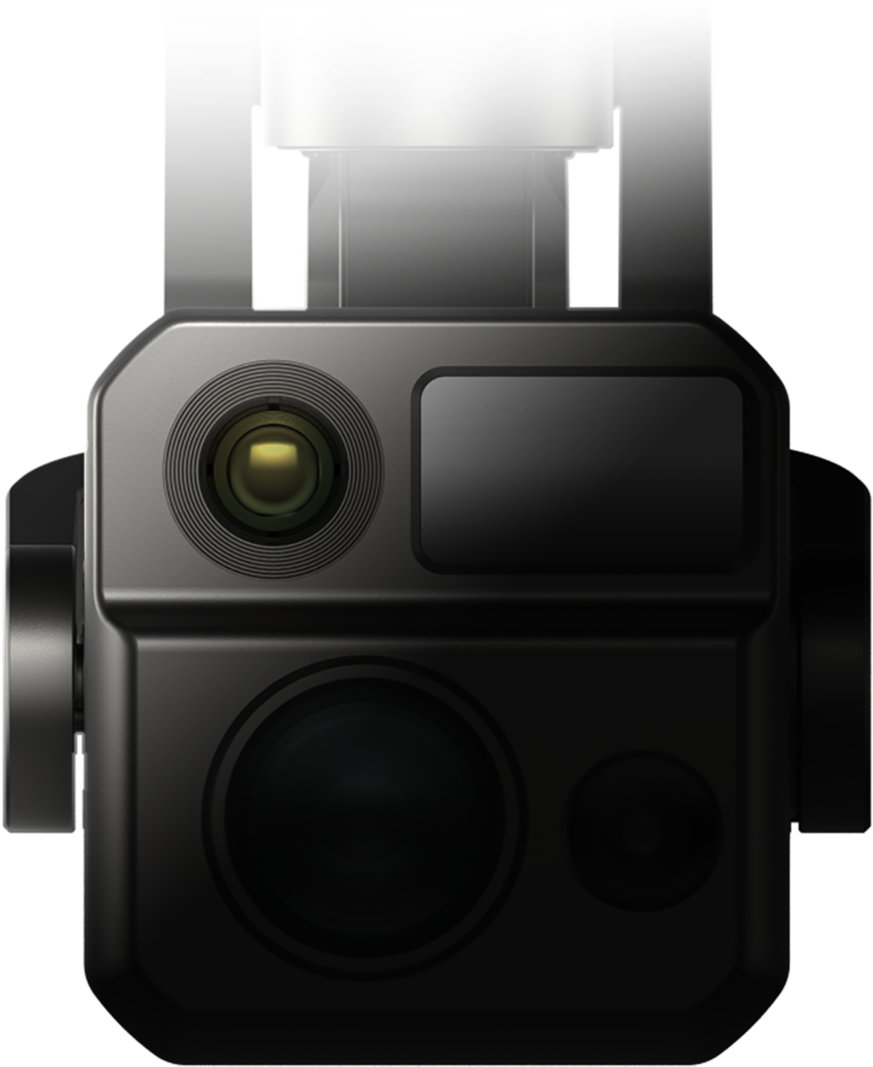
Explore the Night
EVO Max 4N- Super-Starlight Night Vision Camera
- Super-Sensitive Wide-Angle Camera
- Thermal Camera
- Laser Rangefinder

-
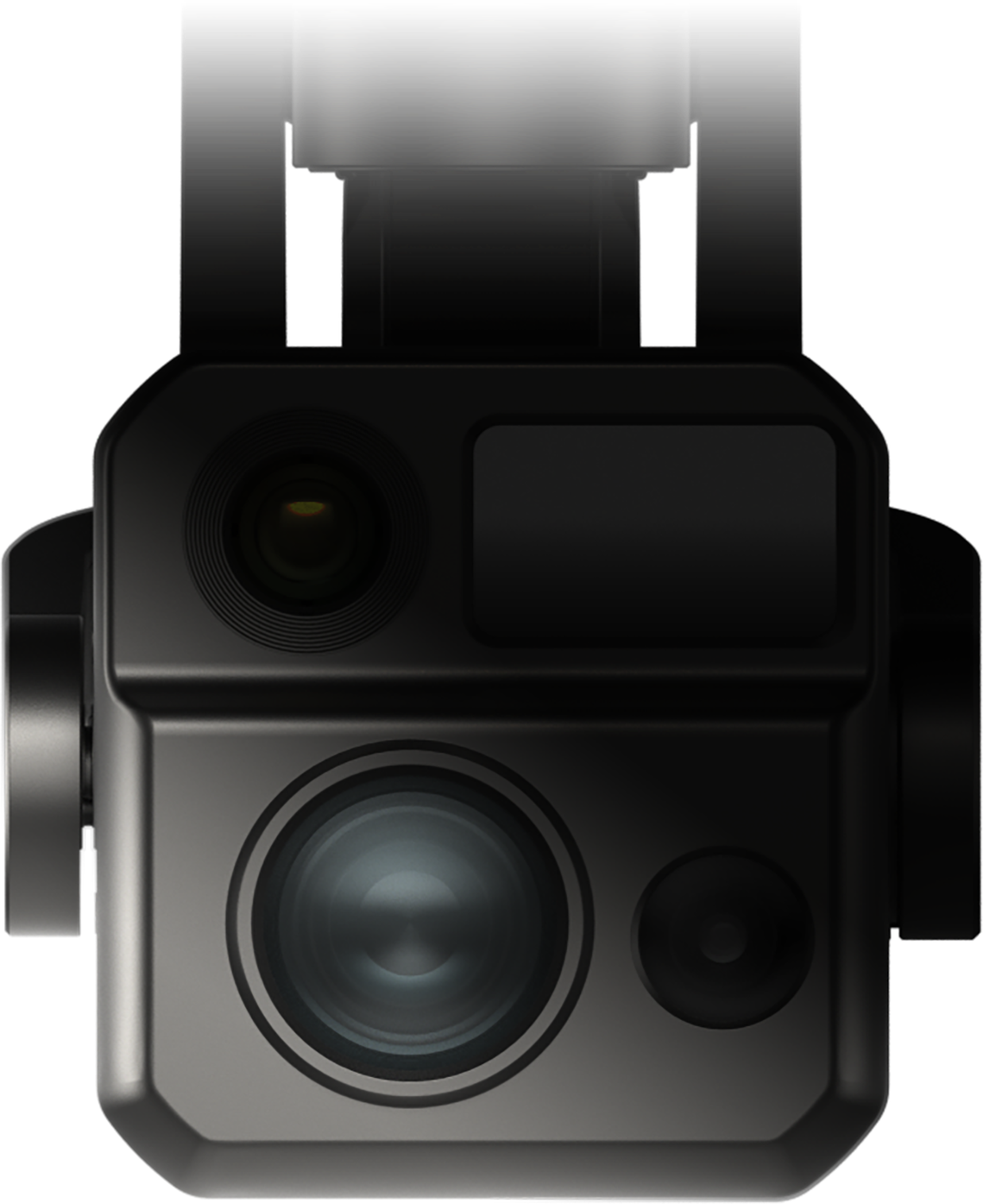
Chase the Heat
EVO Max 4T
Zoom Camera
48MP
8K 10x Optical Zoom
160x Max. Hybrid Zoom
Aperture: f/2.8–f/4.8 -
Super-Sensitive Wide-Angle Camera
50MP
1/1.28" CMOS
Aperture: f/1.9
DFOV: 85°
Equivalent: 23 mm -
Thermal Camera
640×512
Focal Length: 13 mm
16x Digital Zoom
Range: -4 ℉ to 1022 ℉ -
Laser Rangefinder
Measuring Range: 5-1200m
Measurement Accuracy: ± (1 m + D×0.15%)
Chase the Heat
EVO Max 4T- Zoom Camera
- Super-Sensitive Wide-Angle Camera
- Thermal Camera
- Laser Rangefinder
Chase the Heat and Explore the Night
Chase the Heat
and Explore the Night

- Starlight Camera*
- Super Zoom*
- Super-sensitive Imaging
- Superior Infrared
- Precision Ranging
- Starlight Camera*
- Super Zoom*
- Super-sensitive Imaging
- Superior Infrared
- Precision Ranging
Autel Enterprise Professional Software
Autel Enterprise
Professional Software
Autel Enterprise is a flight mission software designed for industry applications, featuring a new interactive design interface that is simple and efficient to operate. It integrates intelligent and rich professional functions, fully unleashing the industry value of the EVO Max series drones.
.jpg)
Intelligent Operations, Efficient and Safe.
Intelligent Operations, Efficient and Safe.
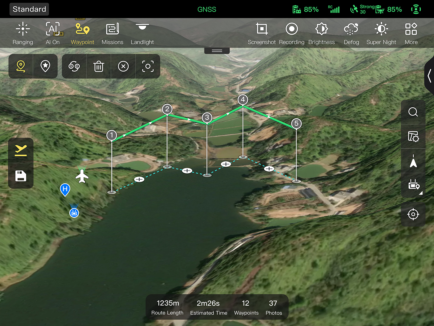
3D Flight Route Planning
Supports planning and previewing flight routes on a 3D map, allowing users to plan routes based on terrain elevation differences, and supports manual switching of map sources.
Emergency Mission Creation*
In case of unforeseen circumstances, users can create temporary tasks in the air and flexibly modify based on the situation.
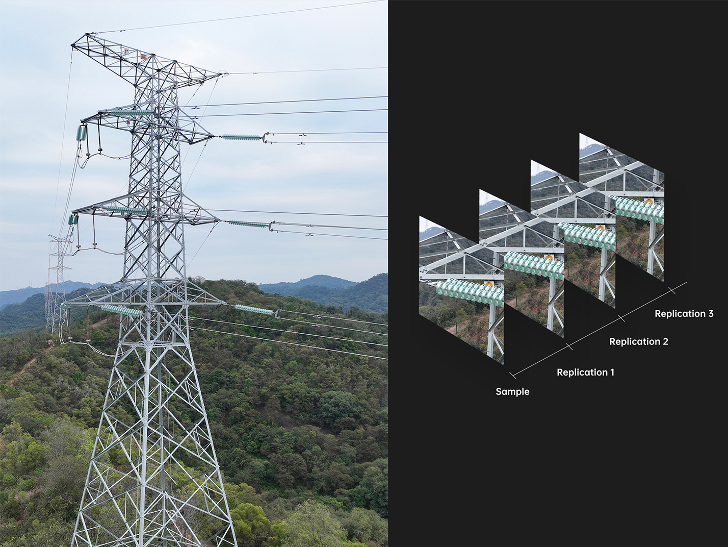
Precise Repetition*
By recording flight trajectories and camera actions, precise repetition can be achieved after selecting target areas in the footage.
*This feature is pending future updates.
- 3D Flight Route Planning
- Emergency Mission Creation*
- Precise Repetition*
Multiple Mission Types
Empower Efficiency
Multiple Mission Types
Empower Efficiency
The app offers various task modes such as waypoint missions, rectangle missions, polygon missions, and mapping aerial photography*, allowing users to import captured photos into modeling software for 2D or 3D model reconstruction. Suitable for scenarios like mapping, inspection, patrols, search and rescue, etc.
*This feature is pending future updates.
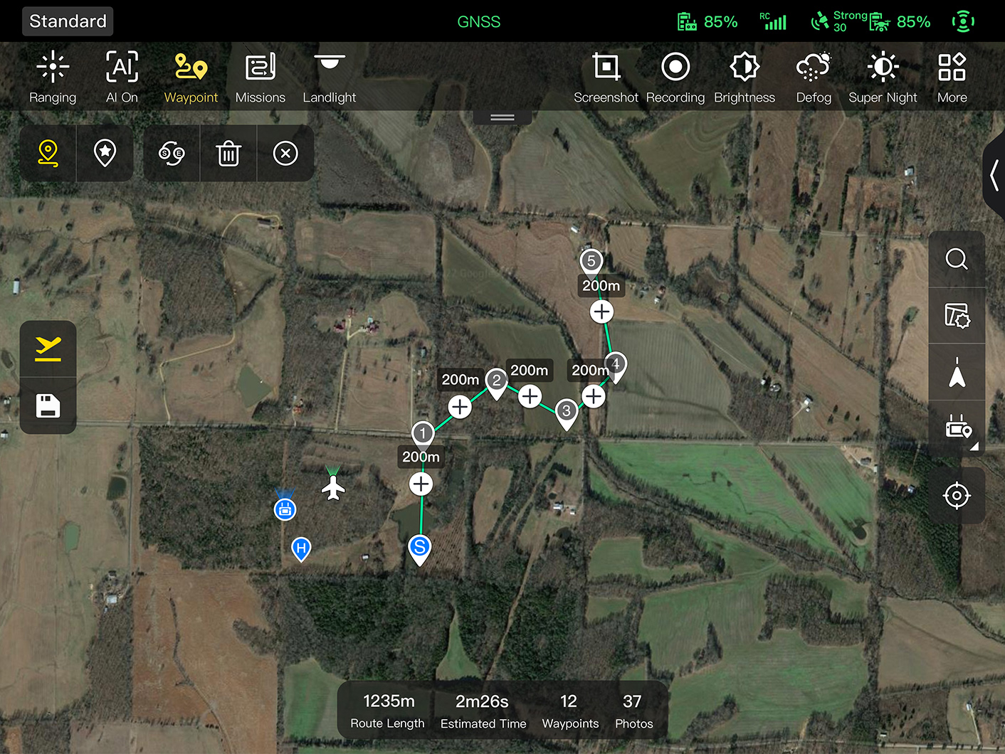
Waypoint Missions
Users can add waypointsfor flexible, non-structured flight paths.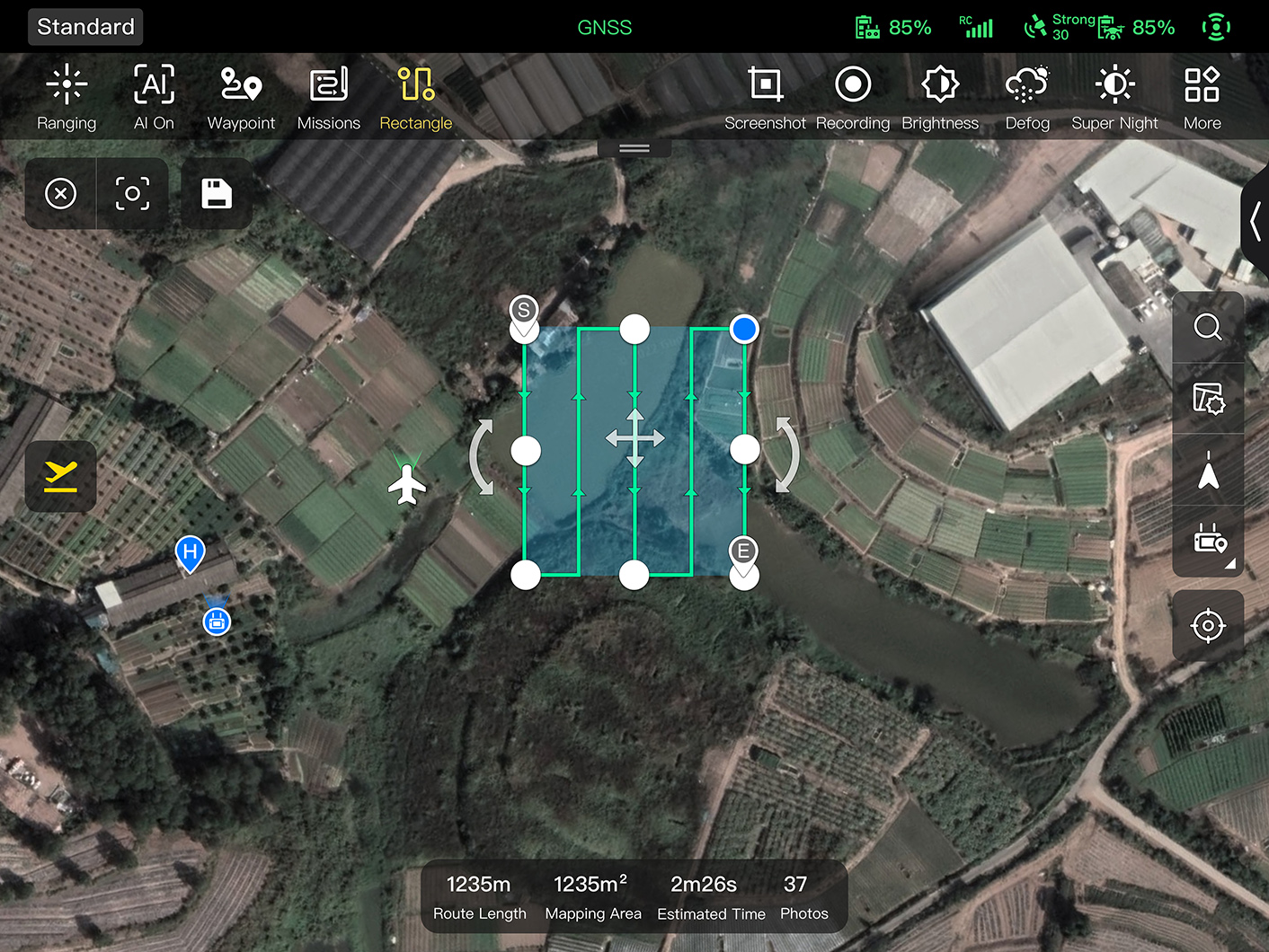
Rectangular Mission
Supports one-click automatic generation of a rectangular flight area.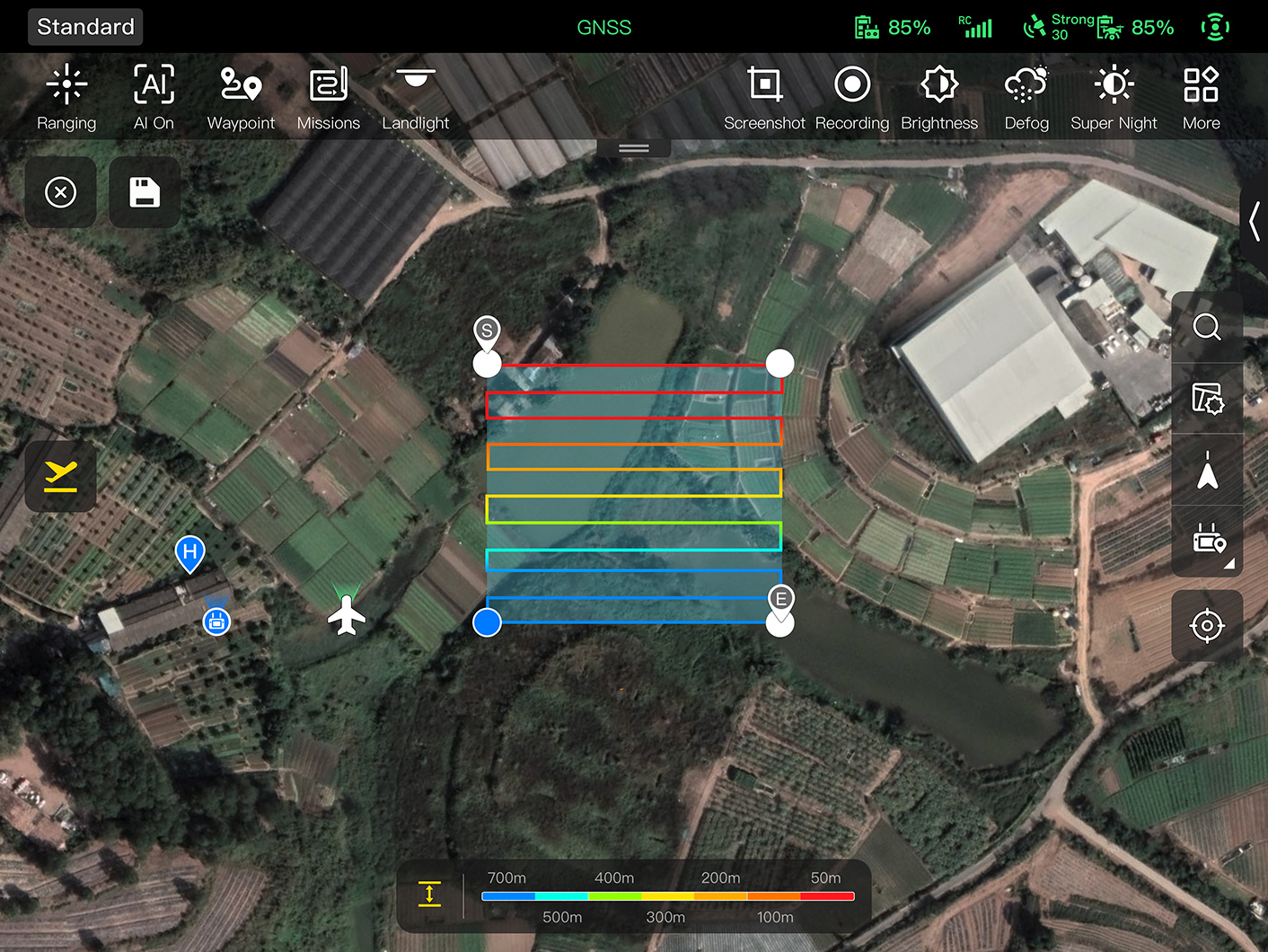
Automatic Mission Generation And Data Capture*
Automatically produce routes by adding regional boundary points through dots or importing KML files.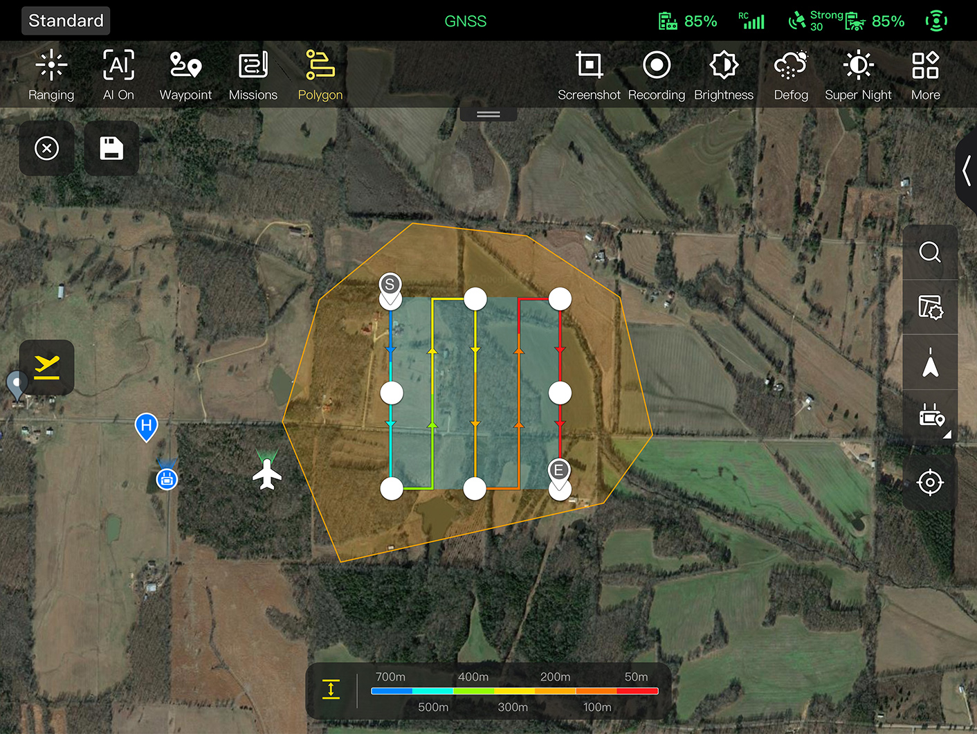
Polygon Mission
Supports one-click automatic generation of polygon flight areas.Data Security
Multi-layer Protection
Data Security
Multi-layer Protection
Data involving user privacy, including flight logs, locations, etc., must be manually agreed upon by the user before uploading. It supports AES-256 encryption for photos, videos, and flight logs, requiring a password input for access.

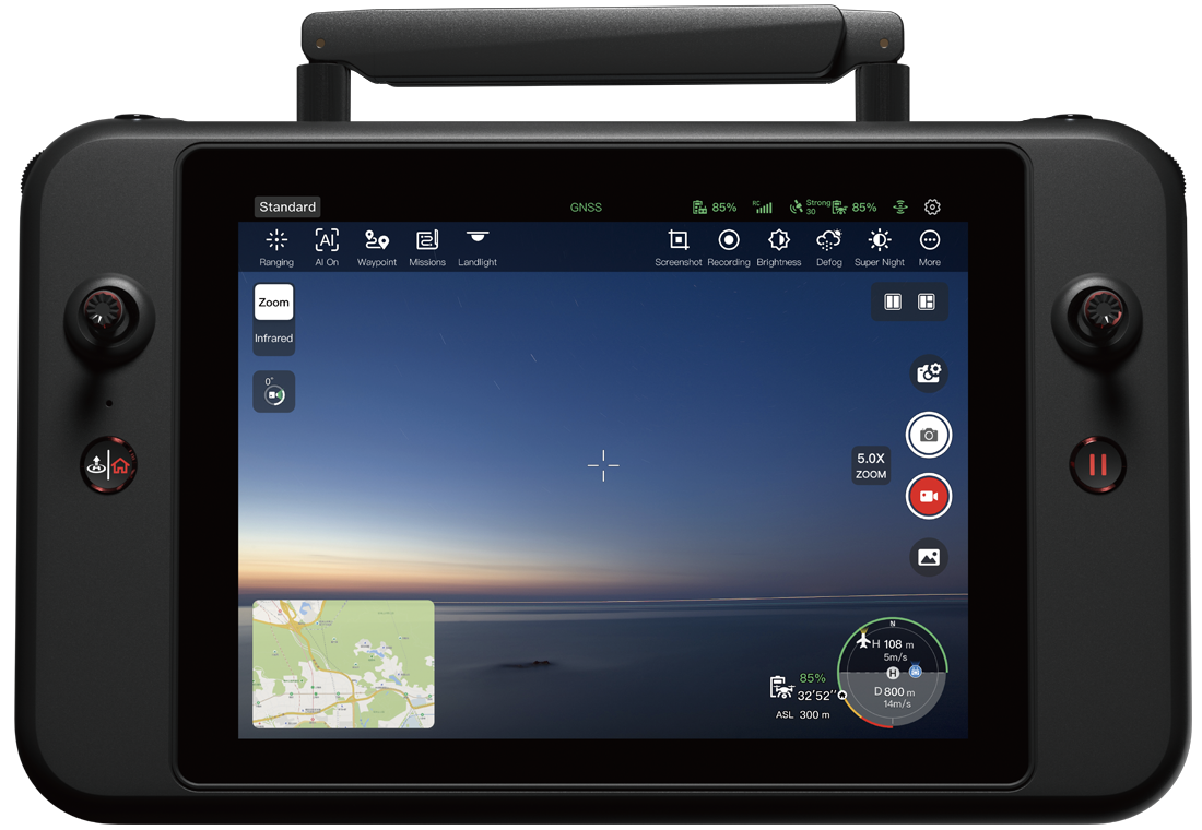
Enhanced Live-View
Enhanced Live-View
Multicast
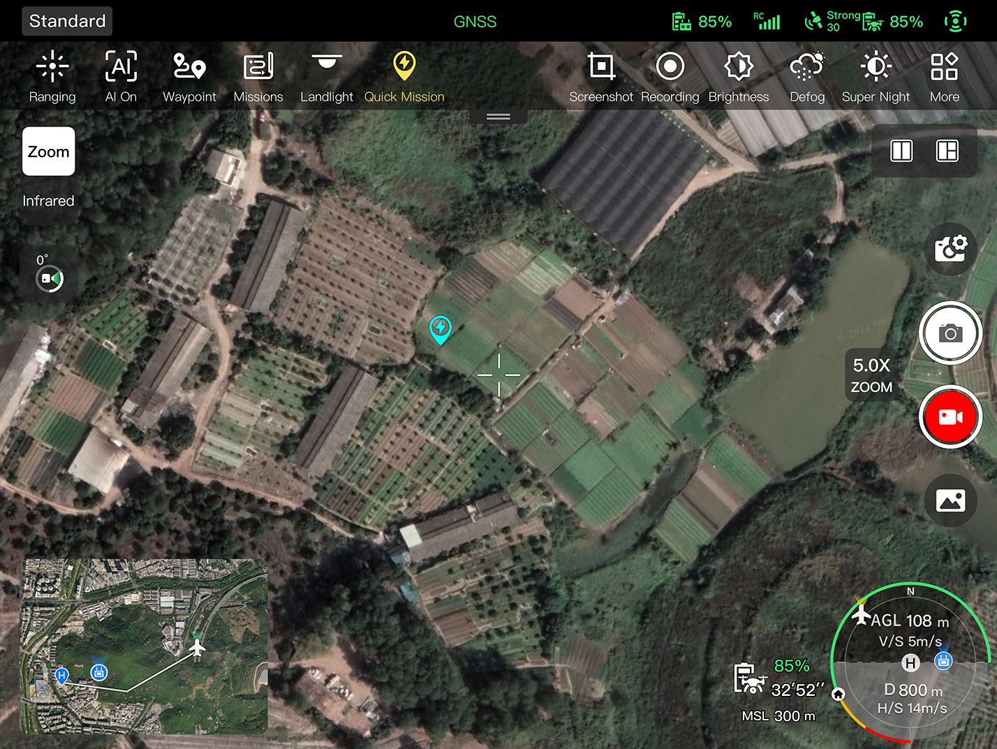
Supports simultaneous output of visible light/night vision, infrared, and map displays.AR Overlay
Real-time overlay of geographical location information and the positions of other aircraft detected by the ADS-B module in the display, facilitating users to quickly locate objects on the ground and avoid other aircraft.
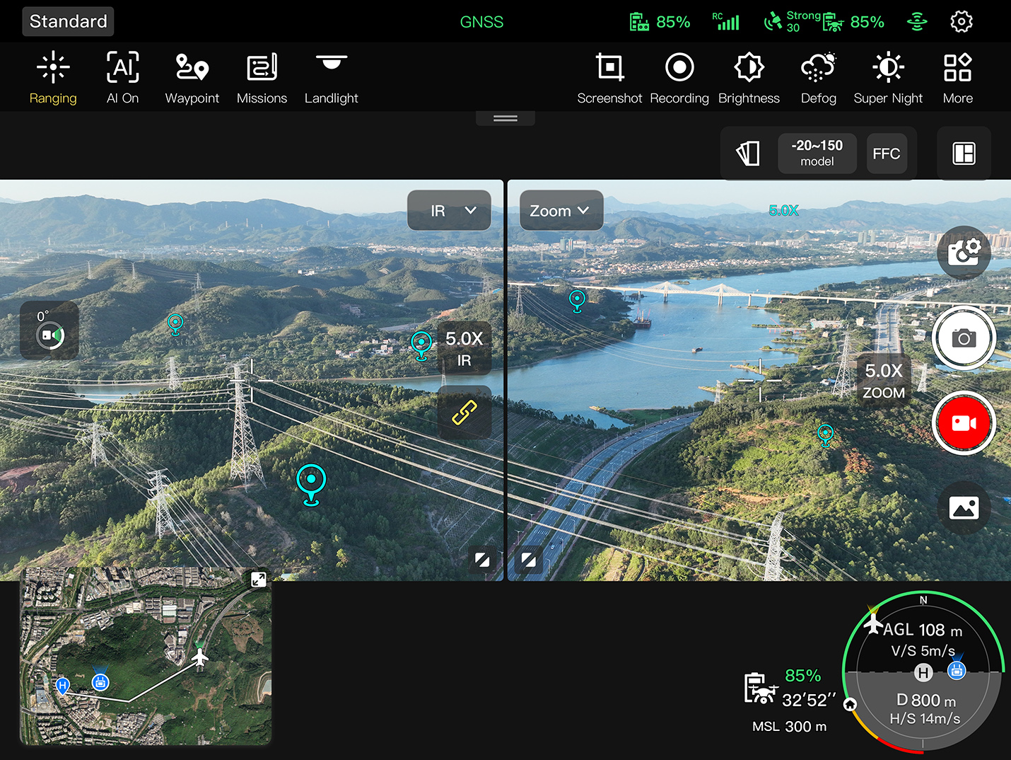
- Multicast
- AR Overlay
Operating Environment
-
IP43
protection level
-
from -20℃ to 50℃
Operating temperature

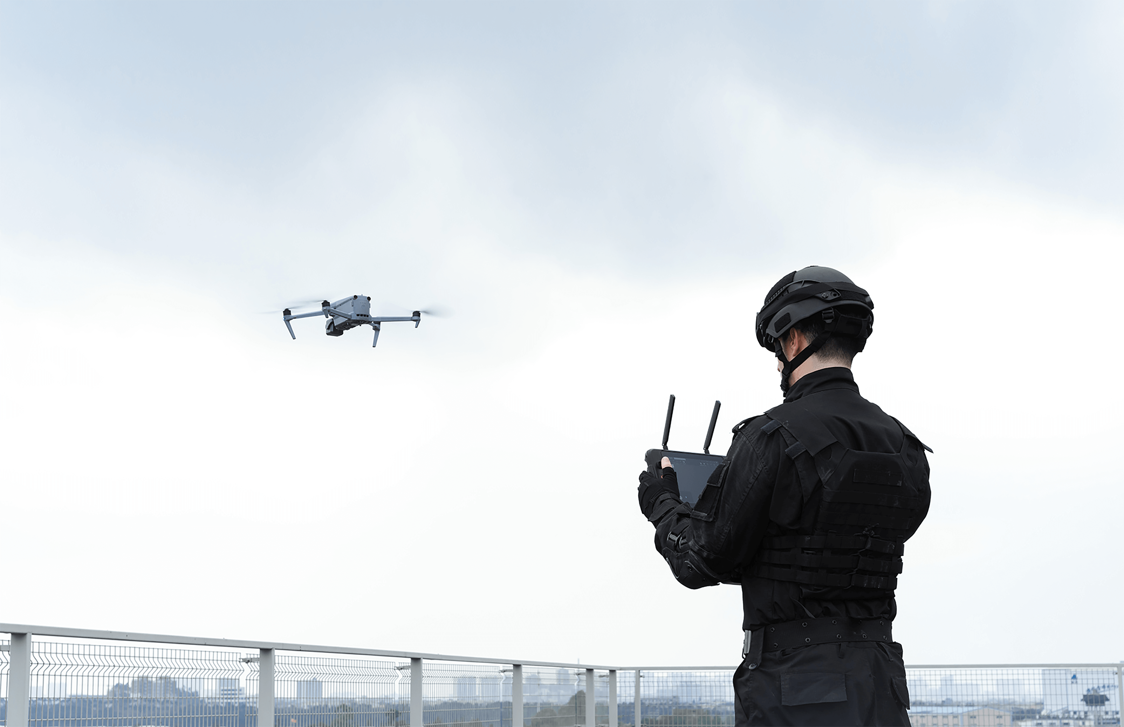
Complete Remote Operations System
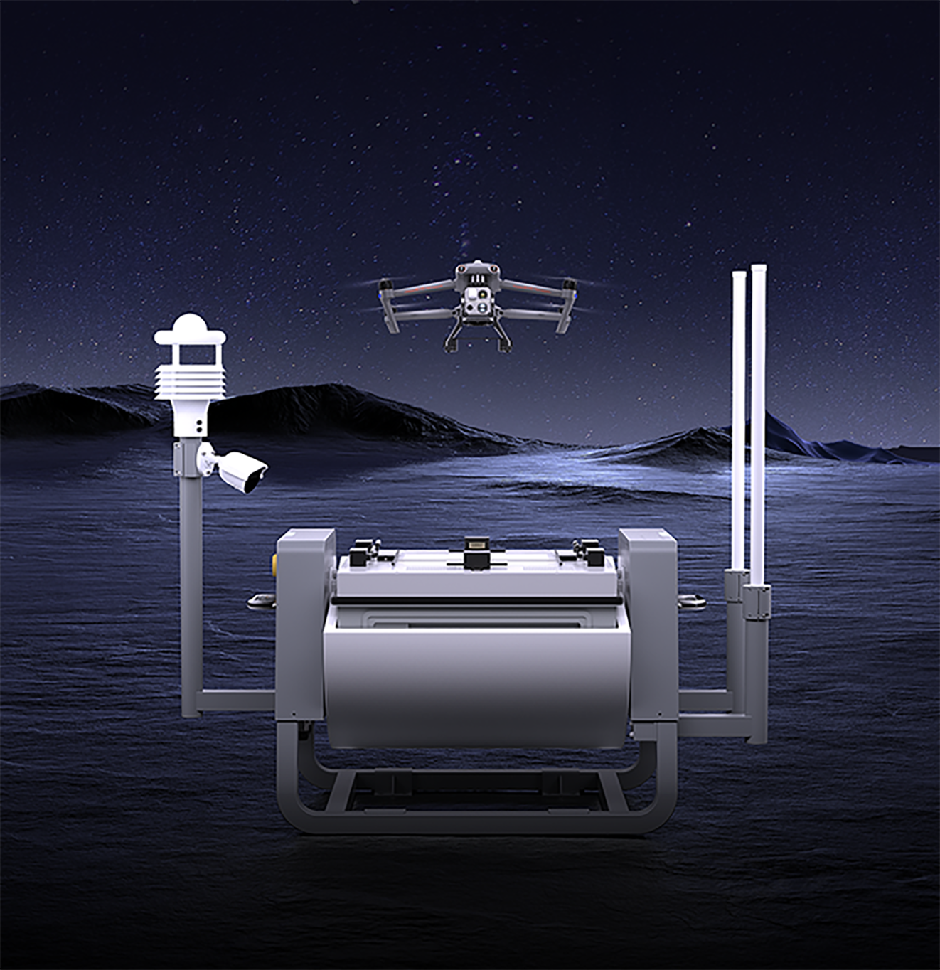
Used with the EVO Nest, the EVO Max series supports all-weather auto piloting for scenarios such as substations, industrial parks, and rooftops.
Autel SDK Ecosystem
Autel Robotics opens the Autel SDK developer platform to the world, helping developers and partners reduce software and hardware development costs, jointly creating a new industrial ecosystem.


Mobile SDK
A reasonable software and hardware architecture makes it easier for developers to get started, simple and easy to use, helping to create a superior new experience for drone mobile applications.
Accessories
-
-
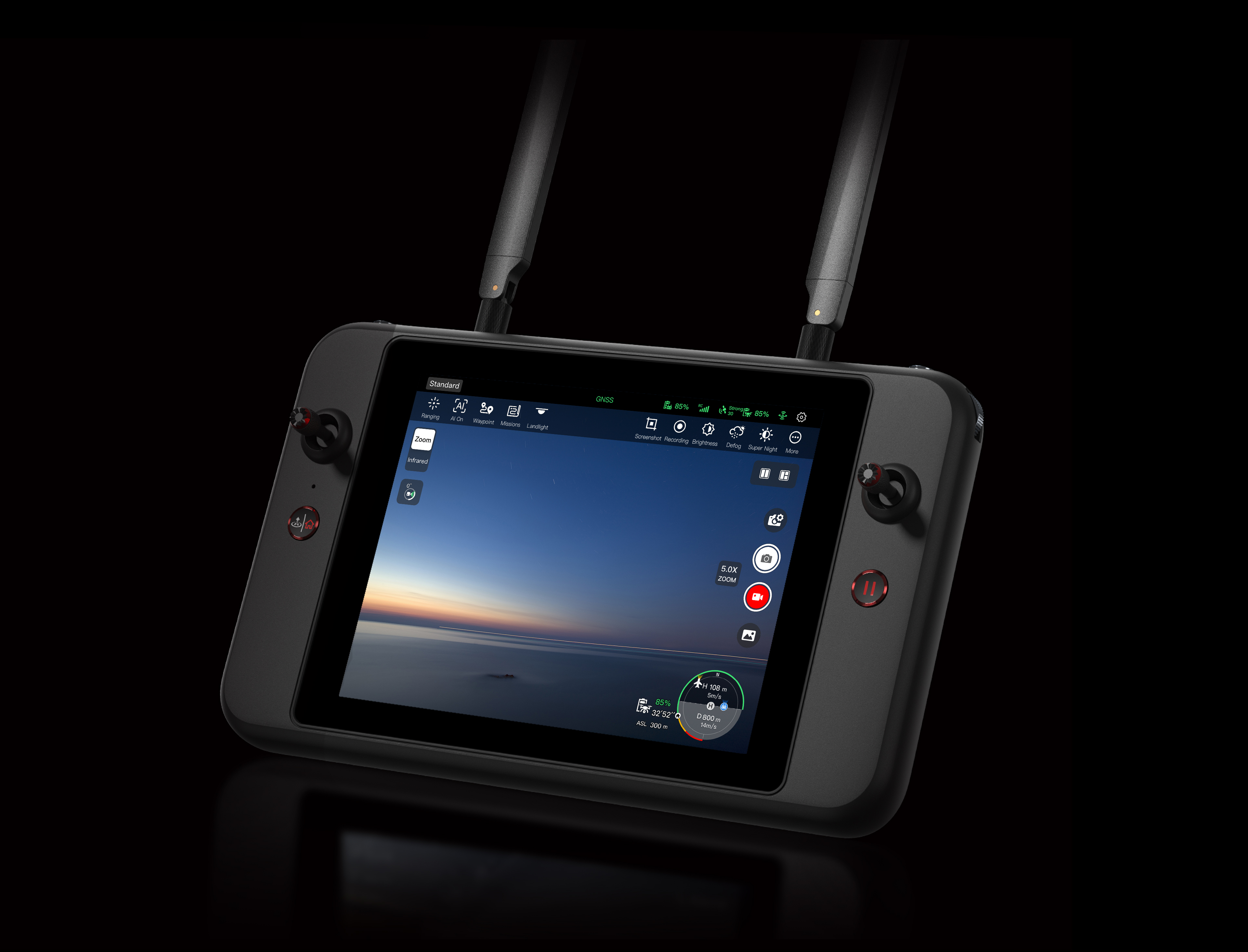
Autel Smart Remote Controller V3
More+
-
-
 More+
More+Evo Nest (optional)
Evo Nest is an unmanned aerial vehicle (UAV) automatic operation platform equipped with an all-weather meteorological monitoring station, modular lightweight design, can be quickly deployed in substations, industrial parks, rooftop platforms, and other various situations. The unattended system consists of the nest, multi-rotor UAVs, and command center, among other components. Autel Command Center can remotely issue operation tasks, ensuring data transmission security while decision-making from miles away.
RTK Module (optional)
Improves anti-electromagnetic interference ability, achieves centimeter-level positioning accuracy, assisting in completing precision inspection tasks.
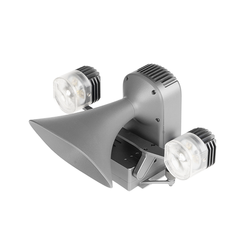
EVO Max Series Loudspeaker and Searchlight Integrated Machine (optional)
Size: 14511683 mm
Interface: Payload SDK
Installation method: Screw quick release
Operating environment temperature: -10℃ to 50℃
Searchlight: Maximum rated power 30W; FOV14°; Illuminance 30Lux@50m / 7Lux@100m / 3Lux@150m; Lighting mode supports strong light flashing or constant on; Illumination pitch angle supports remote adjustment from 30° to -90° or automatic adjustment with the gimbal; Supports brightness adjustment
Loudspeaker: Rated power 10W; 114 decibels @1m; Broadcasting distance ≥300m; Speaker delay <300ms; Supports recording, audio playback
Application
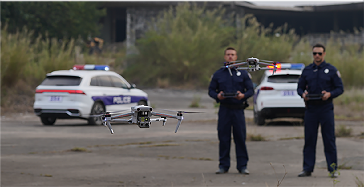
Public Safety
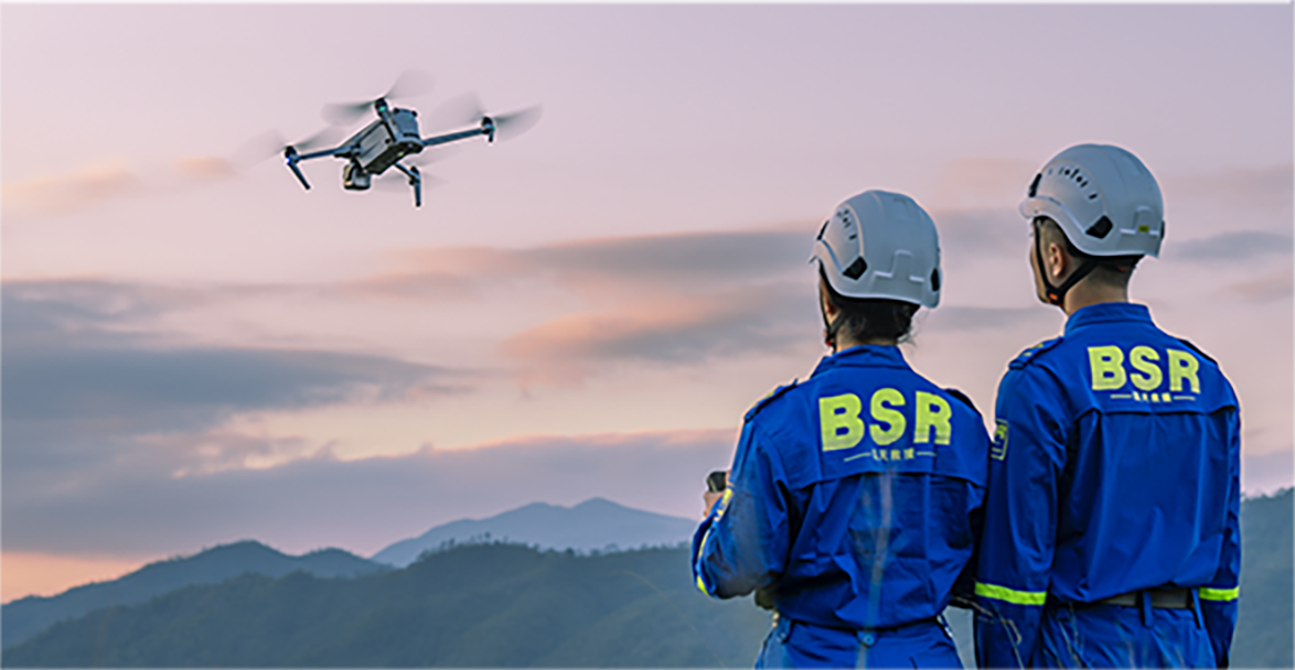
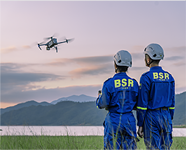
Search & Rescue
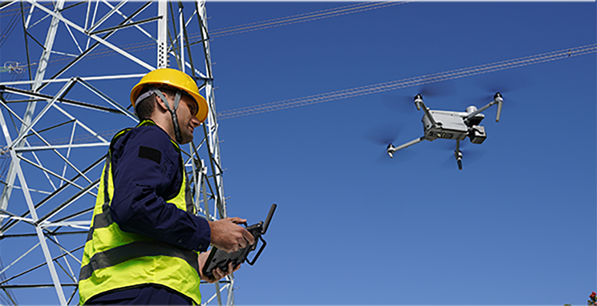
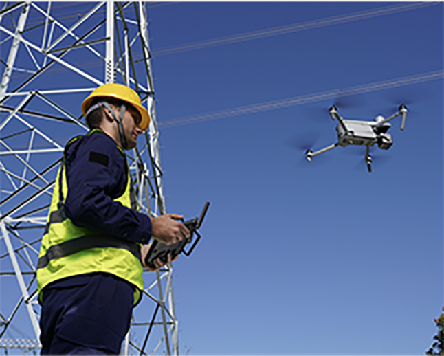
Inspection

Firefighting
Overview
Loading: