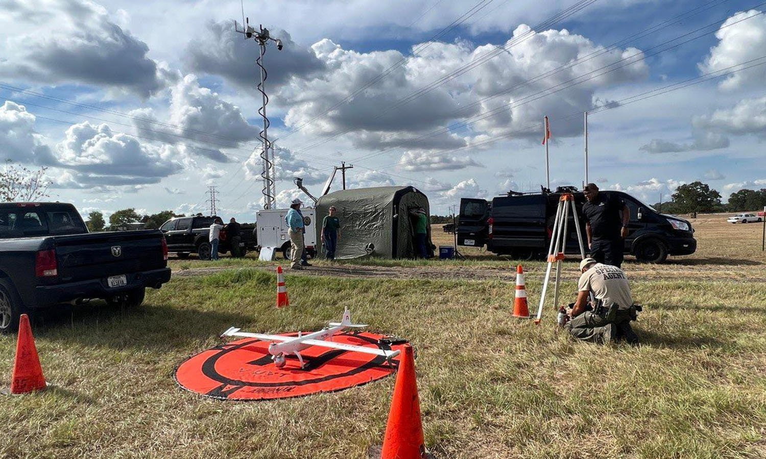
Dragonfish in Action - Responding to the Pine Pond Fire

DPS Officer Ben Tristan deploys the Dragonfish during the Pine Pond Fire. (Credit: Texas A&M Forest Service via Incident Information System)
Ben Tristan was watching his son play football in August 2022 when he noticed smoke rising in the distance.
Bastrop County, Texas was no stranger to fires, but as Tristan watched, he realized this one was serious. As helicopters arrived overhead and planes began dropping water, he went into action.
The Pine Pond Fire quickly accelerated from a flare-up to a 320-acre fire over a few hours, according to the Austin-American Statesman. It ultimately burned 700 acres of forest that included old-growth pines.
Tristan is a member of the Texas Department of Public Safety (DPS), and he had the unique ability to help the responding fire crews. He had access to an Autel Dragonfish.
The firefighters had used drones before, usually quadcopters for short-range flights to observe flare-ups and track crews on the ground. The Dragonfish was a whole different class.
There was originally talk of deploying Tristan with ground teams, to use the Dragonfish as they would a quad. He quickly explained that wasn’t the drone’s role; the Dragonfish was a strategic asset, best deployed from a centralized location where it could respond in a role more similar to a helicopter. They set up in the command post and connected the feed to a larger screen.
The drone quickly proved its worth.
“So I get up in the air, and very quickly I can see where the hotspots are,” Tristan said. “Next thing I know, I have a huge crowd gathered around…the [coordinate] view was very helpful because as the camera’s panning around looking at things, there’s the grid coordinate that’s being displayed…those guys, in turn, are…calling it out so they can send more resources to those hotspots.”
The Dragonfish’s view allowed commanders to deploy ground teams, particularly slow-moving assets like bulldozers, to precise locations. Firefighting crews on the ground used IR strobes, visible on the Dragonfish’s camera, to show their locations in dense smoke.
The long flight time allowed the Dragonfish to stay on-site longer, which in turn allowed it to respond quickly.
“Guys on the ground were calling in with their radios, ‘Hey, we see some smoke, can somebody come check it out?’ Instead of having to dispatch a helicopter to go all the way over there to take a look, the drone was already in the air,” Tristan recounted. “They’d give me a grid coordinate, I’d look at that on the map, plot a course to fly over there…The command post was getting the same video feed so they’d determine whether or not they needed to send people.”
The drone was also used to check homes that were behind the fire line. The Dragonfish could sweep at-risk areas that would have been difficult to access from the ground. Rather than dispatching teams to check out homes on foot, the Dragonfish could survey whole blocks or neighborhoods in one mission. This was a major improvement over quadcopters.
“[For] previous fires, they just had small little drones that would inspect one home…and then come back and do a battery change,” Tristan explained. The Dragonfish’s two-hour flight time let it inspect multiple houses quickly and efficiently.
It took crews ten days to contain the fire, according to the University of Texas’s College of Natural Sciences. 150 firefighters and over 30 departments were involved. There were no fatalities and no houses were destroyed.
Tristan said one of the major long-term benefits was the cooperation between multiple departments.
“Now we’ve built that relationship because of that incident. We’ve shared contact information and we’ve done a couple of other missions since then. So now it got us working together. So now, guaranteed, if another fire kicks off, they’ll call.”
Wrap-Up
Key Applications
Hotspot Monitoring
Personnel Tracking
At-Risk Home Inspection
Key Capabilities
Long Flight Time
Tactical Response and Strategic Information
Precise Geolocating
Key Benefits
Efficient Asset Deployment
Efficient Inspections
Efficient Data Sharing
Increased Interdepartmental Communication
Sources:
Image: https://inciweb.nwcg.gov/incident/photograph/8324/16/133898
Article by Autel Robotics all rights reserved.
