High Tech Solutions to Ancient Problems
Drones for Agriculture

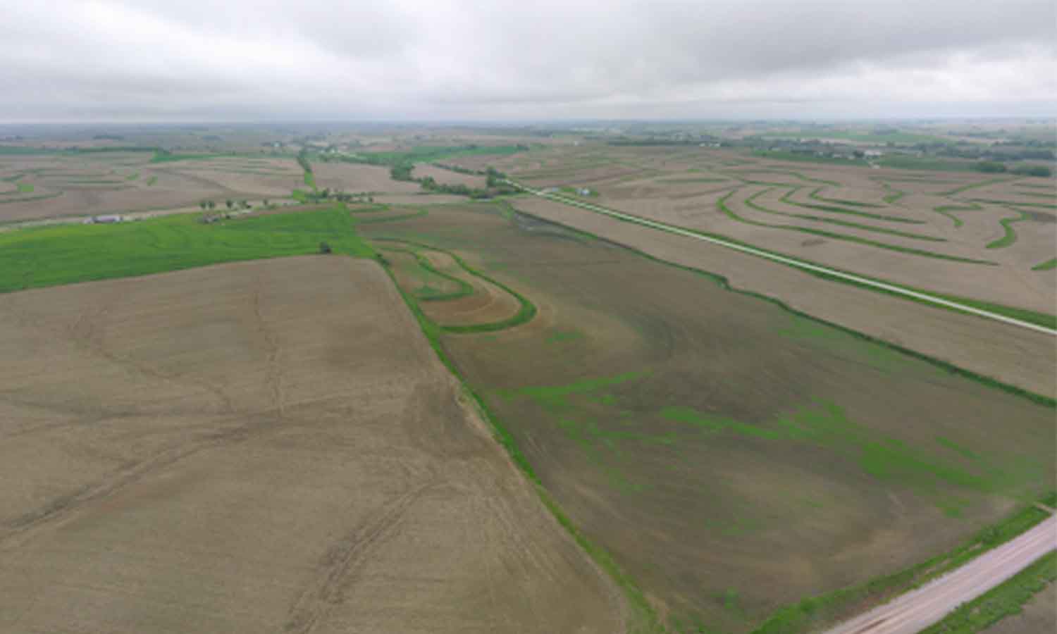
A drone’s eye view of a field before planting. Note the weed growth in the field on the right. Courtesy of Adam Gittins
Drones for police and first responders get a lot of attention, but many of those high-profile programs have gotten advice and assistance from another industry: agriculture.
Routine aerial inspections can monitor crop health, fertilizer effectiveness, weed growth, and more. A far more cost-effective solution than manned flyovers, drones like the EVO II Pro V3 can use their high-quality cameras, autonomous mission planning, and third-party software compatibility to save farmers money, reduce environmental impact, and monitor a wide range of crop conditions.
Saving Money and the Environment
Adam Gittins’ drones have more than proved their worth. As an employee of HTS Ag, a company that provides high-tech solutions for agriculture, he’d been using drones for years and helps farmers adopt the latest tools for their work.
He talked about a time his drones helped him save thousands of dollars. He’d been using drones to monitor his soybean field’s health, and the composite image identified stripes of different colors in the plants. Some sections were a darker green than others. The field had been fertilized by a third party, though their application hadn’t achieved full coverage.
Gittins had the field tested, and found the off-color plants were deficient in sulfur, one of the chemicals in the fertilizer. At harvest, he monitored the output in the different sections of the field and noticed a decrease in the spots the drone had identified as deficient.
Because of that, he had a good case to make to the people he’d hired to apply the fertilizer, and they paid him over $15,000 to make up for the loss.
Field monitoring can also cut down on the amount of chemicals that fields require.
Gittina said a key feature of drone inspections was monitoring weeds or pests in fields. Drones can easily identify weed growth, which lets farmers apply pesticides precisely in the affected areas.
“Instead of having to treat the entire field, which could be dozens or hundreds of acres, we might just be able to go in and treat that one spot,” he said. “So there’s significant cost savings and there’s significantly reduced environmental impact because we’re not applying nearly the quantity of chemicals.”
Seeing Potential
Gittins’ interest in drones started like many programs do: with hobby models.
He had a simple drone for recreational use. One day, he experienced a flyaway and lost the drone in his field. Finding a small drone in the chest-high plants was nearly impossible, but he thought an aerial view could help.
“I went and bought an almost $2000 to find the $300 drone that I’d crashed,” he laughed.
Even as he flew, he began to notice things he wouldn’t have otherwise; a swath of weeds in a particular part of the field, erosion in another part.
“Instantly, my eyes were opened,” he said.
As he was searching, he started thinking of other functions that would make the search easier. If the drone could automatically fly in a grid and create a composite image, searching a field would be easy.
Unfortunately, he never did find his original missing drone.
After seeing the potential uses for drones, Gittins helped beta-test one of the first mapping software programs, DroneDeploy. As a part of HTS Ag, he was uniquely qualified to help bring drones to the agricultural industry, and soon they had become a valuable part of HTS Ag’s catalog.
Composite image software like Pix4D help create maps stitched together from many different images. Other software programs can track water flow, flood inundation, and erosion. Visible Atmospheric Resistance Index (VARI), Near Infrared, NDVI, and near-NDVI programs can analyze crop health by measuring reflected visual and near-infrared light. Different tools are available for different crops, and even relatively simple cameras like the EVO II Pro V3’s 6K RGB camera work for common crops like corn and soybeans.
Drones may seem expensive upfront, but they’re much more cost-effective than manned flights--a plane or helicopter can cost several dollars per acre, but a drone only costs a few cents, which adds up when one needs to survey hundreds of acres. Drones can fly repeated, autonomous missions on set flight paths while leveraging powerful their analytic programs to give continuous updates on field health.
Gittins’ knowledge of drones has gone beyond the agriculture industry as well. He’s helped several police departments choose aircraft for public safety drone programs, and his firsthand success with Autel’s drones makes them a popular choice for first responders nationwide.
We’re proud that so many essential industries use our drones to make their jobs more efficient, precise, and cost-effective. For more stories about Autel Drones in action, check out our other case studies, including the Nebraska State Patrol and Texas Department of Public Safety.
Article by Autel Robotics all rights reserved.
