


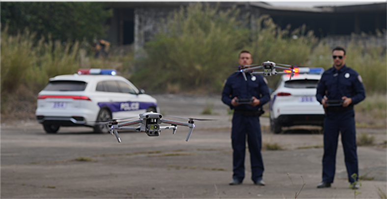
Reach New Frontiers
Reach New Frontiers
Reach New Frontiers
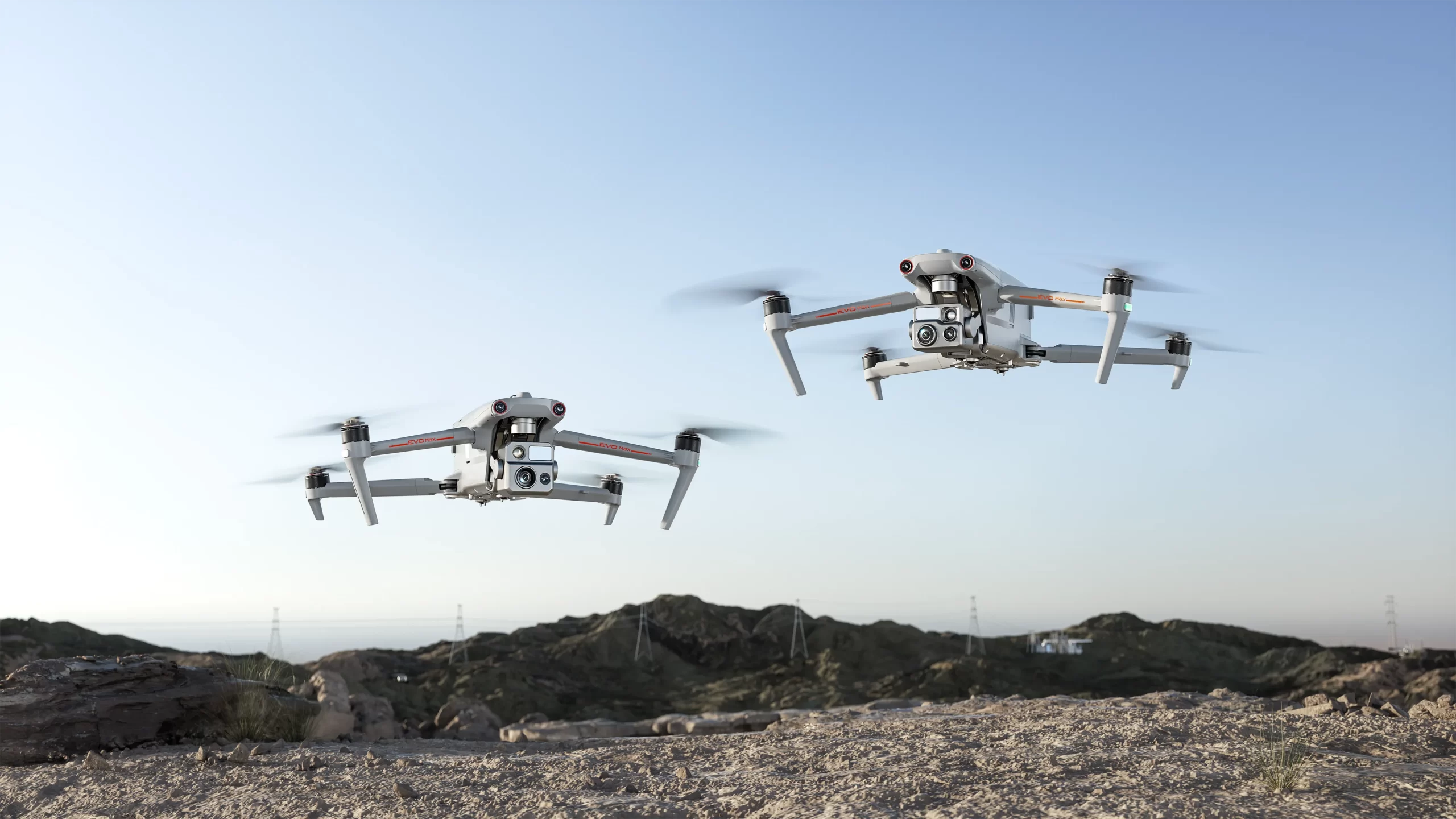
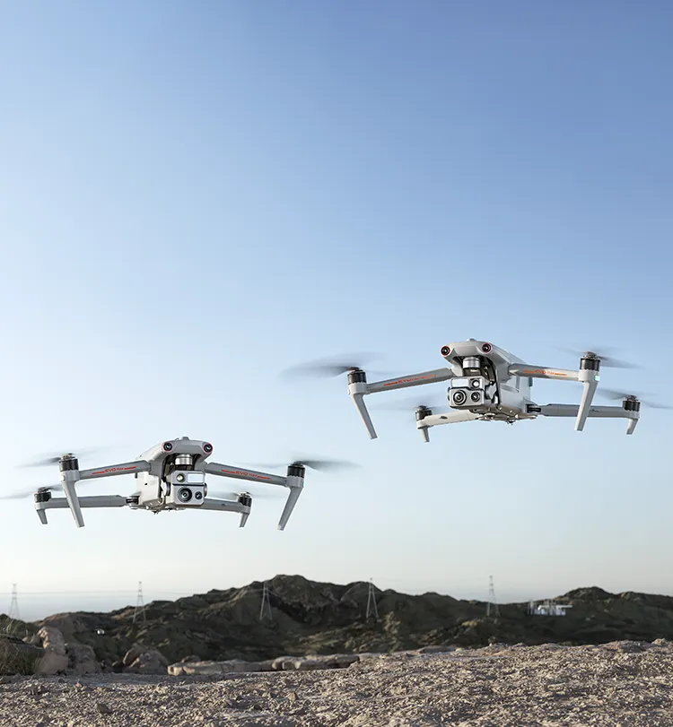
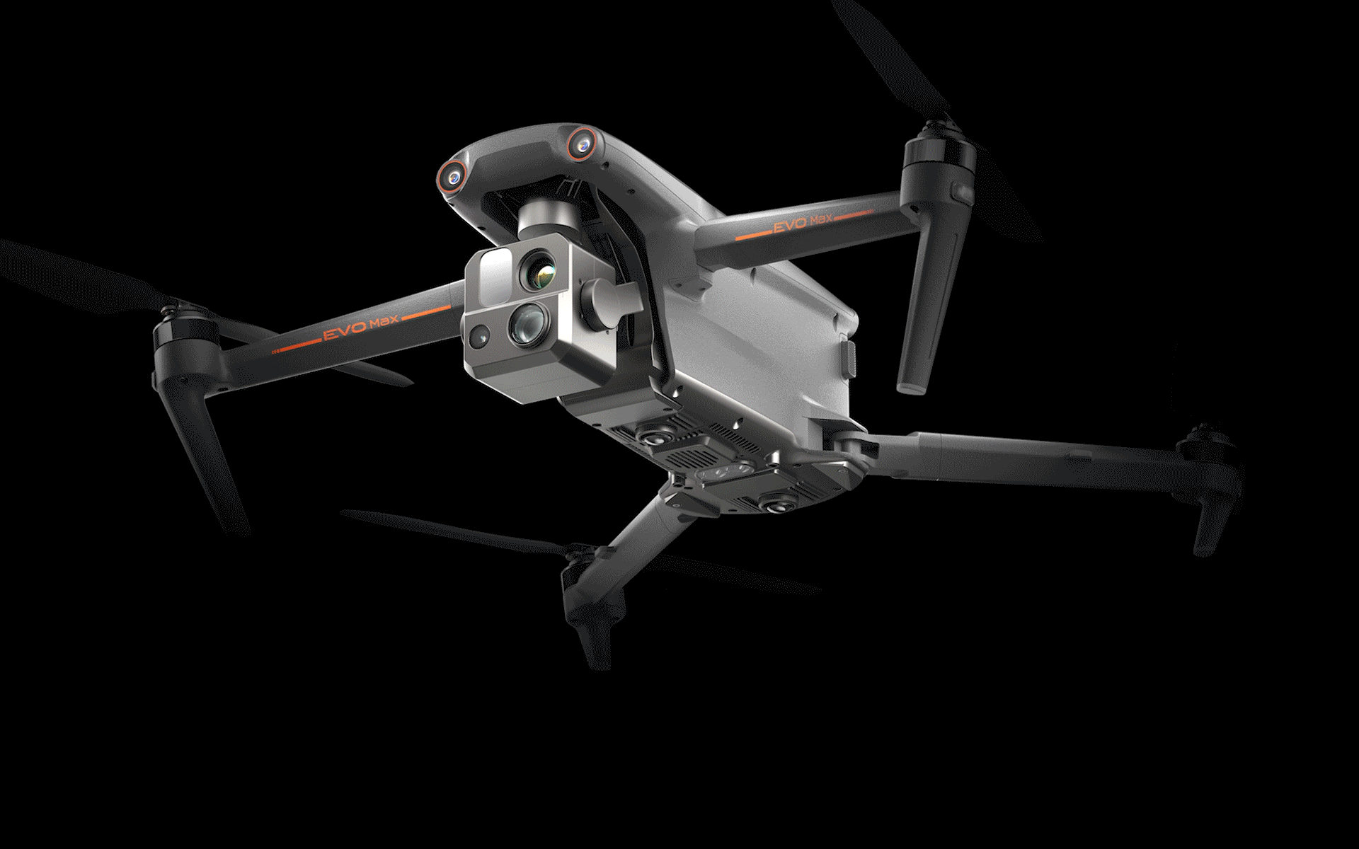
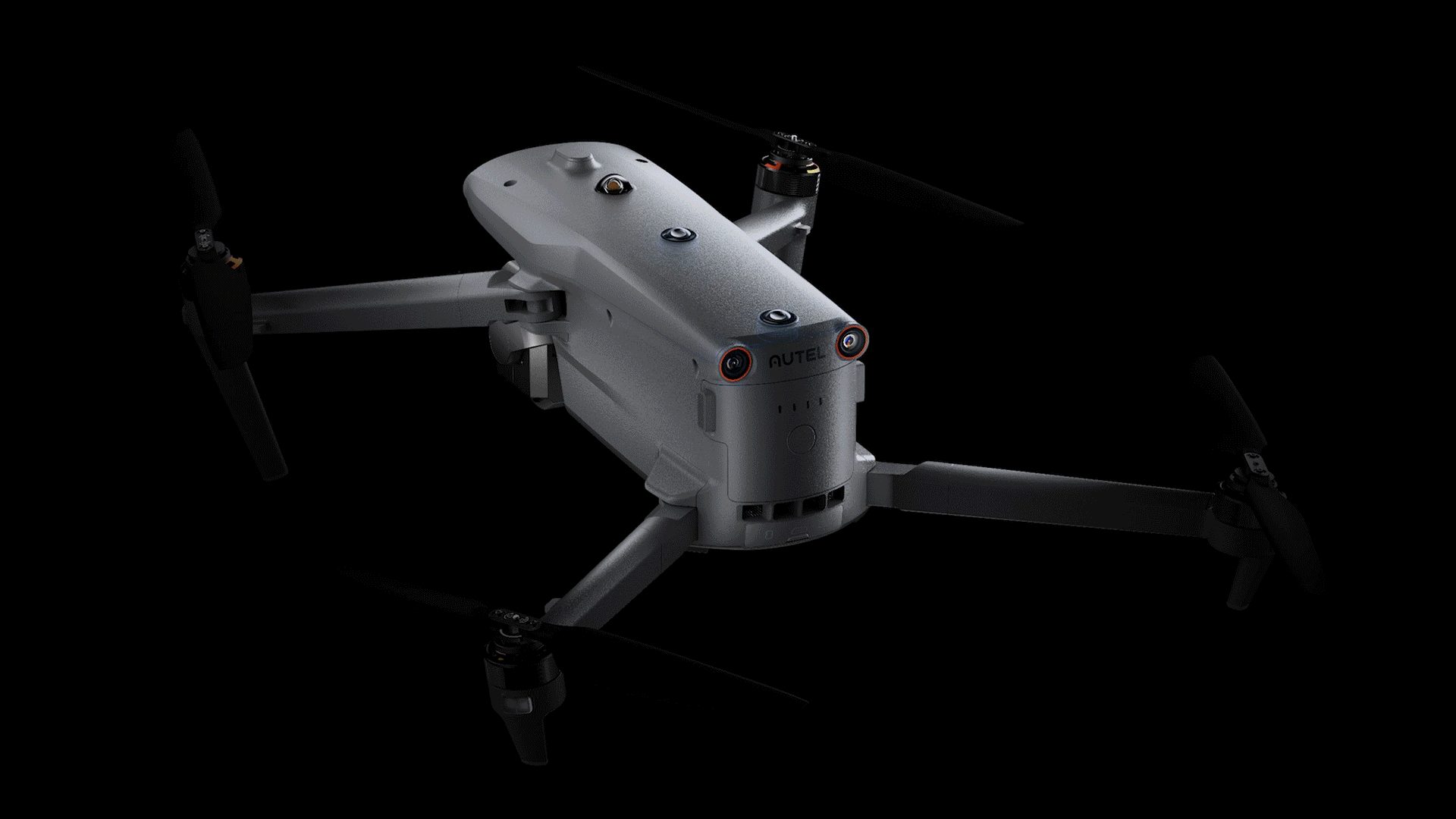
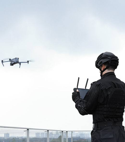
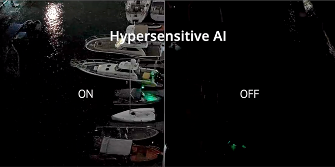
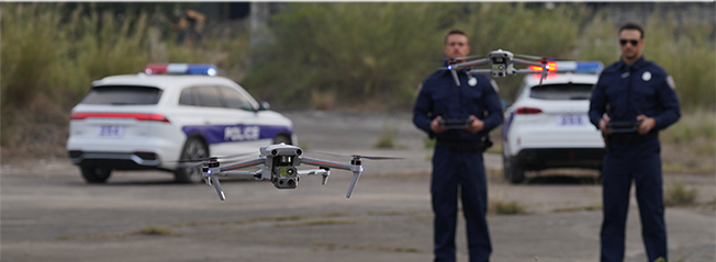
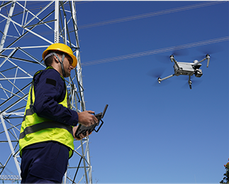
The EVO Max series adopts Autel Autonomy's autonomous flight technology, achieving global path planning, 3D scene reconstruction, autonomous obstacle avoidance, and return-to-home in complex environments. With the capability of precise navigation without GNSS, it offers high-precision visual navigation in scenarios where GNSS signals are blocked, weak, or heavily interfered with, ensuring stable and reliable flight with high accuracy and low latency. The industry's first A-Mesh networking technology supports the free networking of multiple devices, achieving integrated air-ground network coverage. Featuring a "dual fisheye vision + millimeter-wave radar" multi- sensor fusion perception technology, it has 720° omnidirectional sensing and obstacle avoidance capabilities. The EVO Max series is equipped with the FusionLight camera 4T and FusionLight camera 4N, integrating a zoom camera, an ultra-starlight level night vision camera, an ultra-sensitive wide-angle camera, a thermal imaging camera, and a laser rangefinder. It efficiently empowers public safety, energy inspection, emergency management, and other fields, setting a new benchmark for industry applications of drones.
-
 720° Obstacle
Avoidance -
 Superior Anti-Interference
Capability
Superior Anti-Interference
Capability
-
 High-Precision Visual
Navigation
High-Precision Visual
Navigation
-
 A-Mesh Self-Organizing
Network
A-Mesh Self-Organizing
Network
-
 8K 10x Optical
Zoom Camera -
 Superstarlight-Grade
Night Vision Camera -
 Hot-Swappable
Battery -
 15-Kilometer HD Video
Transmission
15-Kilometer HD Video
Transmission
-
 42 Minutes of Enduring
Endurance
42 Minutes of Enduring
Endurance
-
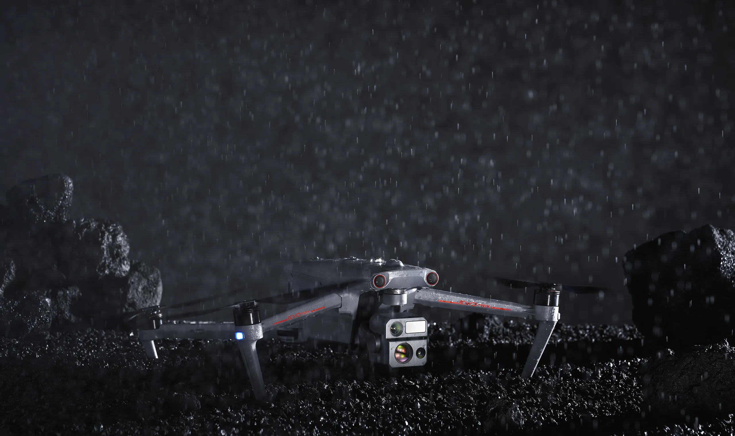
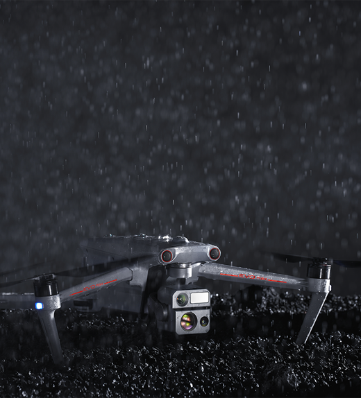
 IP43 Protection Rating
(Custom service)
IP43 Protection Rating
(Custom service)
-
Autonomous Flight
PlanningUtilizing Autel Autonomy autonomous flight technology, the system gathers real-time environmental data to achieve global path planning, 3D scene reconstruction, autonomous obstacle avoidance, and return-to-home capabilities in complex environments such as mountains, forests, and urban areas. This empowers industries such as security, inspection, and mapping. -
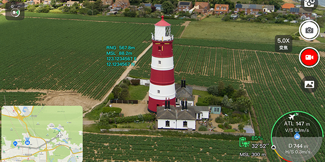
High-precision visual
navigationIn scenarios where satellite signals are obstructed or weakened between urban buildings, high-precision and low-latency distance and coordinate information can still be obtained. This is achieved through SLAM (Simultaneous Localization and Mapping) visual navigation technology to enable stable flight with high-precision indoor and outdoor navigation positioning capabilities. -
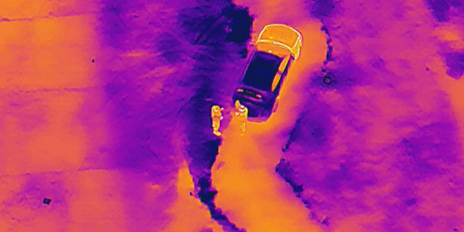
Accurate Object
Identification and TrackingFlexibly accommodating various payloads, based on AI image recognition technology, the system automatically identifies and precisely locks onto different types of targets within the observation area, such as heat sources, moving individuals, and vehicles, enabling data collection.
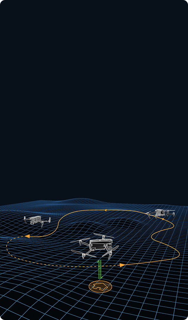
Autonomous Flight
Planning
Planning
Utilizing Autel Autonomy autonomous flight technology, the
system gathers real-time environmental data to achieve global
path planning, 3D scene reconstruction, autonomous obstacle
avoidance, and return-to-home capabilities in complex
environments such as mountains, forests, and urban areas. This
empowers industries such as security, inspection, and mapping.
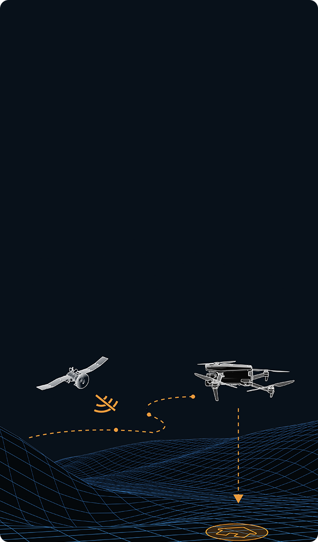
High-precision visual
navigation
navigation
In scenarios where satellite signals are obstructed or weakened
between urban buildings, high-precision and low-latency distance
and coordinate information can still be obtained. This is
achieved through SLAM (Simultaneous Localization and Mapping)
visual navigation technology to enable stable flight with
high-precision indoor and outdoor navigation positioning
capabilities.
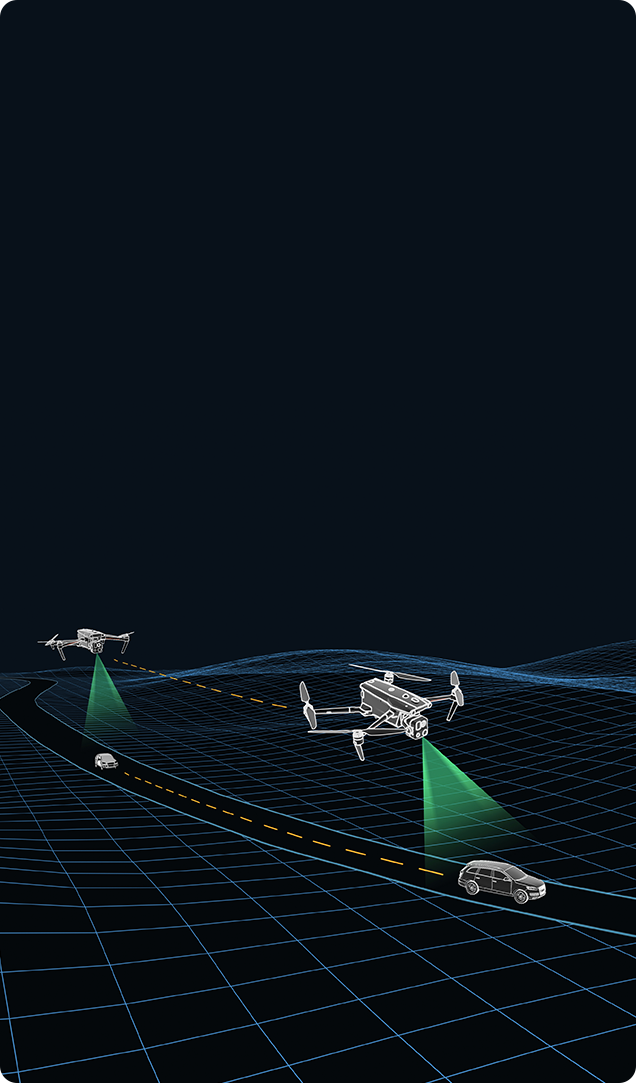
Accurate Object
Identification and Tracking
Identification and Tracking
Flexibly accommodating various payloads, based on AI image
recognition technology, the system automatically identifies and
precisely locks onto different types of targets within the
observation area, such as heat sources, moving individuals, and
vehicles, enabling high-altitude tracking and data collection.
720° Omni-directional
Obstacle Avoidance
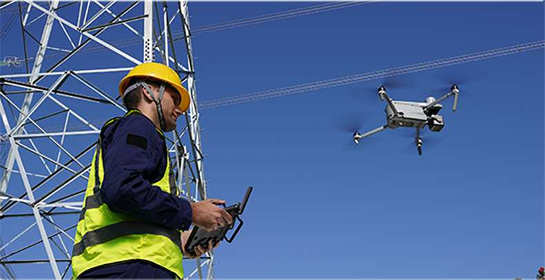
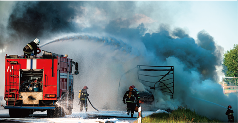
The EVO Max series adopts a multi-source sensor fusion perception technology combining "binocular fisheye vision + millimeter-wave radar", providing 720° omni-directional perception and obstacle avoidance capabilities. It supports all-weather operations, overcoming complex working environments such as water surfaces and high-voltage power lines. It can penetrate dust, fog, rain, and snow, remaining unaffected by harsh weather conditions. Even at night, it ensures flight safety.
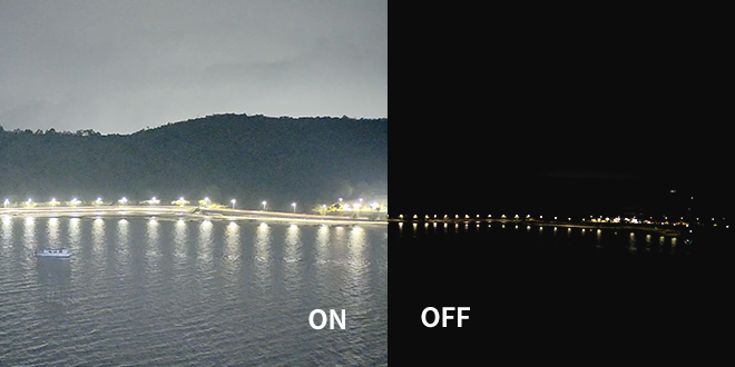
Superior Anti-interference
More Stable Flight
Superior Anti-interference
More Stable Flight
The built-in flight control computing unit, GNSS receiver module, and image transmission module enable the EVO Max series to identify flight control interference signals and satellite positioning interference signals, providing outstanding anti-interference capabilities. This equips the EVO Max series with reliable flight stability.
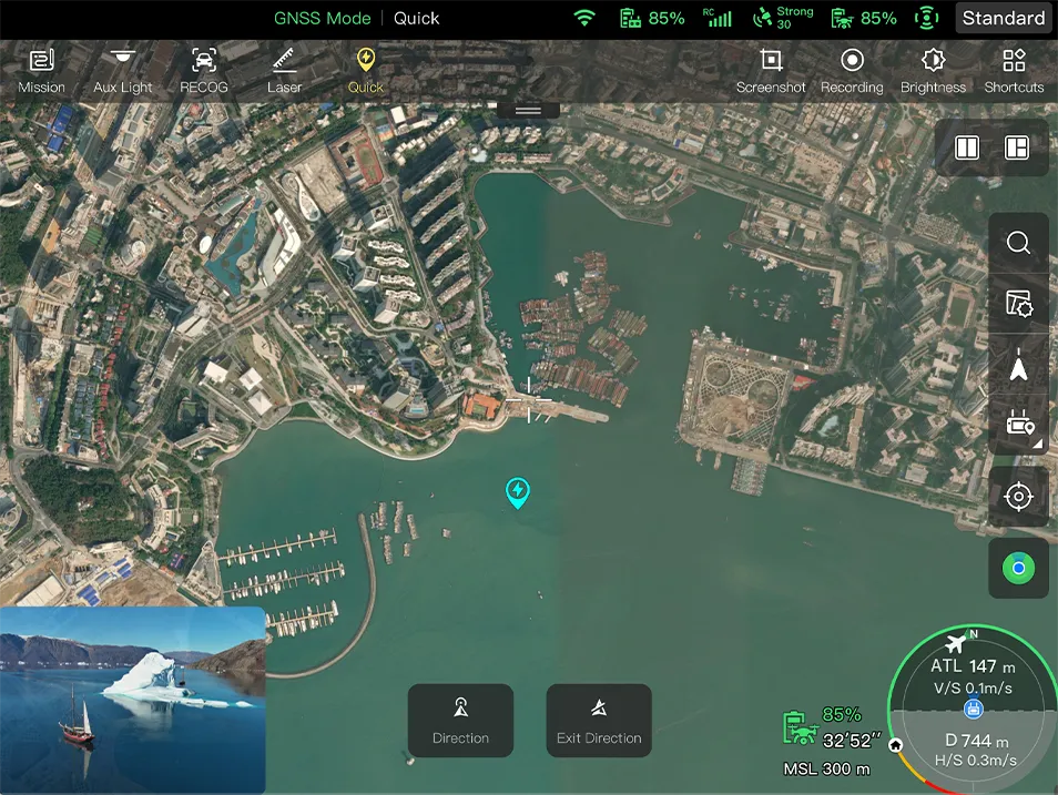
Industry-First Integrated Air-Ground
A-Mesh Networking Solution
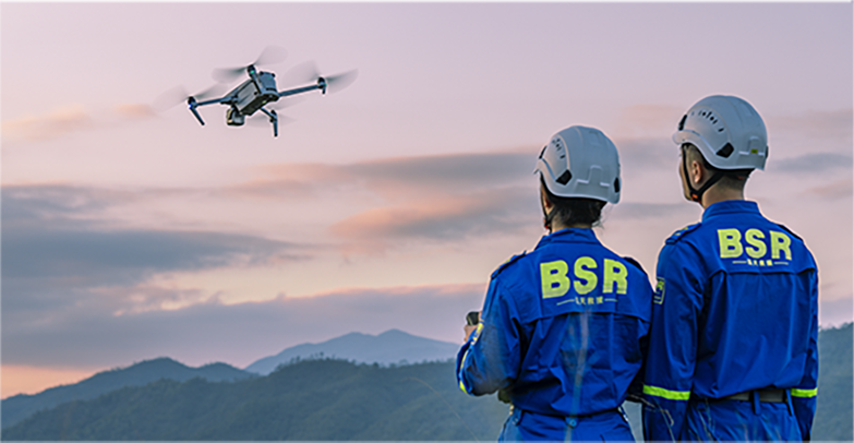
The EVO Max series features the industry-first A-Mesh networking technology, enabling multiple devices to form a free network between drones, drones and ground terminals. It supports various modes such as "One Remote, Multiple Aircraft" and "Lead-Member Dual Control". Even in scenarios involving long-distance flights, obstacle traversal, flying around mountains or buildings, or even in areas with no network coverage, it can establish a free network among multiple devices within the network, enabling collaborative operations. This breaks through the operational boundaries of conventional drones, achieving integrated air-ground network coverage and confidently dealing with complex terrains.

Zonal operations
Supports dual-drone dual-control to achieve zonal operations of aircraft, improving flight work efficiency. It also supports mutual obstacle avoidance among drones within the network, ensuring flight operation safety.

Information sharing
The two remote controllers within the network can simultaneously monitor the aircraft footage. The AI target recognition feature used in the lead controller can also be displayed on the member controller. Additionally, both controllers can utilize the pinpoint positioning feature.

Relay operations
In scenarios with signal obstructions or weak signals such as crossing hills or remote areas, the aircraft can be quickly deployed as a mobile relay communication node, providing reliable signal support for another member aircraft at a distance, efficiently expanding the communication coverage area.
Zonal operations
Supports dual-drone dual-control to achieve zonal operations of aircraft, improving flight work efficiency. It also supports mutual obstacle avoidance among drones within the network, ensuring flight operation safety.
Information sharing
The two remote controllers within the network can simultaneously monitor the aircraft footage. The AI target recognition feature used in the lead controller can also be displayed on the member controller. Additionally, both controllers can utilize the pinpoint positioning feature.
Relay operations
In scenarios with signal obstructions or weak signals such as crossing hills or remote areas, the aircraft can be quickly deployed as a mobile relay communication node, providing reliable signal support for another member aircraft at a distance, efficiently expanding the communication coverage area.
Autel SkyLink 3.0 Upgraded
Performance
Equipped with four image transmission antennas, capable of two-way signal transmission and four-way signal reception, the EVO Max series achieves a communication distance of up to 15 kilometers between the drones and ground control station. It supports adaptive frequency hopping transmission in four frequency bands: 900MHz, 2.4GHz, 5.2GHz, and 5.8GHz, automatically selecting the optimal channel based on electromagnetic interference conditions, demonstrating strong anti-interference capabilities. Real-time transmission quality reaches 1080P@30FPS, with a high transmission rate of 64Mbps and low latency transmission of less than 150 milliseconds. Both image transmission data transmission and storage utilize AES encryption to ensure that communication data between end points is not intercepted.
Equipped with four image transmission antennas, capable of two-way signal transmission and four-way signal reception, the EVO Max series achieves a communication distance of up to 15 kilometers between the drones and ground control station. It supports adaptive frequency hopping transmission in four frequency bands: 900MHz, 2.4GHz, 5.2GHz, and 5.8GHz, automatically selecting the optimal channel based on electromagnetic interference conditions, demonstrating strong anti-interference capabilities. Real-time transmission quality reaches 1080P@30FPS, with a high transmission rate of 64Mbps and low latency transmission of less than 150 milliseconds. Both image transmission data transmission and storage utilize AES encryption to ensure that communication data between end points is not intercepted.
15 Kilometers
Image Transmission Distance
<150ms
Latency
1080P@30FPS
Real-Time Image Quality
900M / 2.4G / 5.2G / 5.8G *
Frequency Bands
* Some frequencies are only available in some regions or for indoor use only.
Check local laws and regulations for details.
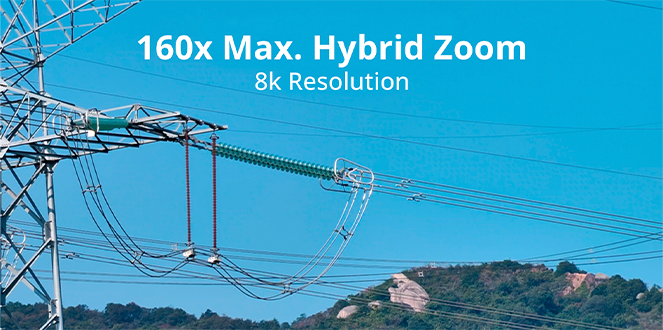
Mission Ready Payload
The EVO Max 4T integrates a 160x zoom camera, a super-sensitive wide-angle camera, a thermal imaging camera, and a laser rangefinder. Additionally, the EVO Max 4N, equipped with a super-starlight-grade gimbal camera, integrates a super-starlight-grade night vision camera, a super-sensitive wide-angle camera, a thermal imaging camera, and a laser rangefinder. Intelligent coordination between multiple sensors enables seamless all- weather operations like never before.
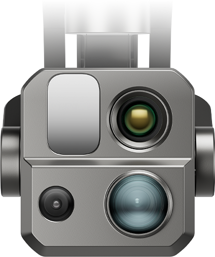
EVO Max 4T
Chase the Heat
Zoom Camera
48MP
10x Optical Zoom
160x Max. Hybrid Zoom
Video Resolution: 4000x3000 30P
Aperture: f/2.8–f/4.8
Super-Sensitive Wide-Angle Camera
50MP
1/1.28" CMOS
Aperture: f/1.9
DFOV: 85°
Equivalent: 23 mm
Thermal Camera
640x512
Focal Length: 13 mm
16x Digital Zoom
Range: -4 ℉ to 1022 ℉
Laser Rangefinder
Measuring Range: 5-1200m (16.4–3737 ft)
Measurement Accuracy: ± (1 m + D×0.15%)
*where D is the distance to a vertical reflecting plane
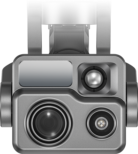
EVO Max 4T XE
Chase the Heat
Zoom Camera
48MP
10x Optical Zoom
160x Max. Hybrid Zoom
Video Resolution: 4000x3000 30P
Aperture: f/2.8–f/4.8
Super-Sensitive Wide-Angle Camera
48MP
1/2" CMOS
Aperture: f/2.8
DFOV: 83.4°
Equivalent: 24 mm
Thermal Camera
640x512
Focal Length: 9.1 mm
16x Digital Zoom
Range: -4 ℉ to 1022 ℉
Laser Rangefinder
Measuring Range: 5-1200m (16.4–3737 ft)
Measurement Accuracy: ± (1 m + D×0.15%)
*where D is the distance to a vertical reflecting plane
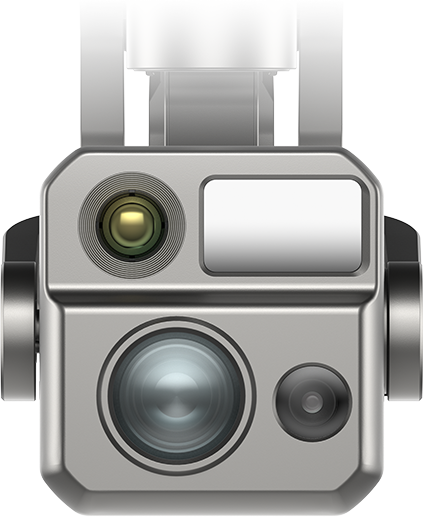
EVO Max 4N
Explore the Night
Super-Starlight Night Vision Camera
2.3MP
LUX: 0.0001
ISO: 440000
Equivalent: 41.4mm
Super-Sensitive Wide-Angle Camera
50MP
1" CMOS
Aperture: f/1.9
DFOV: 85°
Equivalent: 23 mm
Thermal Camera
640x512
Focal Length: 9.1 mm
16x Digital Zoom
Range: -4 ℉ to 1022 ℉
Laser Rangefinder
Measuring Range: 5-1200m (16.4–3737 ft)
Measurement Accuracy: ± (1 m +D×0.15%)
*where D is the distance to a vertical reflecting plane
EVO Max 4T
Chase the Heat
- Zoom Camera
- Super-Sensitive Wide-Angle Camera
- Thermal Camera
- Laser Rangefinder
EVO Max 4T XE
Chase the Heat
- Zoom Camera
- Super-Sensitive Wide-Angle Camera
- Thermal Camera
- Laser Rangefinder
EVO Max 4N
Explore the Night
- Super-Starlight Night Vision Camera
- Super-Sensitive Wide-Angle Camera
- Thermal Camera
- Laser Rangefinder
Chase the Heat and Explore the Night
Chase the Heat
and Explore the Night

- Starlight Camera*
- Super Zoom*
- Super-sensitive Imaging
- Superior Infrared
- Precision Ranging
- Starlight Camera*
- Super Zoom*
- Super-sensitive Imaging
- Superior Infrared
- Precision Ranging
Intelligent Operations, Efficient and Safe.
Intelligent Operations, Efficient and Safe.
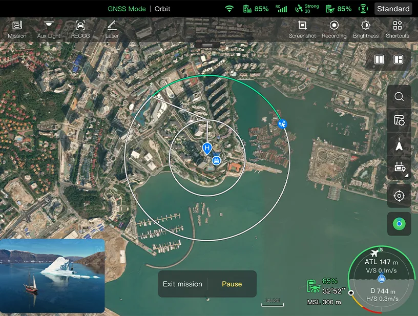
Quick Mission
In case of unforeseen circumstances, users can create temporary tasks in the air and flexibly modify based on the situation.
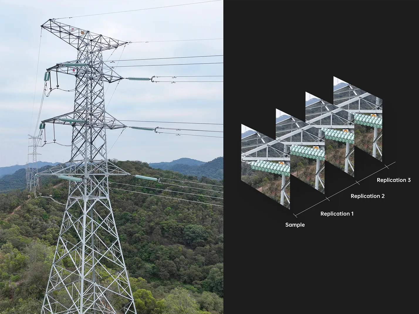
Precise Repetition
By recording flight trajectories and camera actions, precise repetition can be achieved after selecting target areas in the footage.
*This accessory will be launched later.
- Quick Mission
- Precise Repetition
Multiple Mission Types Empower Efficiency
Multiple Mission Types Empower Efficiency
The app offers various task modes such as waypoint missions, polygon missions, and mapping aerial photography*, allowing users to import captured photos into modeling software for 2D or 3D model reconstruction. Suitable for scenarios like mapping,inspection, patrols, search and rescue, etc.
*This feature is pending future updates.
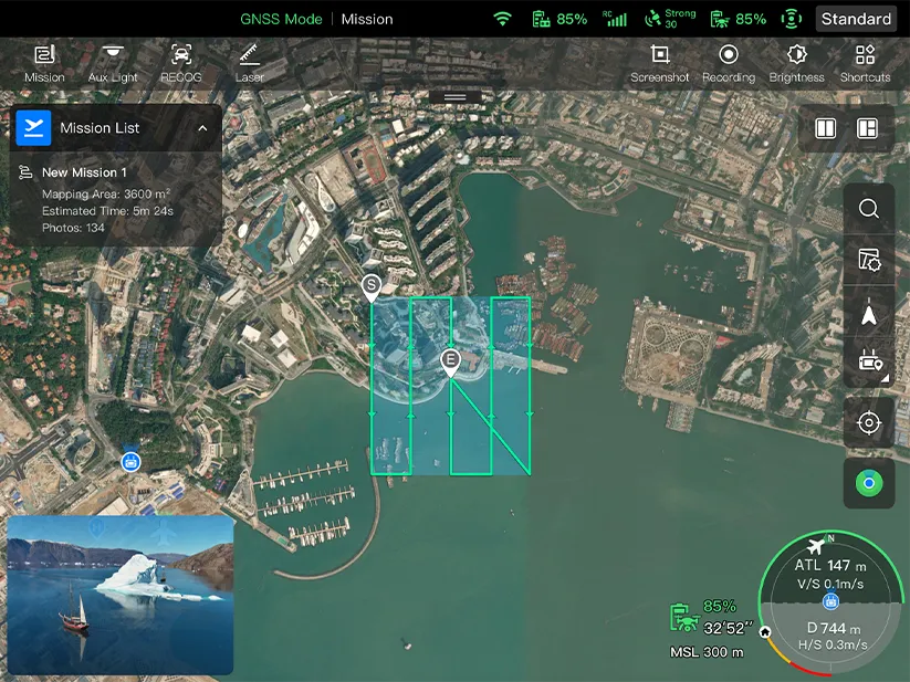
Polygon Mission
Supports one-click automatic generation of polygon flight areas
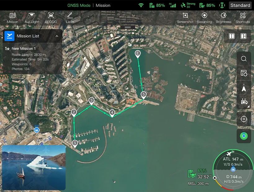
Waypoint Missions
Users can add waypointsfor flexible, non-structured flight paths
Automatic Mission Generation And Data Capture*
Automatically produce routes by adding regional boundary points through dots or importing KML files
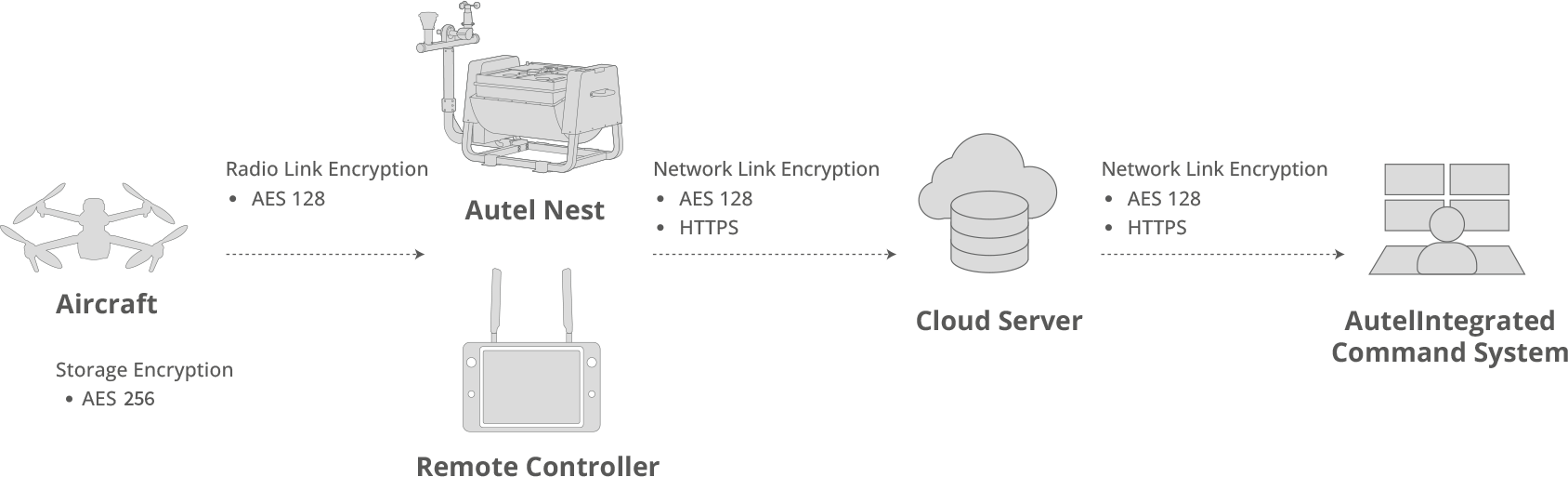
Data Security Multi-layer Protection
Data Security Multi-layer Protection
Data involving user privacy, including flight logs, locations, etc., must be manually agreed upon by the user before uploading. It supports AES encryption for photos, videos, and flight logs, requiring a password input for access.
Enhanced Live-View
Enhanced Live-View
Multicast
Supports simultaneous output of visible light/night vision, infrared, and map displays.
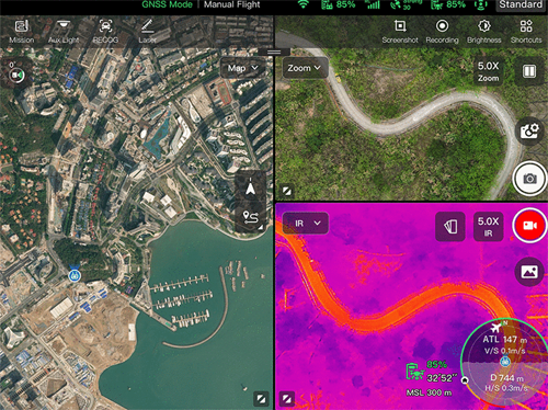
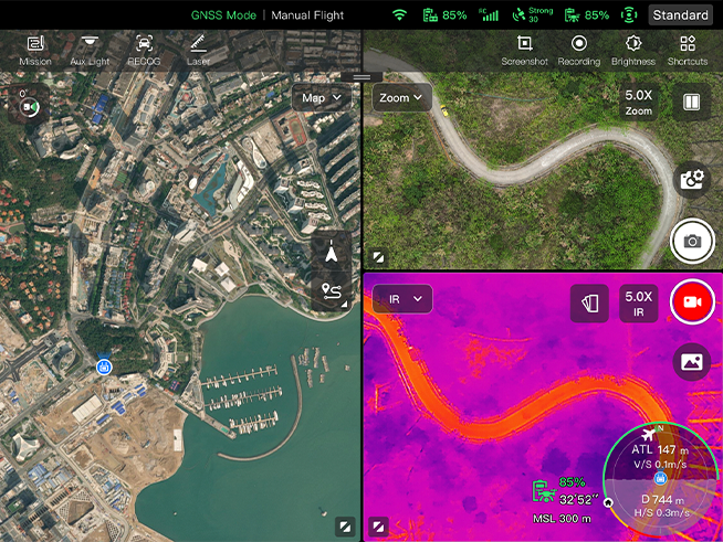
- Multicast
Operating Environment
-
IP43*
protection level
-
-20℃ to 50℃**
Operating temperature
* Custom service
** Without load
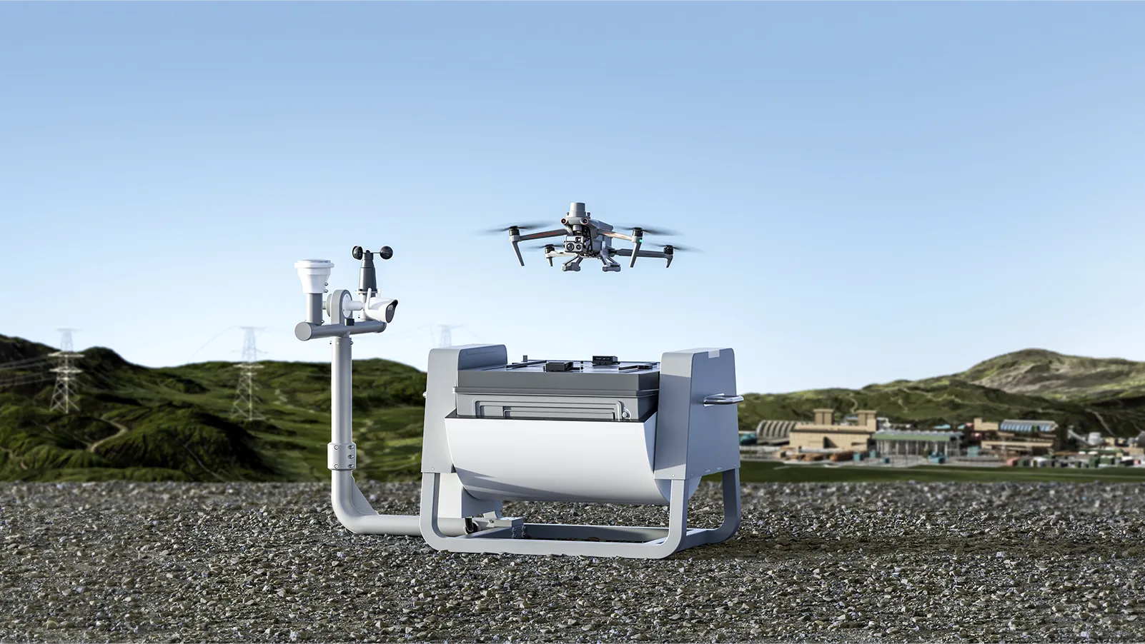
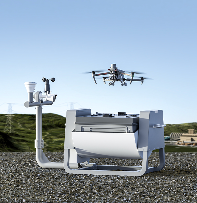
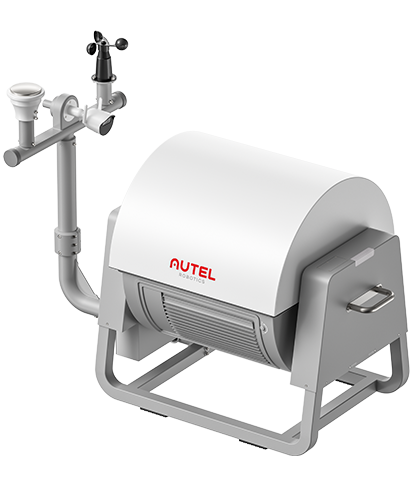
Complete Remote Operations System
Used with the EVO Nest, the EVO Max series supports all-weather auto piloting for scenarios such as substations, industrial parks, and rooftops.
Autel SDK Ecosystem
Autel Robotics opens the Autel SDK developer platform to the world, helping developers and partners reduce software and hardware development costs, jointly creating a new industrial ecosystem.
-


Mobile SDK / Payload SDK
A reasonable software and hardware architecture makes it easier for developers to get started, simple and easy to use, helping to create a superior new experience for drone mobile applications.
Accessories
Application
Download Brochure