

Spatial Planning Solutions
Accurate digital recreation of environments, allowing for intuitive regional planning
Spatial Planning Solutions
Accurate digital recreation of environments, allowing for intuitive regional planning
Overview
As the US urban areas continue to expand, the need for efficient and accurate land and space governance is becoming increasingly important. To meet this need, multi-rotor UAVs can be used to collect high-resolution photos and generate 2D and 3D models. With a mechanical shutter, high-pixel camera, and free image control, drones can provide a comprehensive visual basis for the rational layout of urban buildings and the comprehensive deployment of engineering construction. With 83% of the population living in urban areas, and a predicted increase of up to 89% by 2050, it is inevitable that city centres will need to harness new tools and innovate the development process of cities. Drone solutions can provide governments and urban planners with new tools and ways to develop cities, including managing areas safely and sustainably, conducting land surveys, mapping and more.
Pain Points

Limited Information Sources
Traditional map displays are not intuitive and complex GIS analysis cannot be completed, resulting in incomplete planning.

Large Picture Discrepancies
BIM design drawings, satellite images and real-world models can differ greatly, and accurate matching cannot be performed.

Heavy Workload
There are many types of infrastructure such as water conservancy, bridges, and highways, with construction time often spanning over a long period. On-site measurement can become difficult when project workloads are heavy, and spatial data requires time, which can prove to be an issue.

Slow Turnaround
Traditional topographic maps take a long time to draw and have low resolution, making it difficult to intuitively grasp key information such as topography, landforms, and land attachments.
Solution
Business Value
-
Scalable, Rich Routing Functions
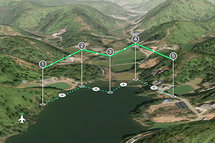
All aircraft can achieve image control-free accuracy, satisfying 2D photography, oblique photography, elevation route planning, and route simulation functions, and support offline map planning, which effectively improves acquisition efficiency, flight safety and mold release quality.
-
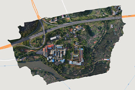
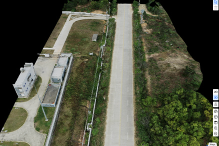
Highly Efficient Modeling
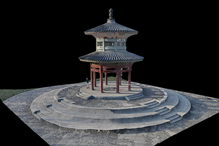
Autel Mapper can quickly generate a high-precision 2D and 3D model with coordinates from collected photos, which can then easily be combined with the BIM model to visually display plans.
-
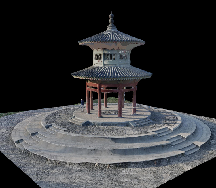
High-Precision Dimension Measurements
The measurement of position point, distance, area and volume utilizing 2D and 3D models, with high precision and small errors.
-
Cross-Functional Results
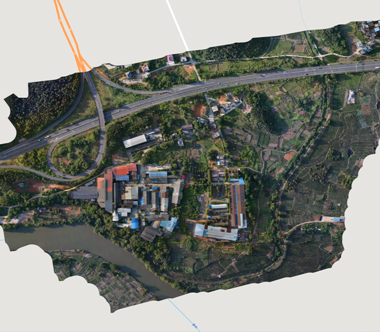
The 3D results processed by Autel Mapper are perfectly compatible with other GIS systems in full HD.
Recommended Autel Products
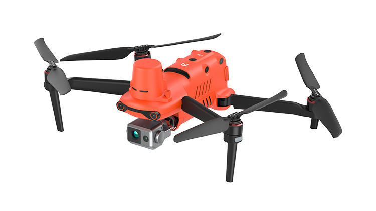
EVO II Dual 640T RTK V3
Centimeter-Level & High-Precision Positioning System
No GCP Required | 640*512 Thermal Camera
Learn More
EVO NEST
Autonomous, Semi-Autonomous, Or Remote Piloting | Multi-Nest Systems
All Weather Performance | Transportable & Easy Setup
Learn More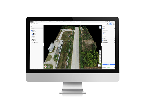
EVO II Dual 640T RTK V3
Centimeter-Level & High-Precision Positioning System
No GCP Required | 6K 1" CMOS
Learn More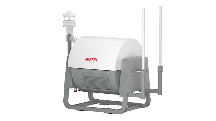
EVO NEST
Autonomous, Semi-Autonomous, Or Remote Piloting | Multi-Nest Systems
All Weather Performance | Transportable & Easy Setup
Learn More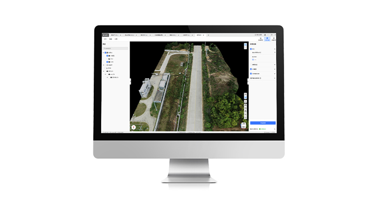
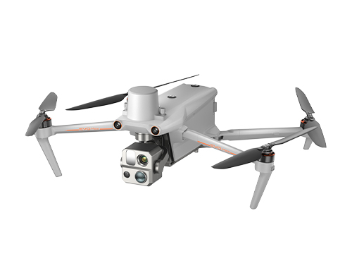
EVO Max Serie
720° Obstacle Avoidance | Non-GPS Return-to-Home
42 Mins Flight Time | Automatic Obstacle Rerouting
Learn MoreEVO NEST
Autonomous, Semi-Autonomous, Or Remote Piloting | Multi-Nest Systems
All Weather Performance | Transportable & Easy Setup
Learn More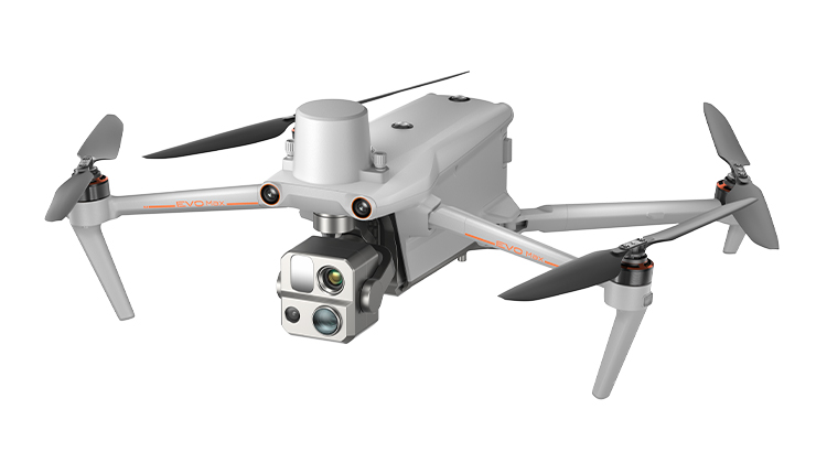
EVO Max 4T
720° Obstacle Avoidance | Non-GPS Return-to-Home
42 Mins Flight Time | Automatic Obstacle Rerouting
Learn More
EVO NEST
Autonomous, Semi-Autonomous, Or Remote Piloting | Multi-Nest Systems
All Weather Performance | Transportable & Easy Setup
Learn More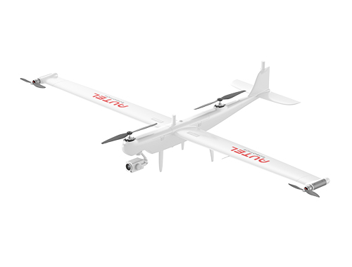
Dragonfish Series
158 Mins Flight Time | 3 Mins Quick Assembly
4K 50x Optical Zoom | 18.6 Miles Transmission Range
Learn More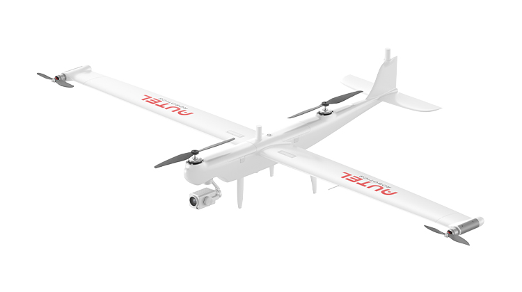
Dragonfish Series
158 Mins Flight Time | 3 Mins Quick Assembly
4K 50x Optical Zoom | 18.6 Miles Transmission Range
Learn More