
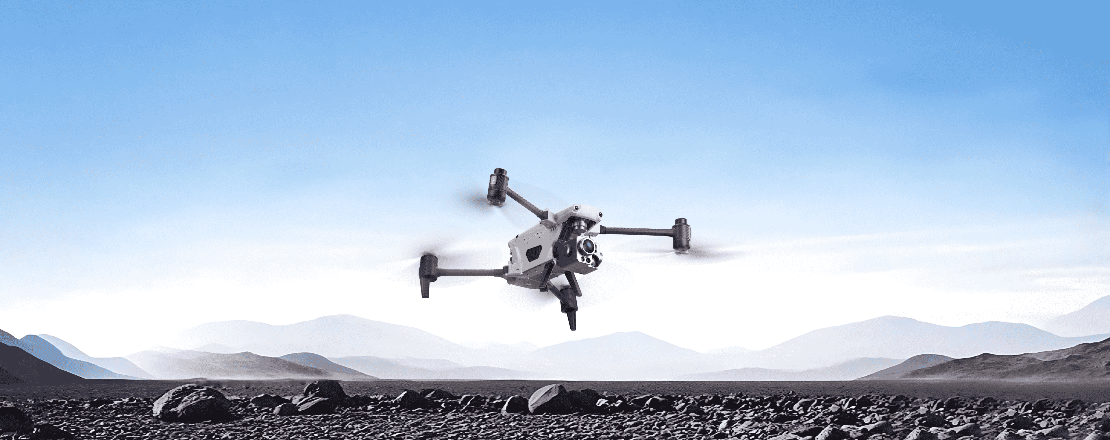
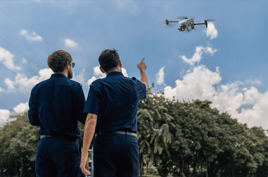
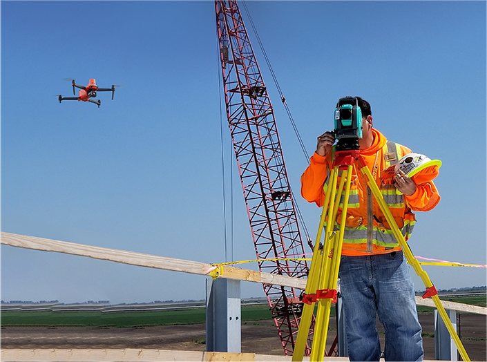
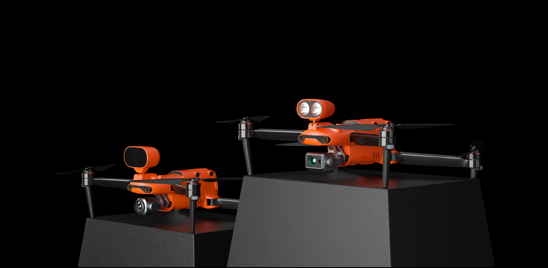
Reach New Frontiers

Reach New Frontiers
Reach New Frontiers
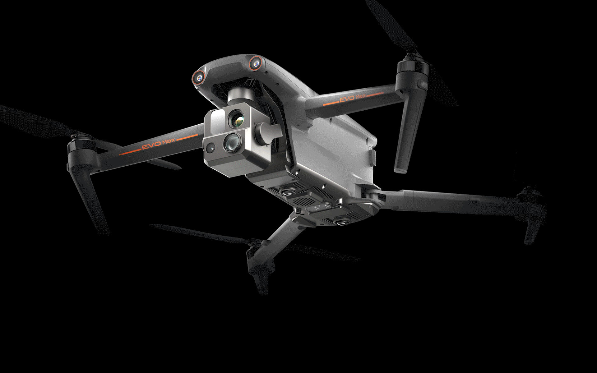
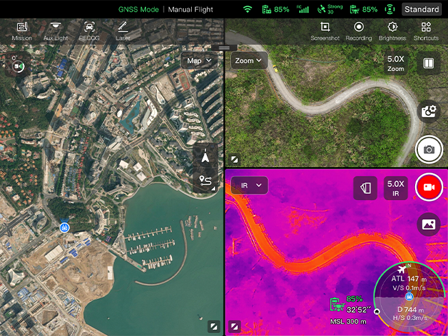
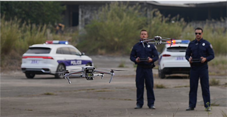
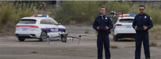
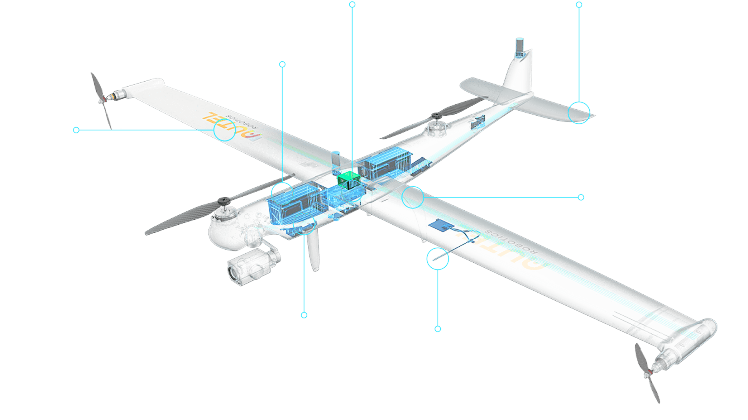
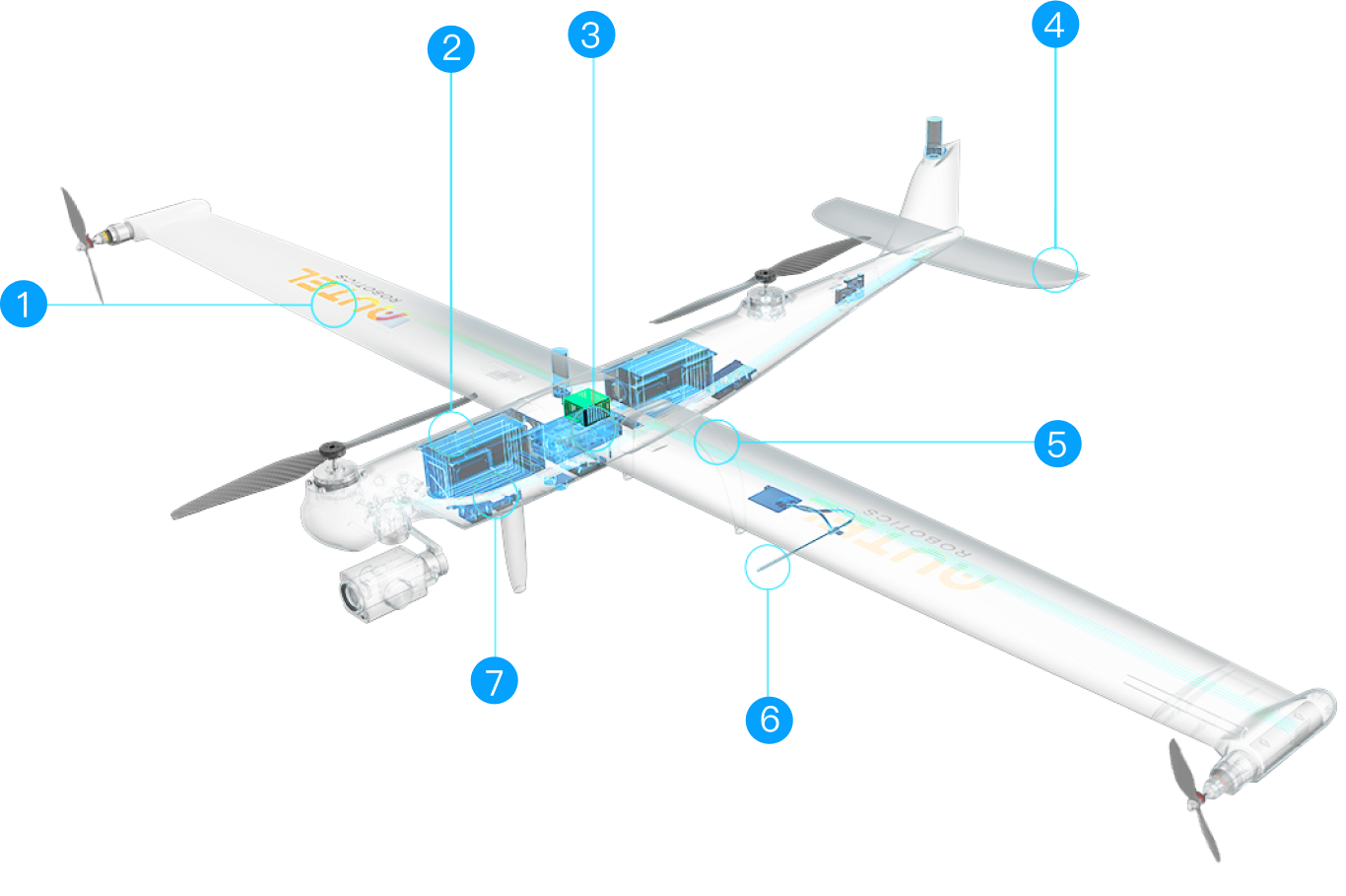
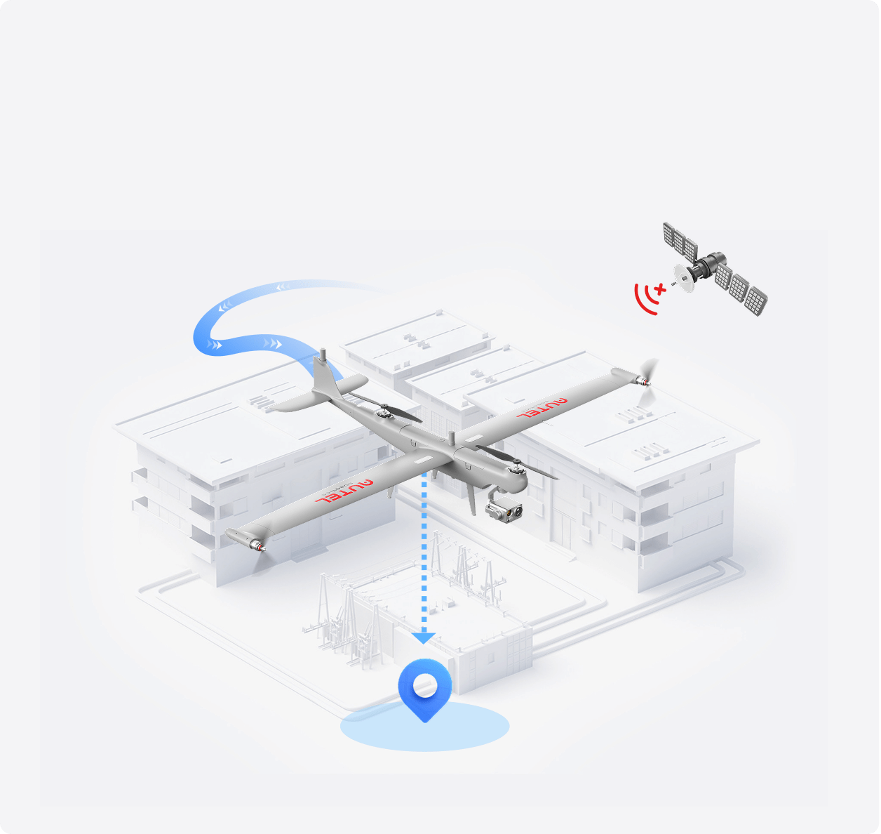
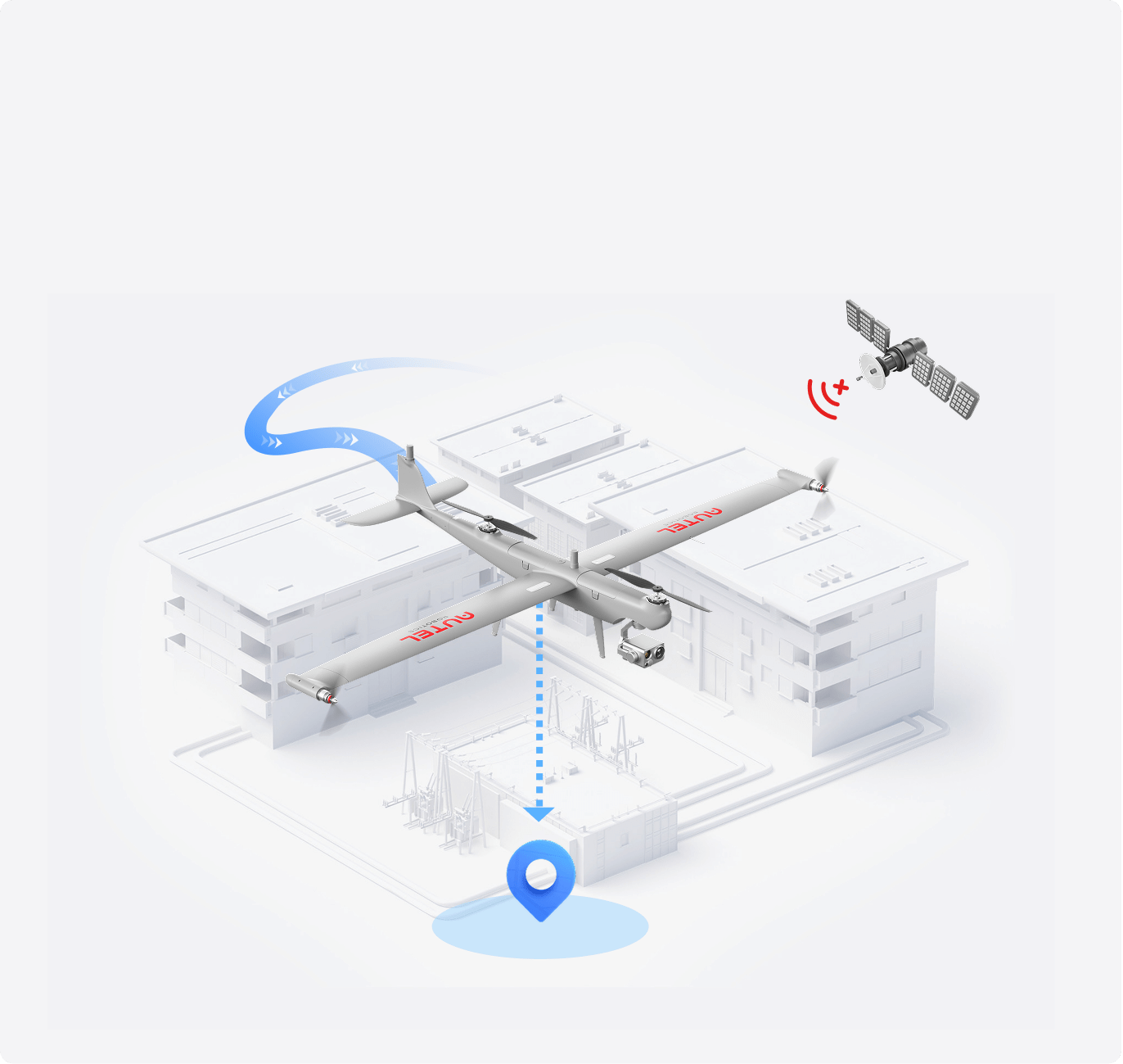
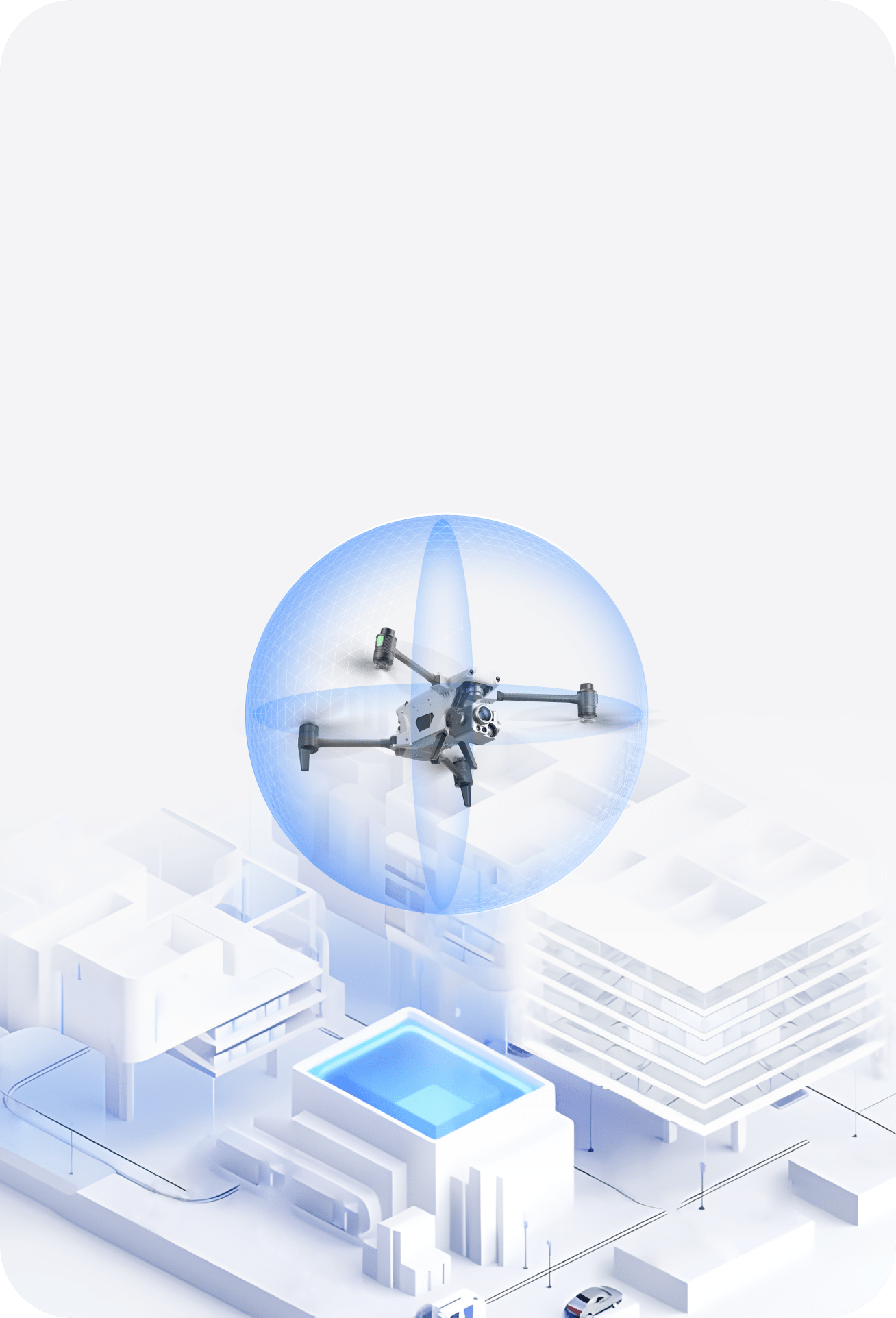
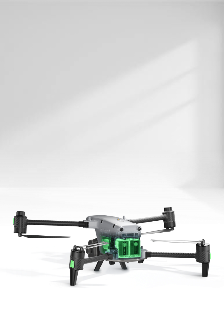
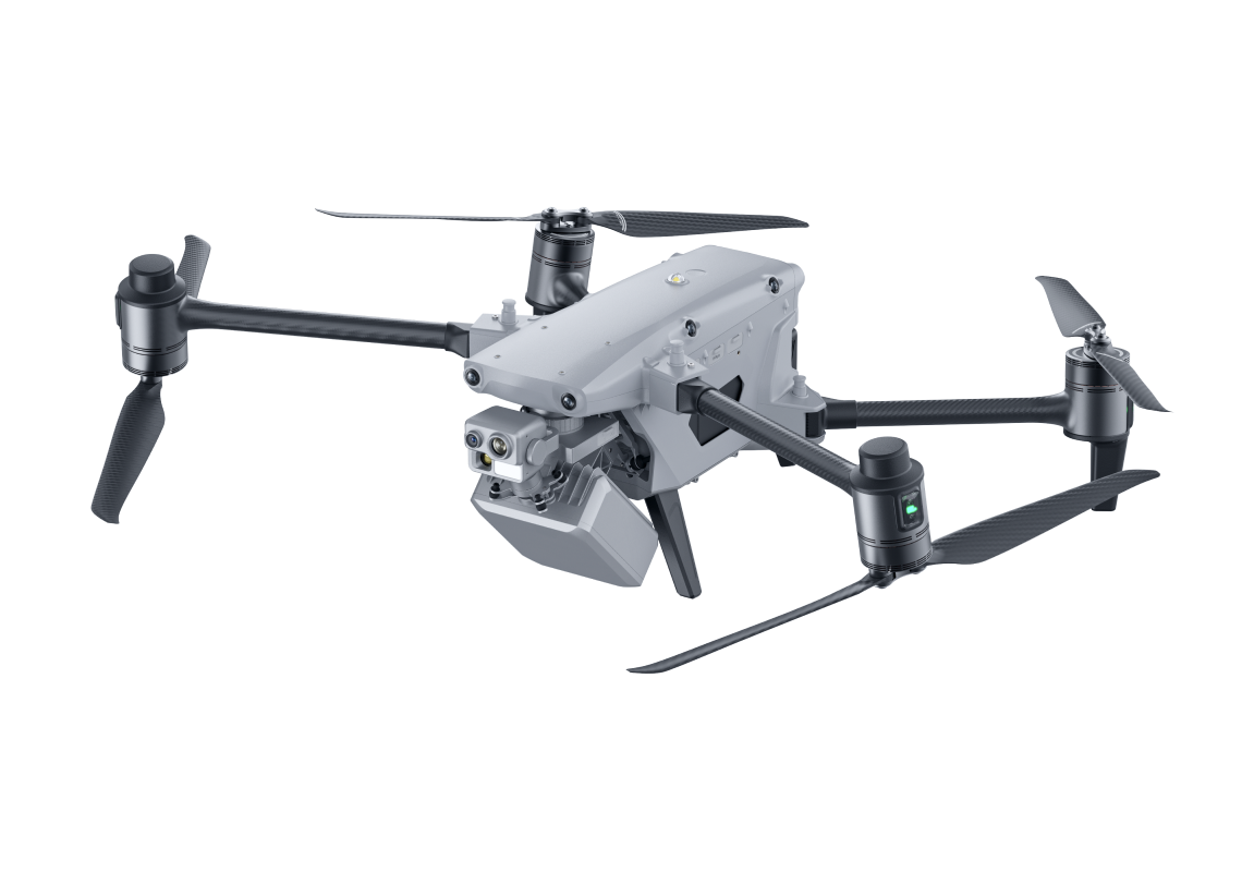
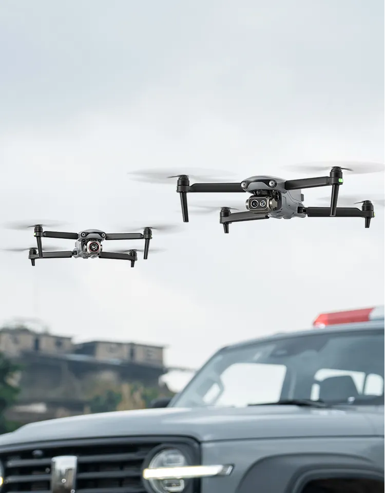
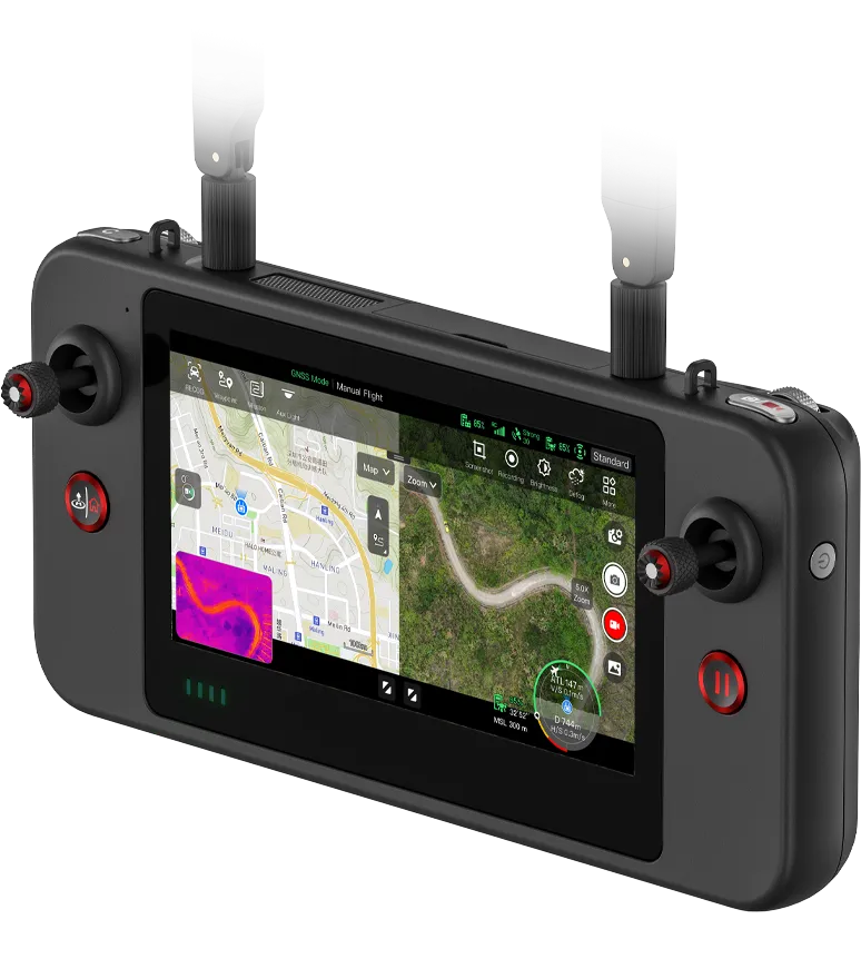
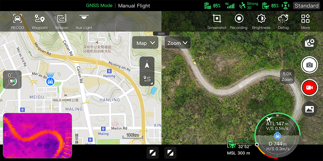
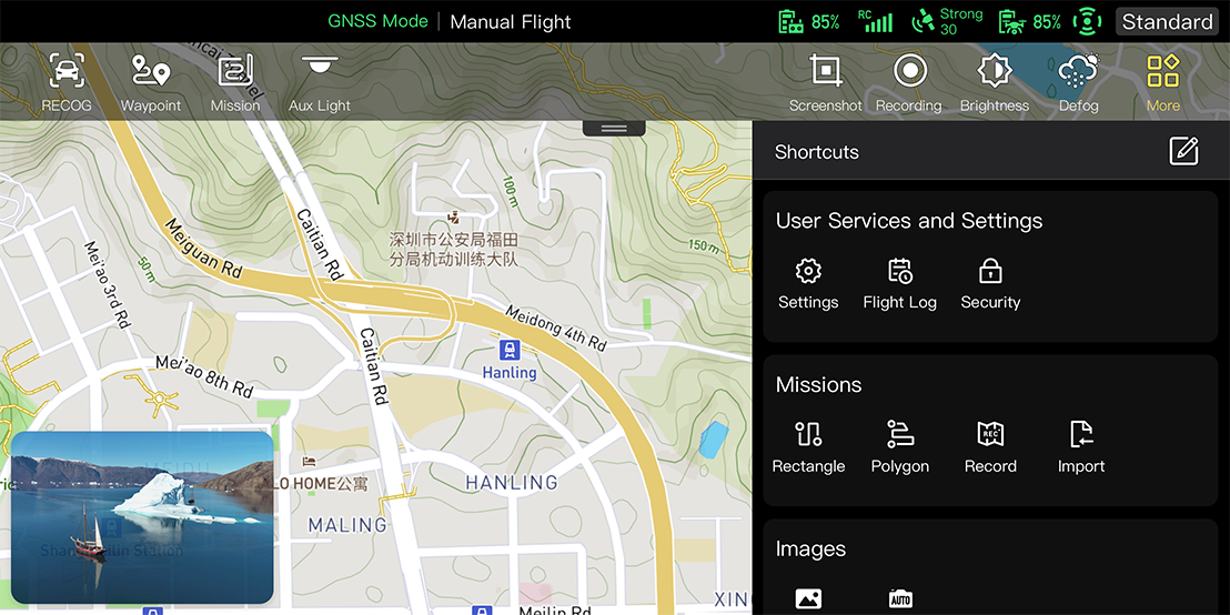
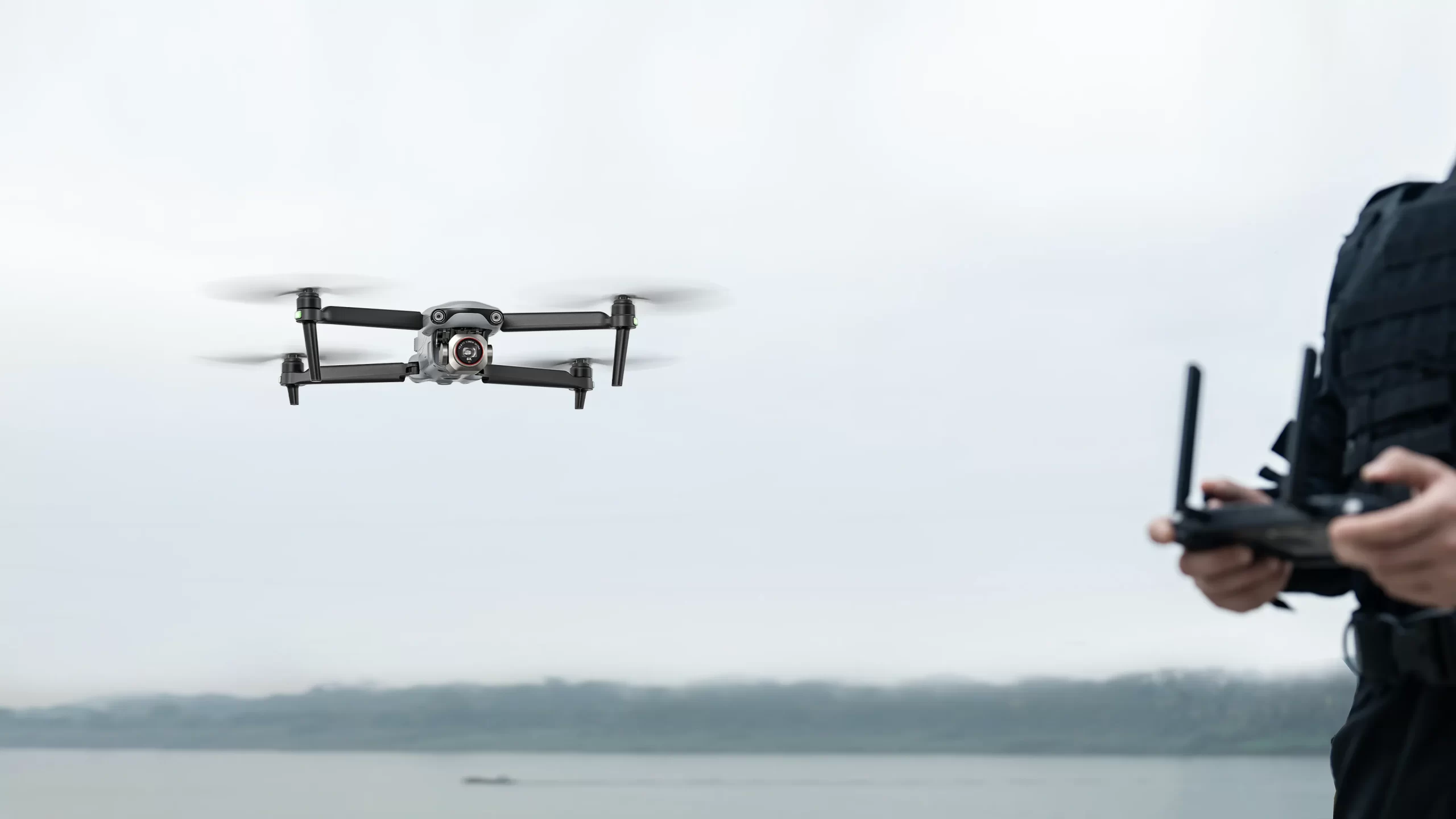
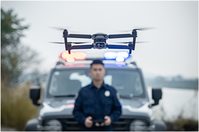
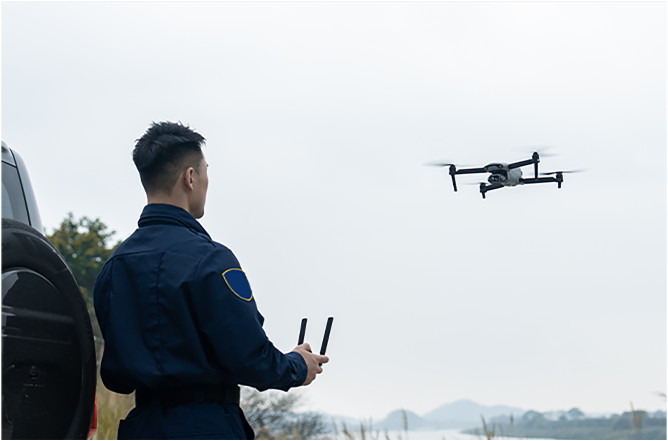
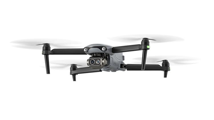
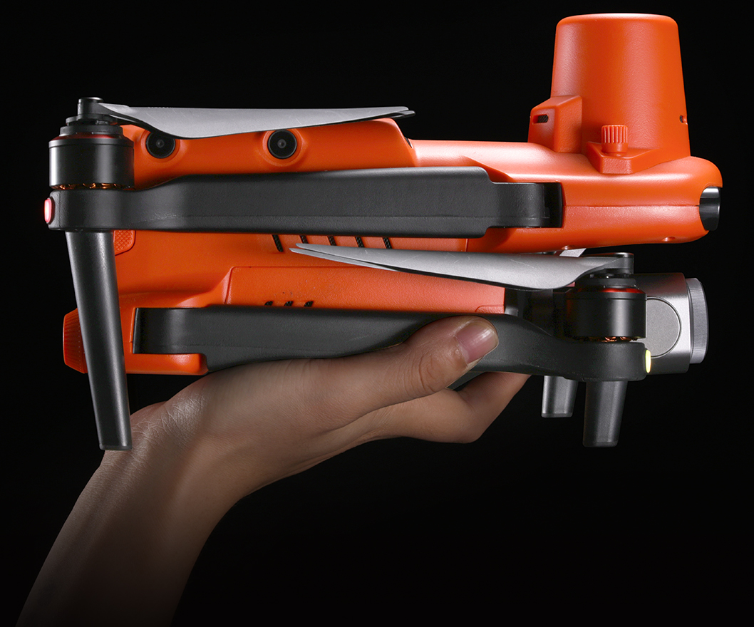
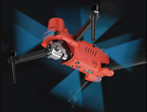
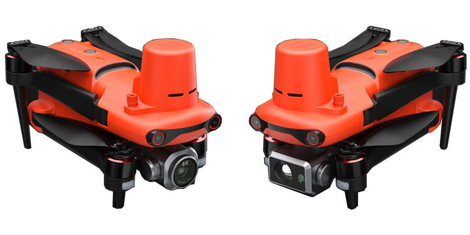
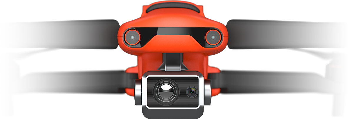
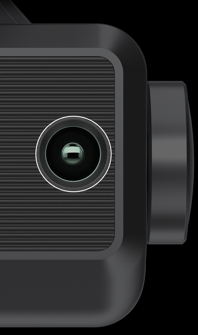
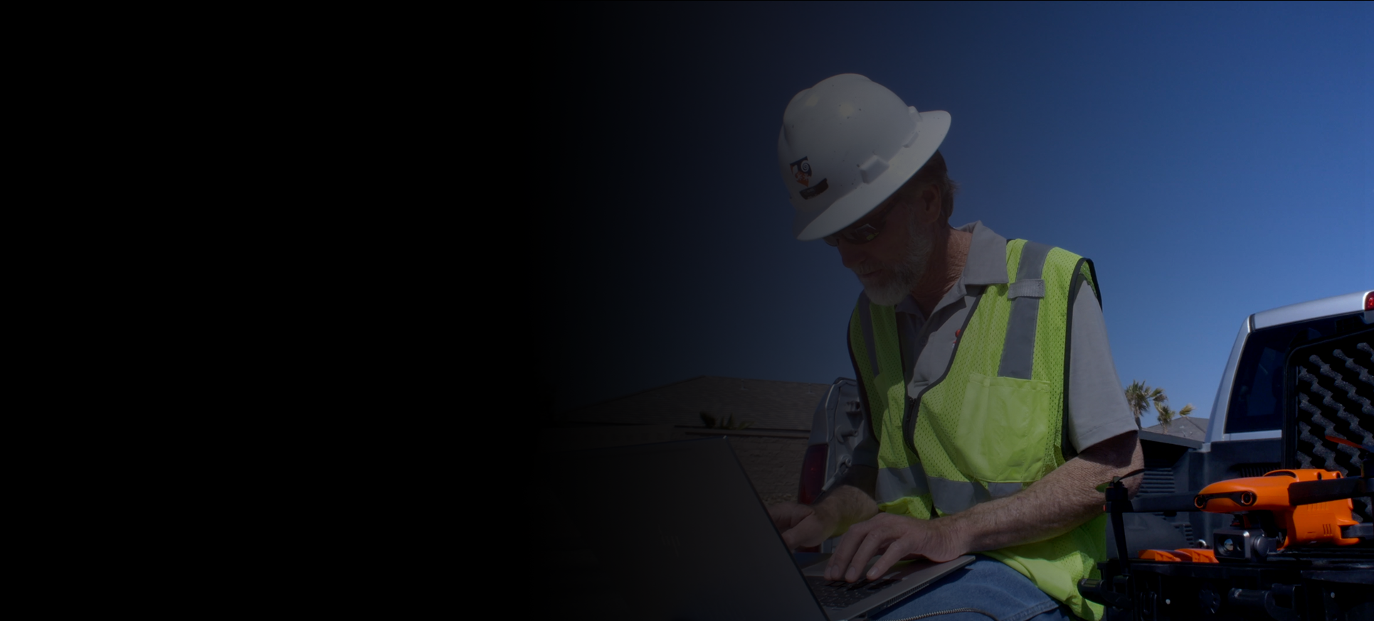
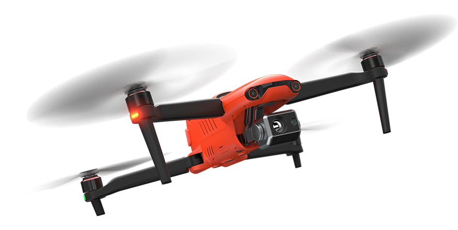
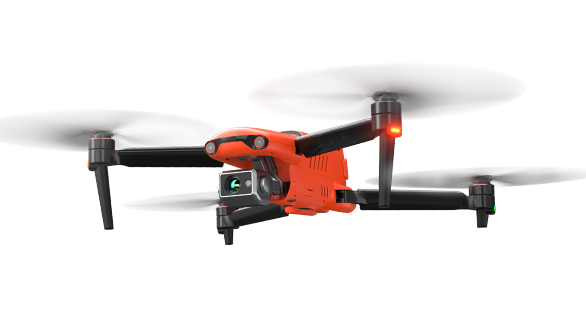
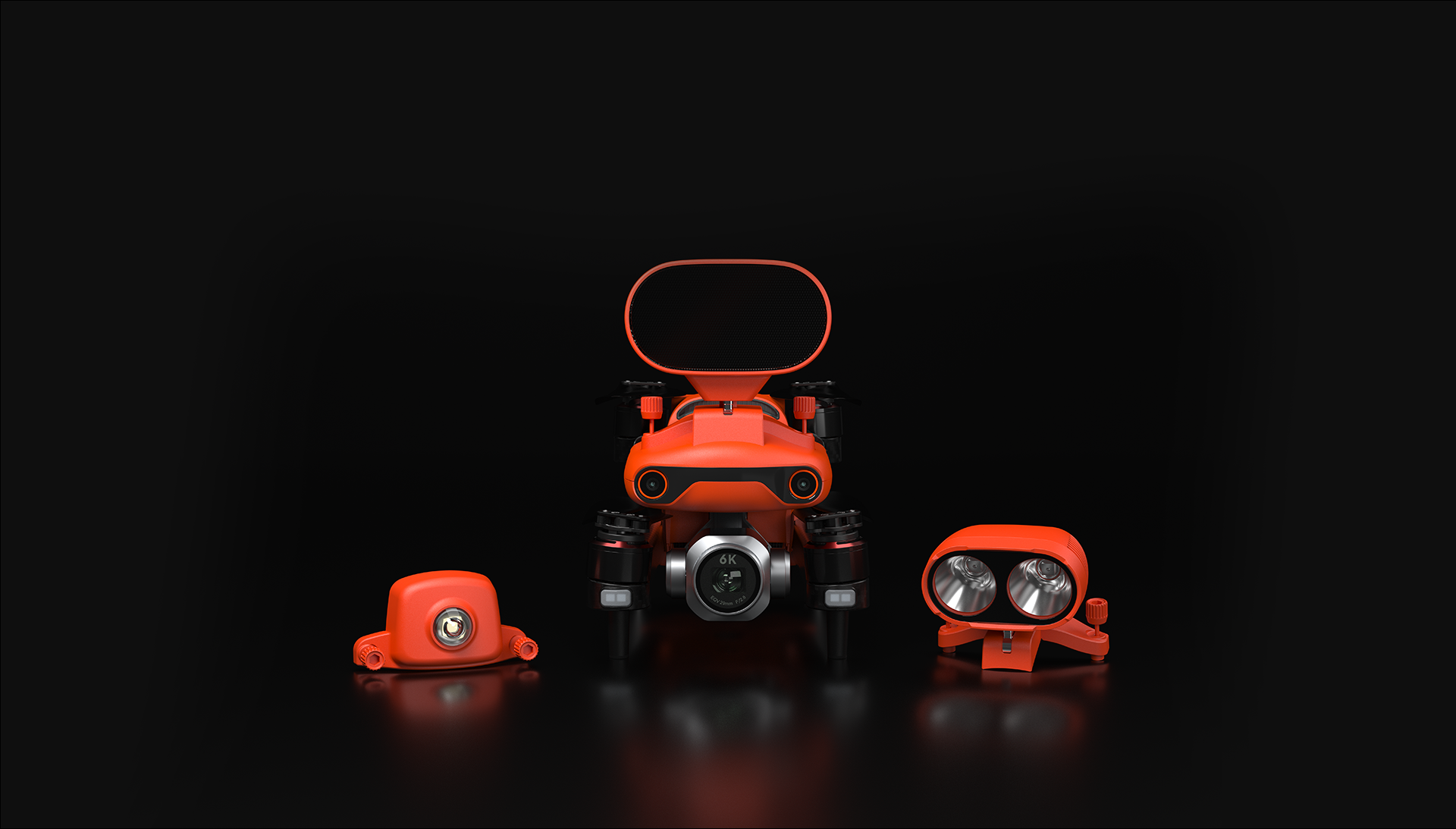
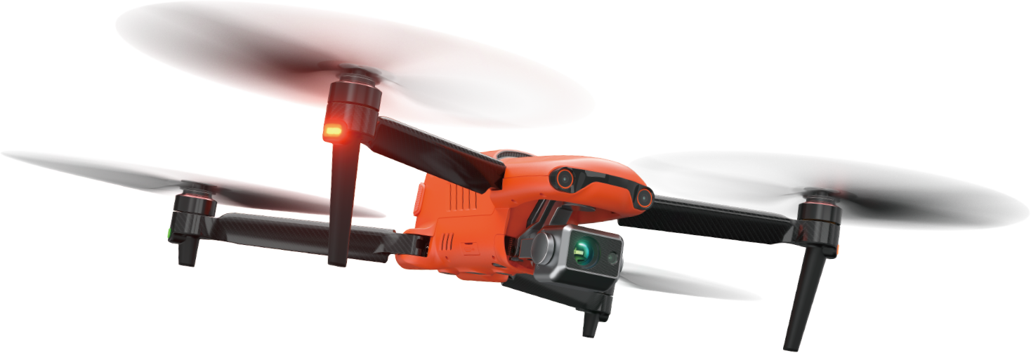
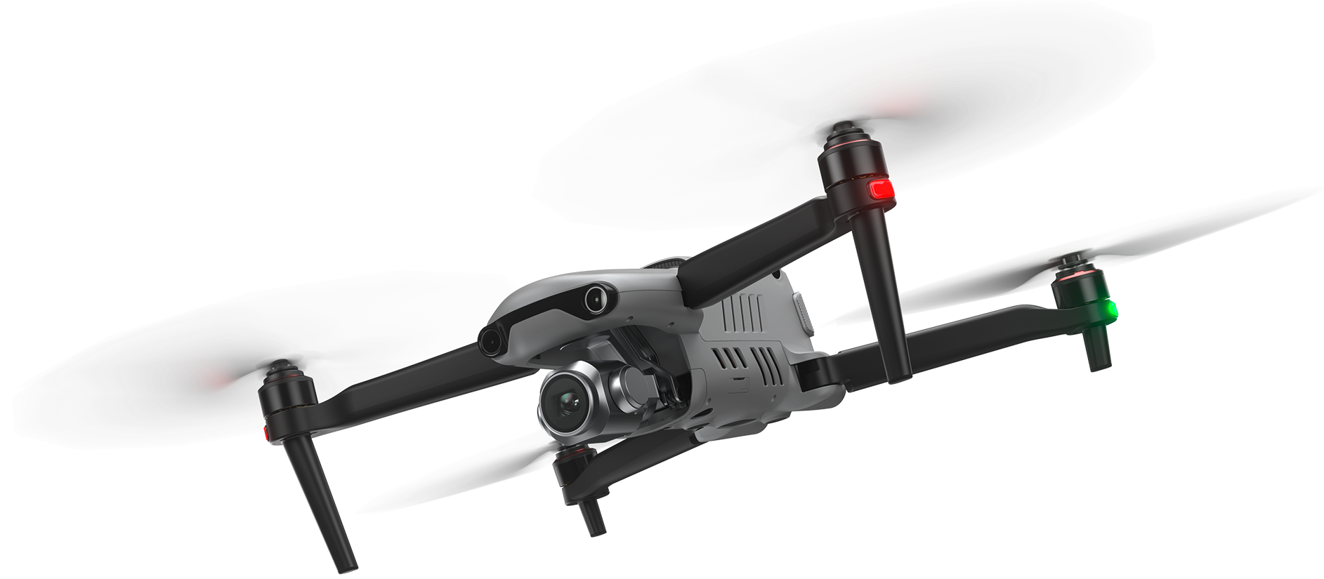
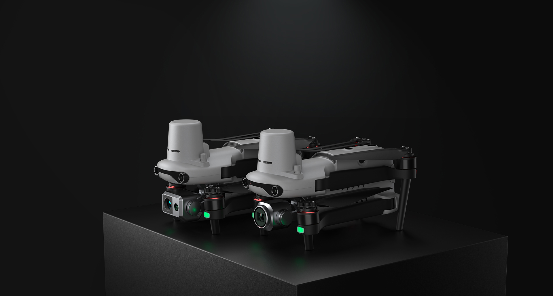
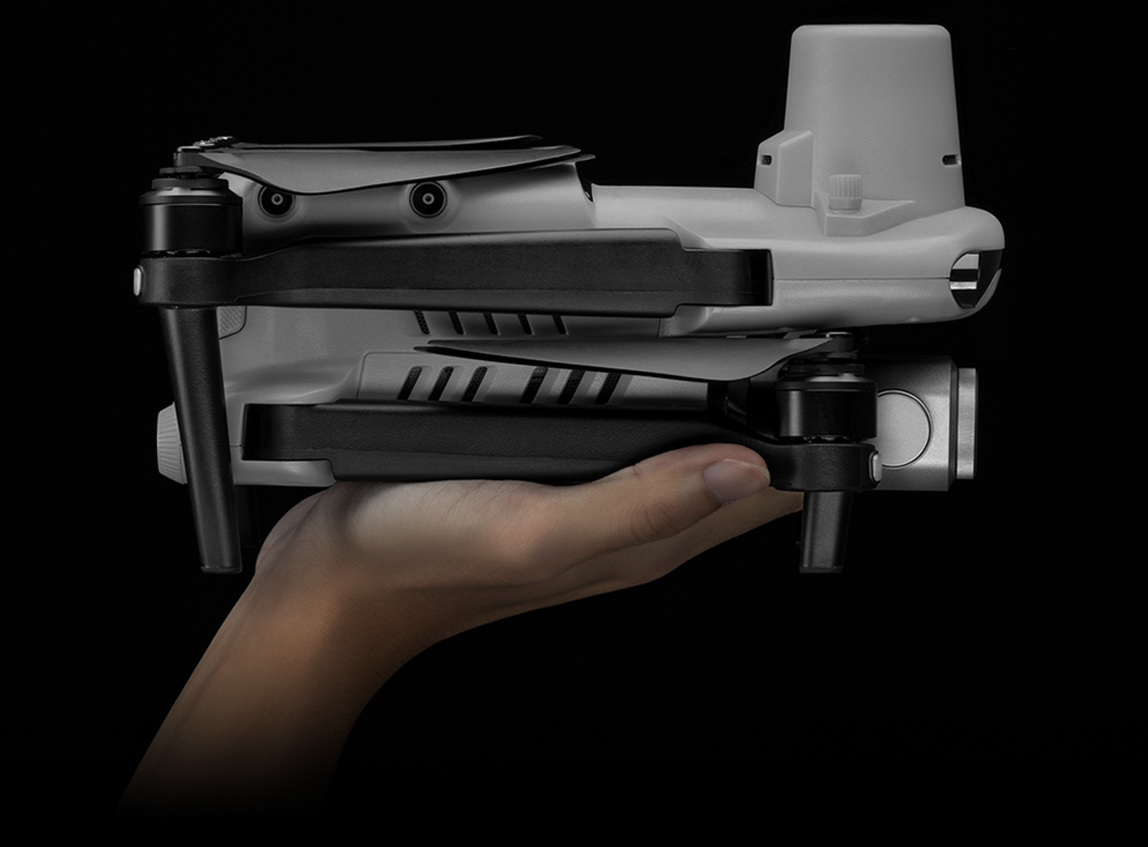
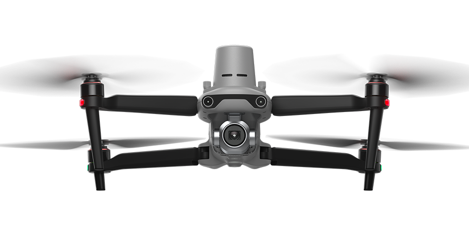
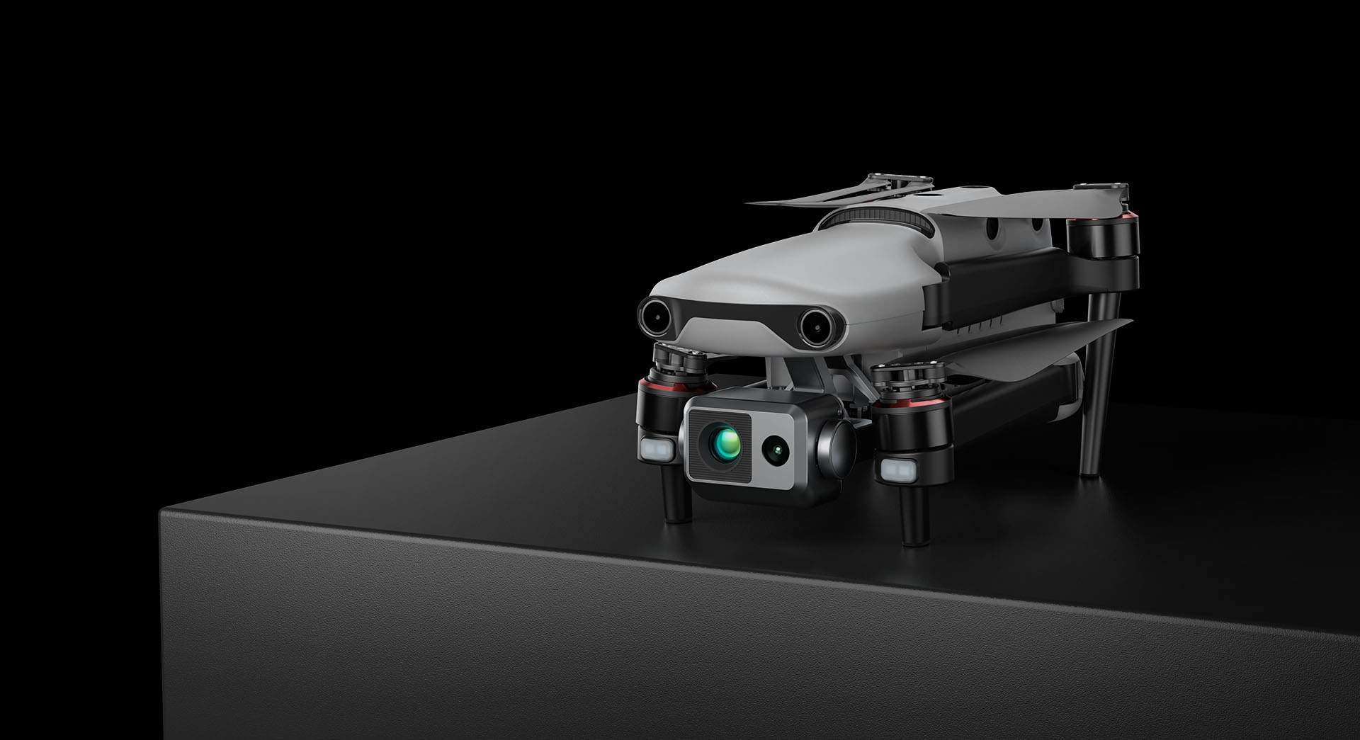
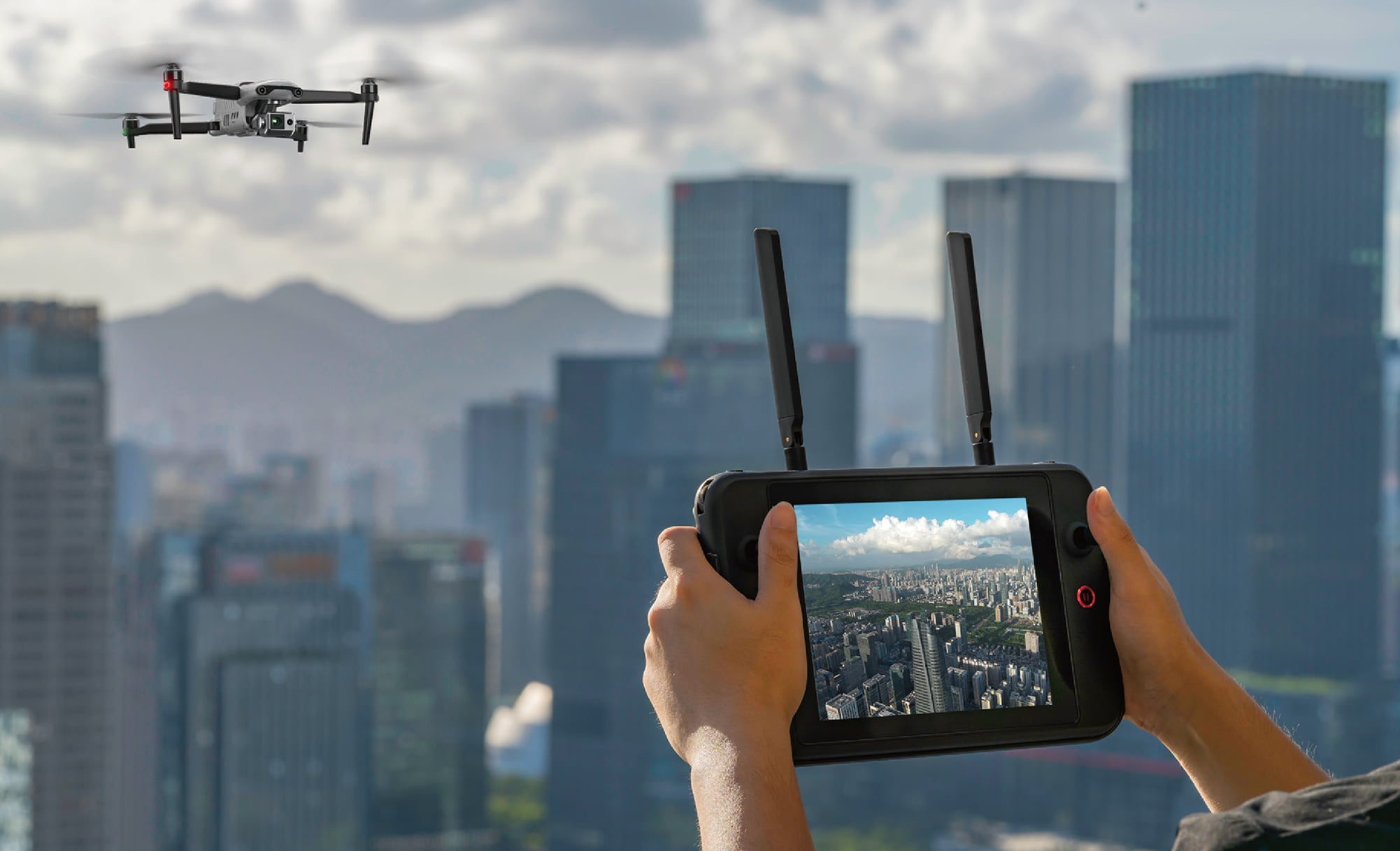
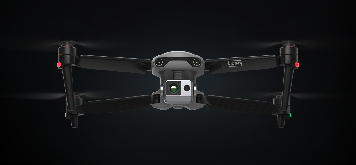
The EVO Max 4T brings powerful technologies and advanced autonomy to users. EVO Max 4T assesses complex environments to create real-time 3D flight paths for unparalleled obstacle avoidance. Advanced sensors make flight in GNSS unavailable areas possible and the incredible new thermal payload unlocks new object identification and tracking scenarios. With a foldable, weather-resistant design, the EVO Max 4T is as portable as it is capable.
-
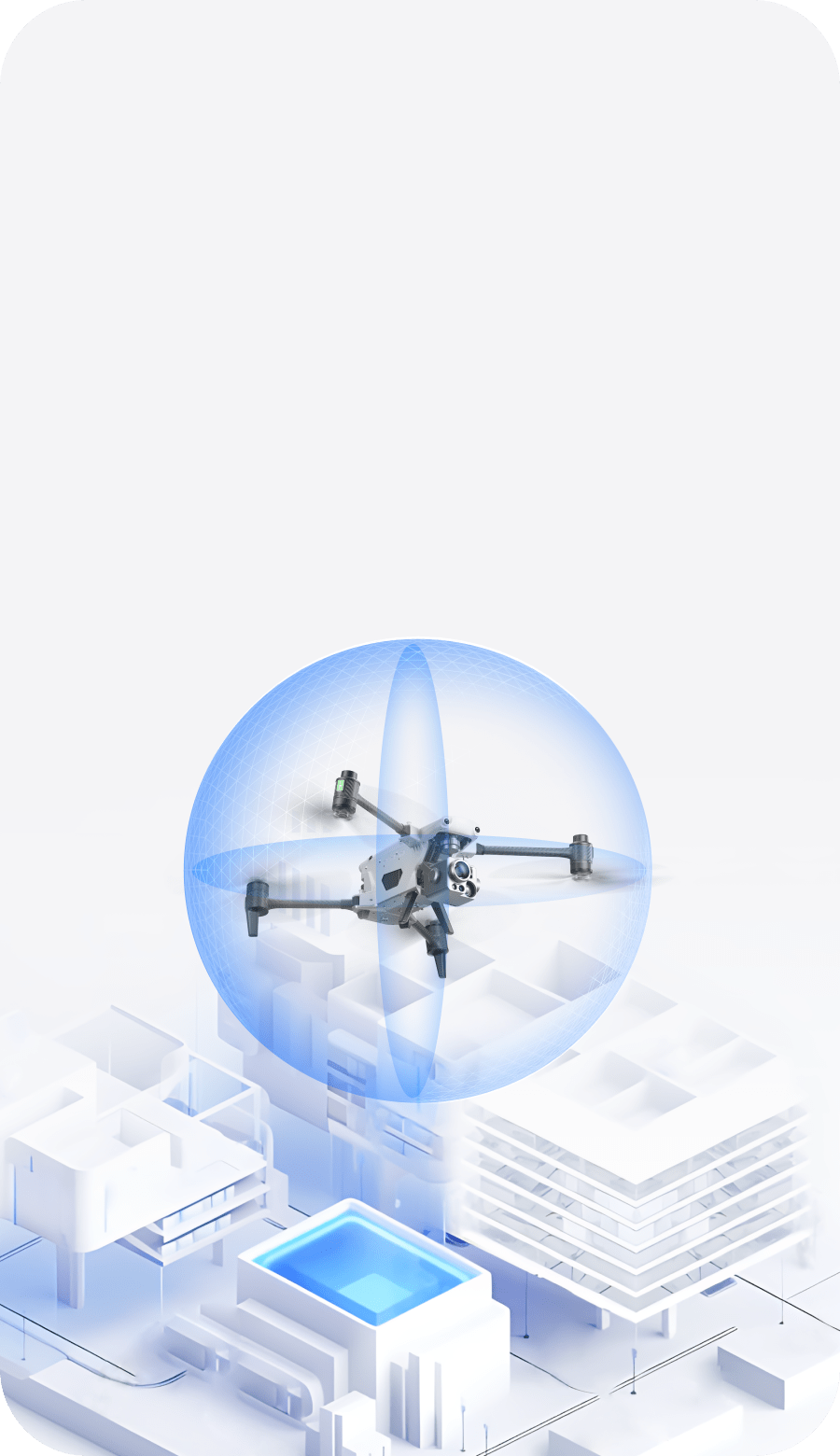
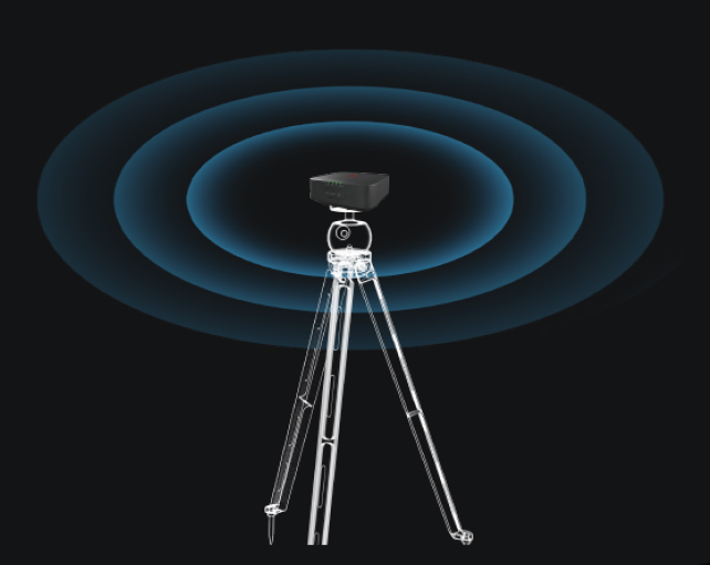
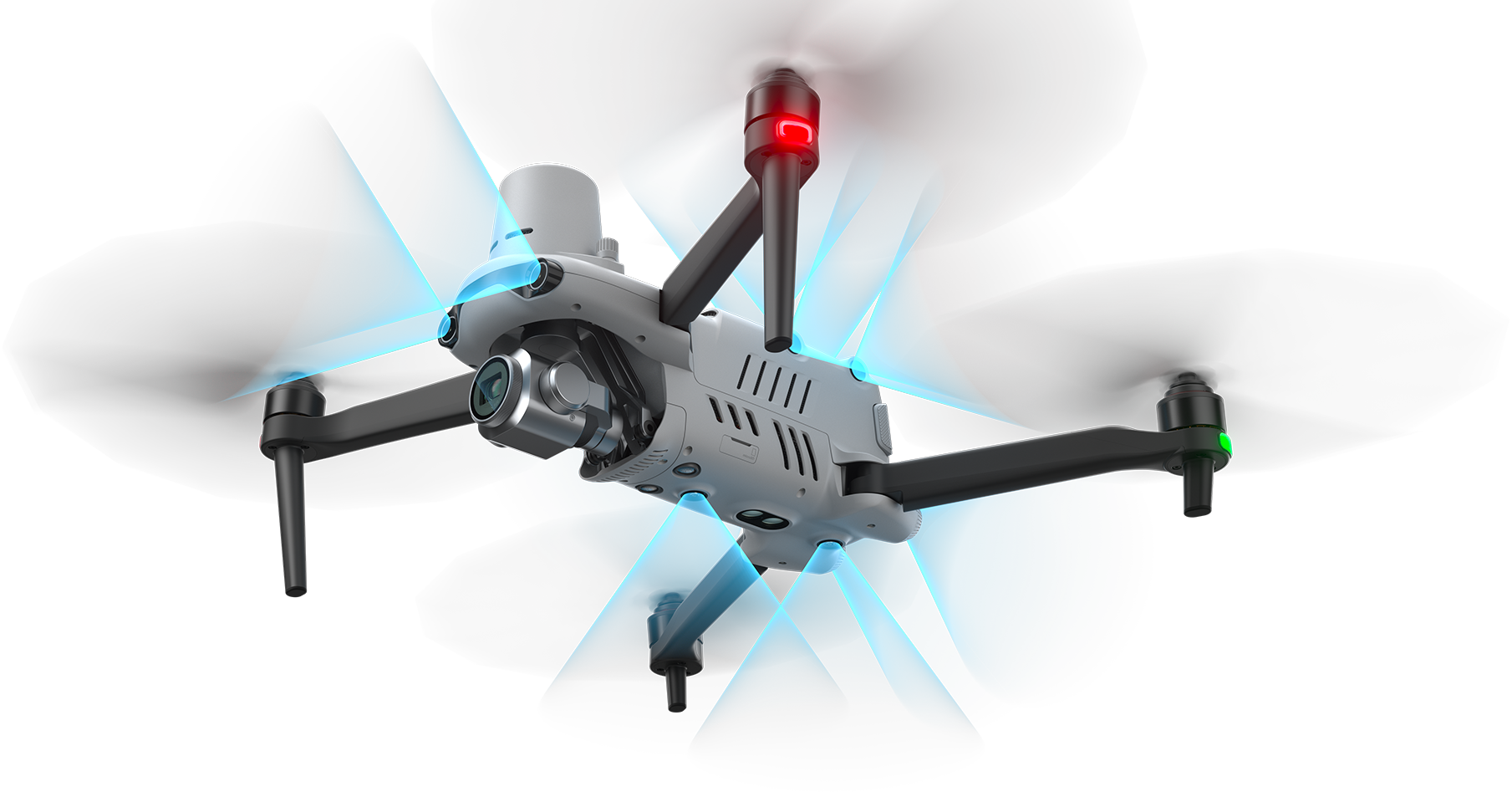
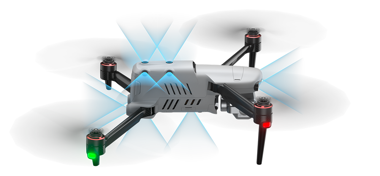
 No Blind Spots
-
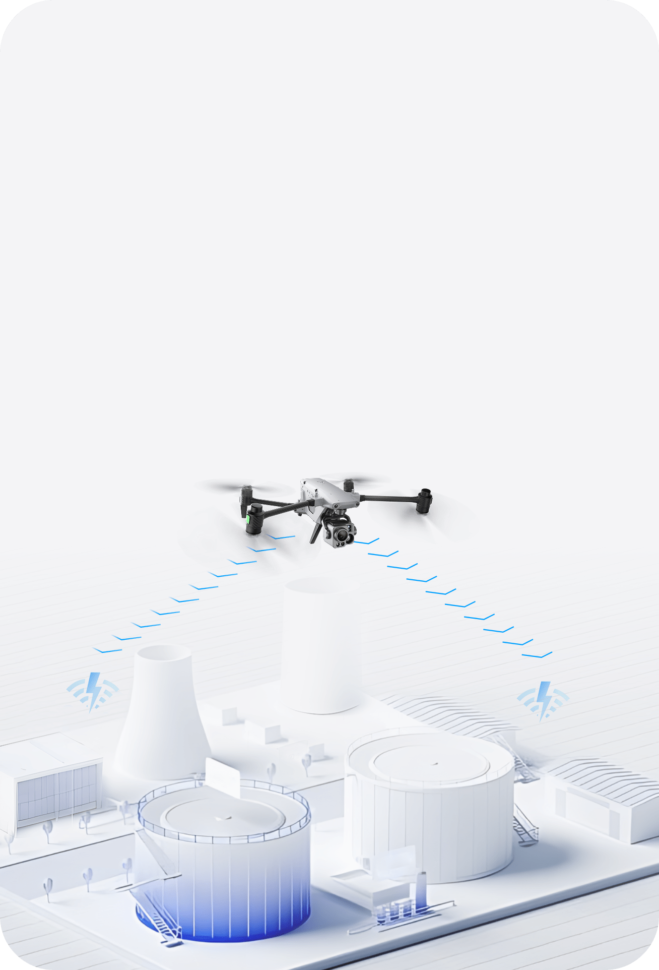
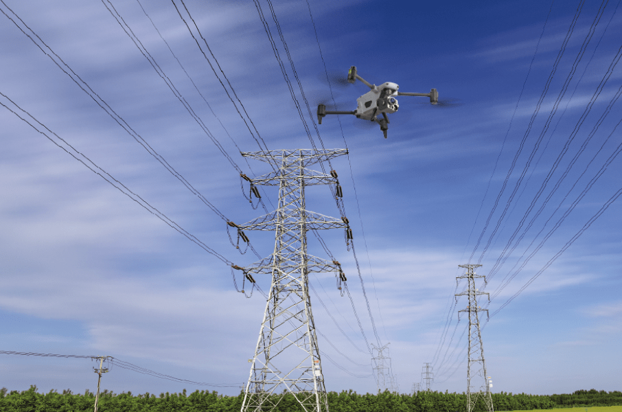
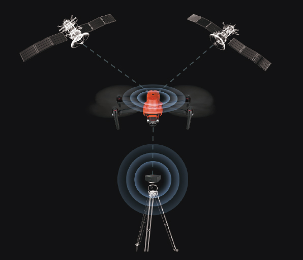
 Superior Anti-Interference
Capability
Superior Anti-Interference
Capability
-
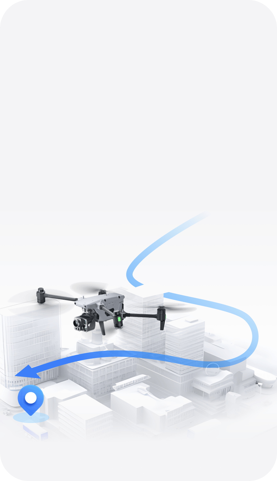
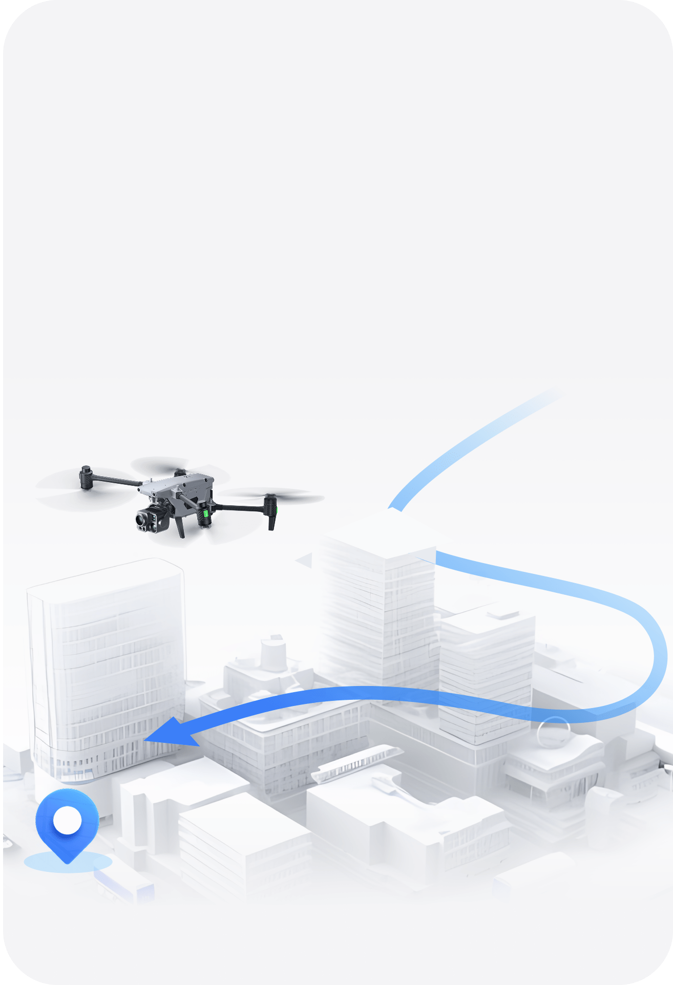
 High-Precision Visual
Navigation
High-Precision Visual
Navigation
-
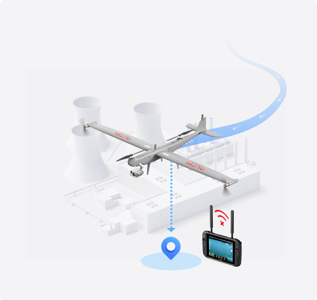
 A-Mesh Networking
-
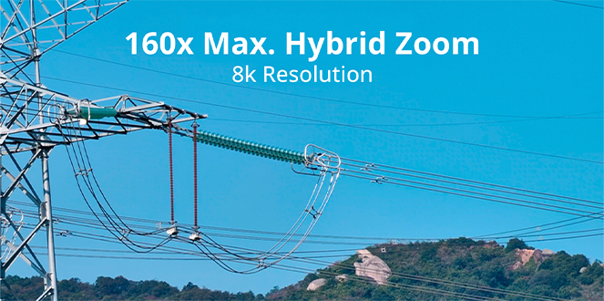
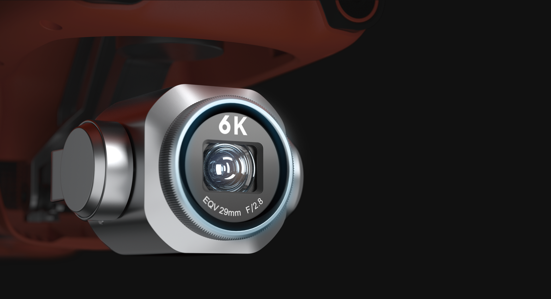
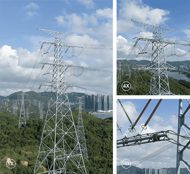
 8K 10x Optical
Zoom -
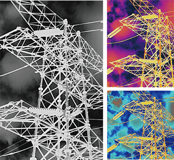
 AI Target Recognition
-
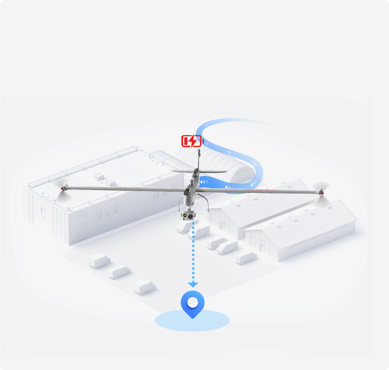
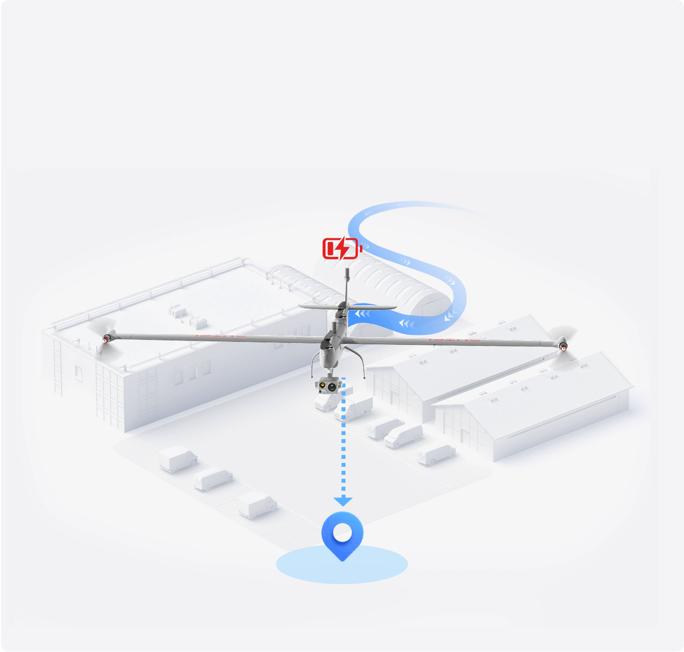
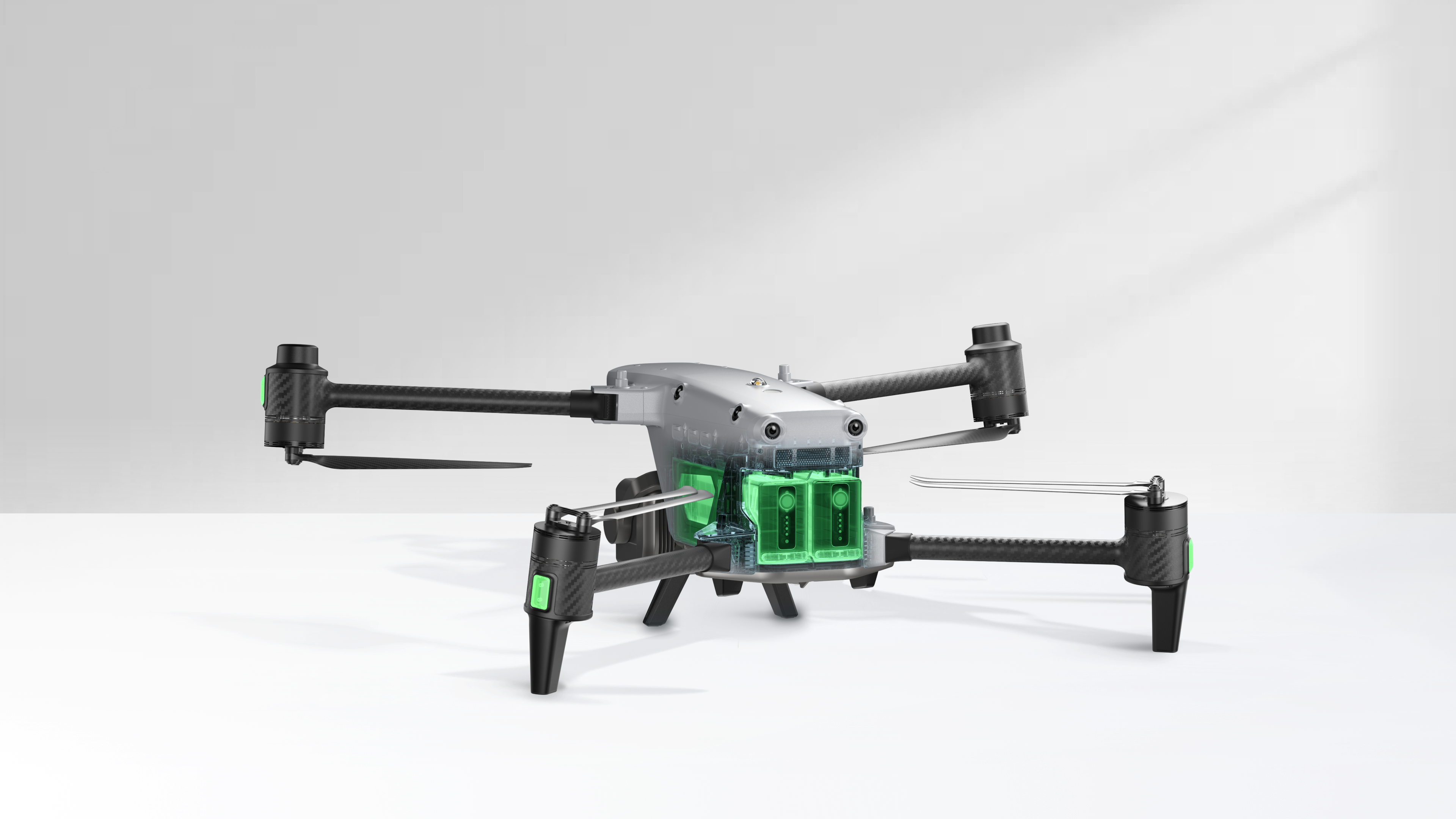
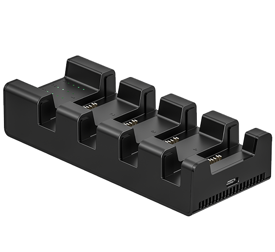
 Hot-Swappable
Battery -
 15 km Transmission Range
-
 42 Min Max. Flight Time
-
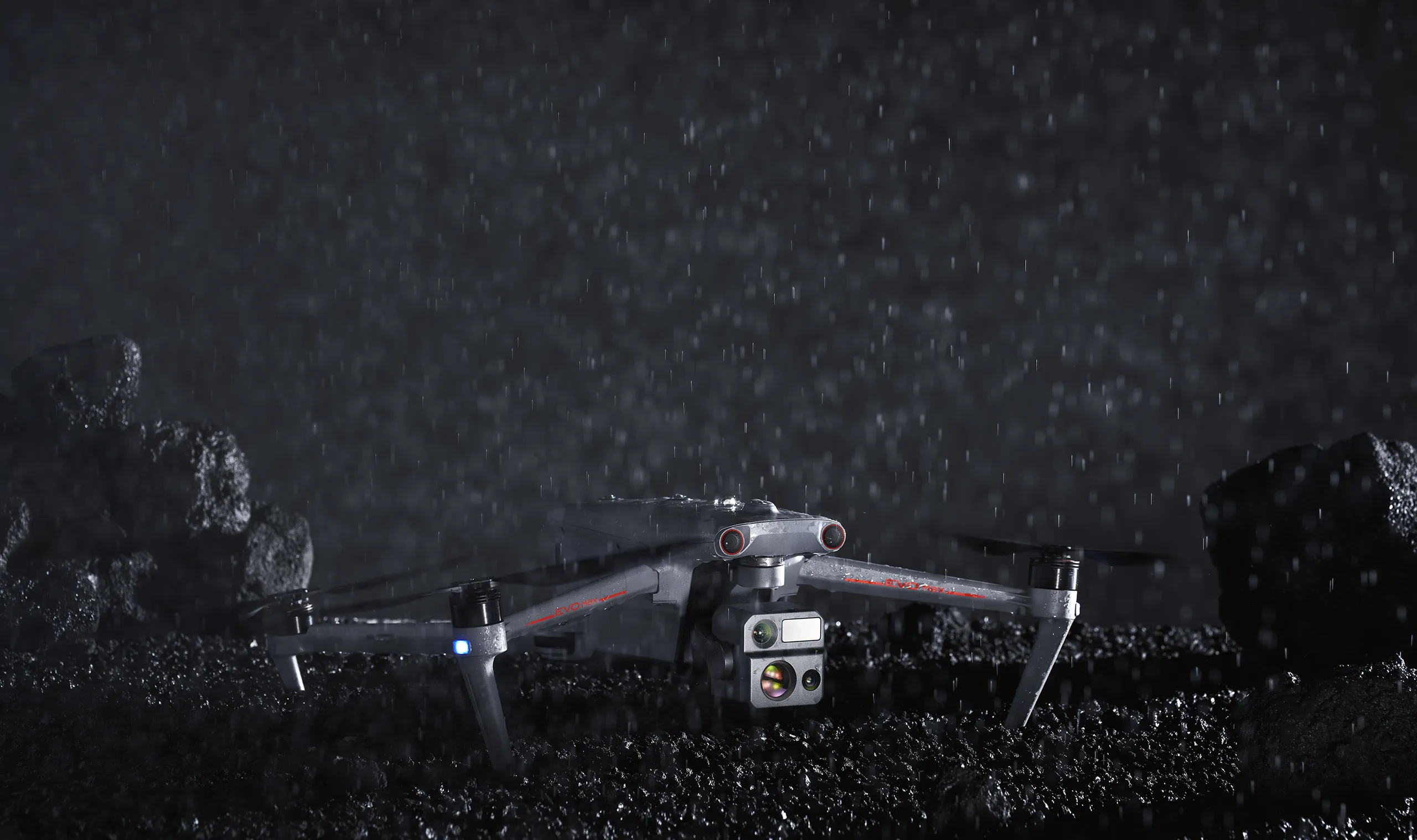
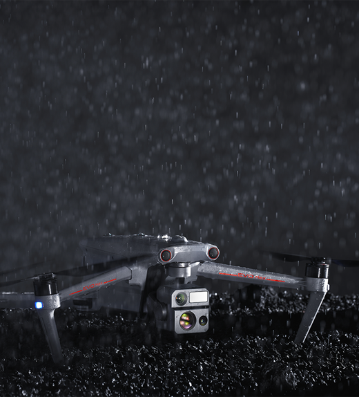
 IP43 Weather Rating (Custom service)
-
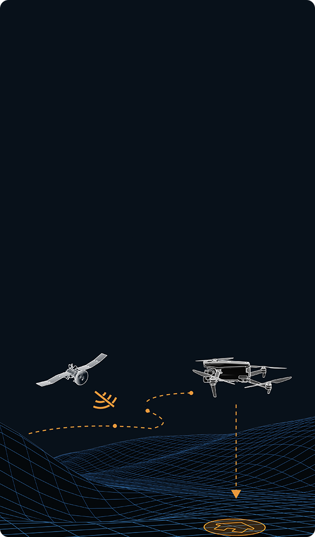
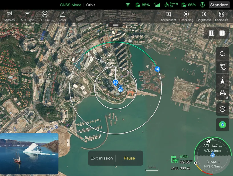
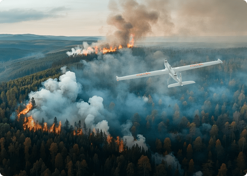
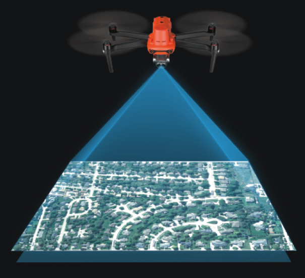
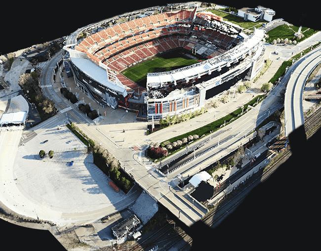
Autonomous Path
FindingAutel's Autonomy Engine collects surrounding environmental data and plans 3D flight paths through complex environments such as mountains, forests, and buildings. Use cases include rapid 3D scene reconstruction, public safety overwatch, industrial inspection, and land surveying. -
Navigation In GNSS
Denied EnvironmentsAdvanced sensors allow the EVO Max 4T to navigate within hardened structures, underground, or in environments without GNSS. -
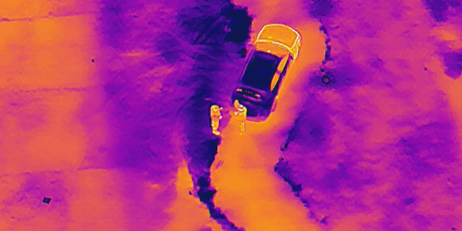
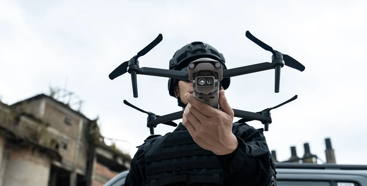
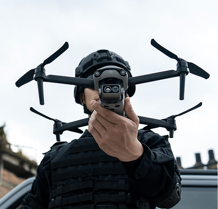
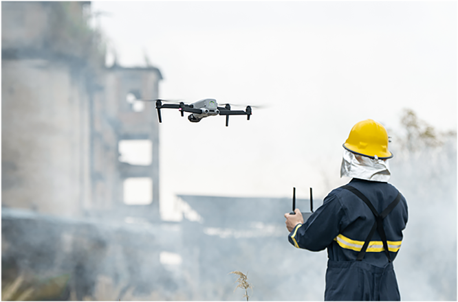
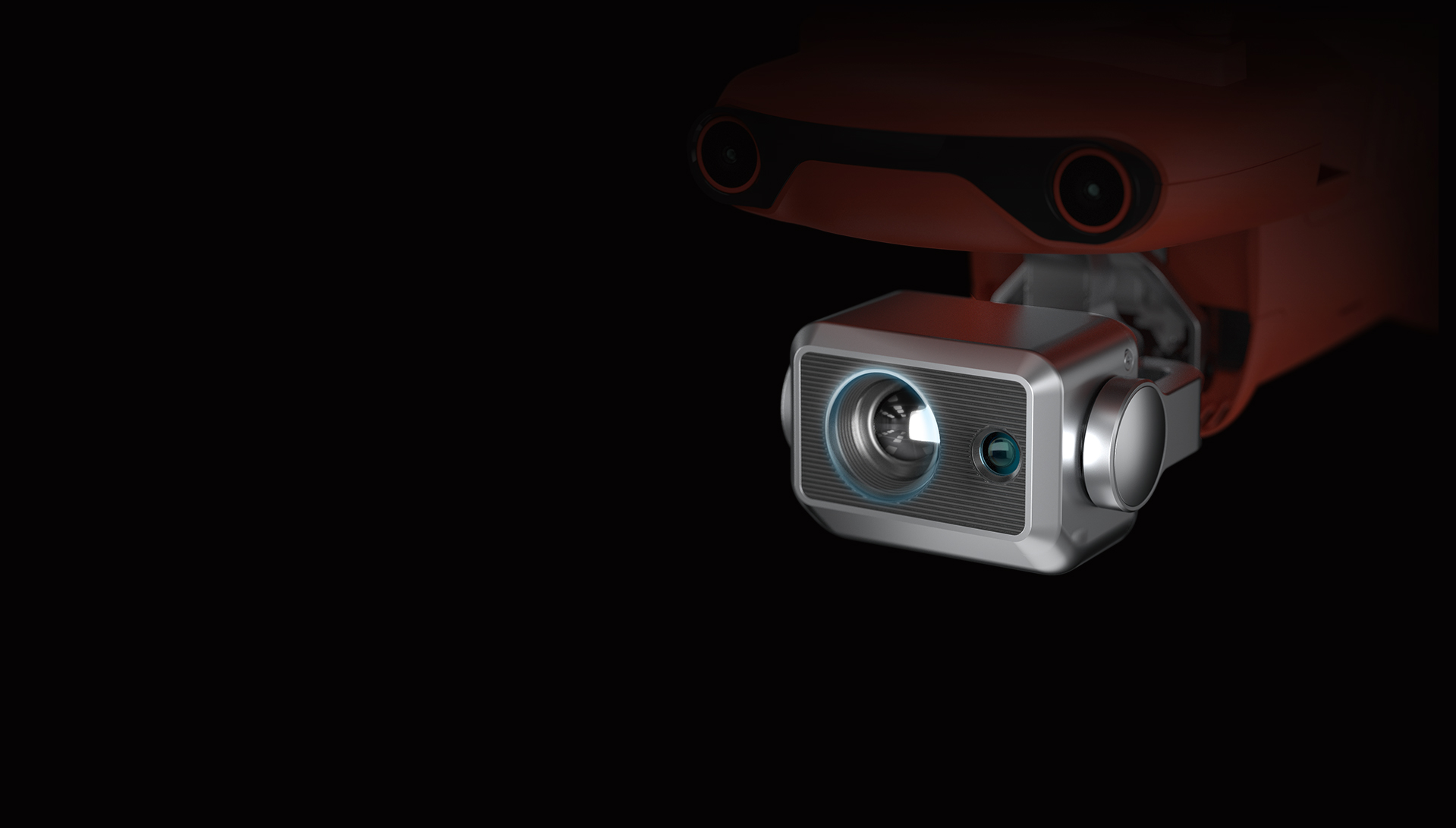
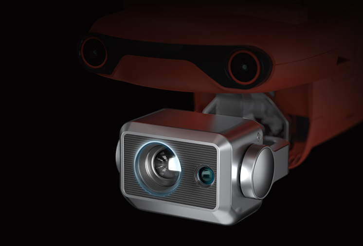
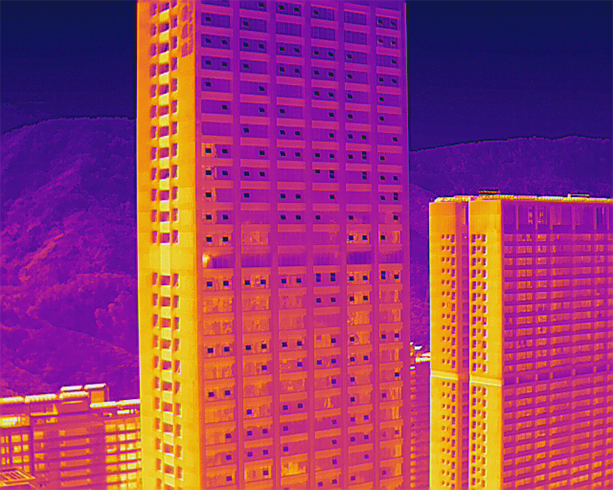
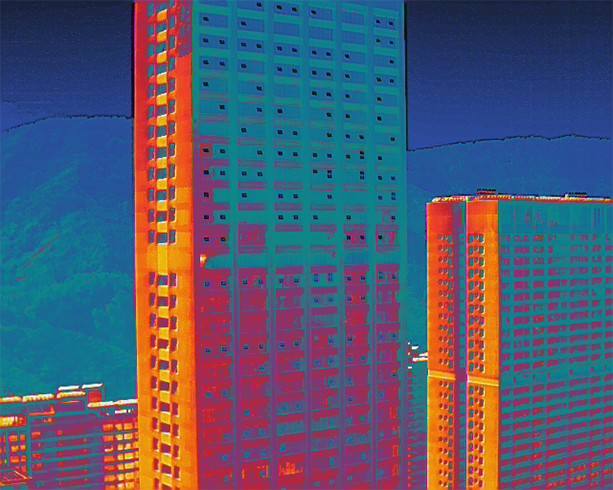
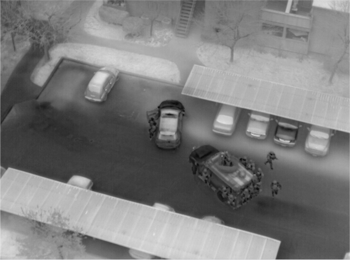
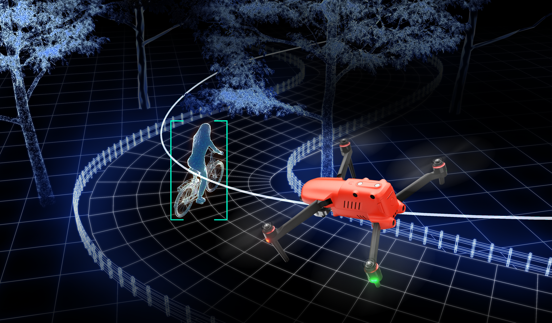
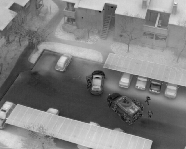
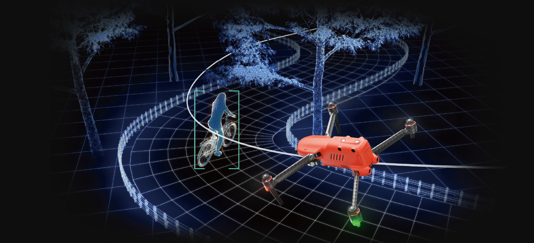
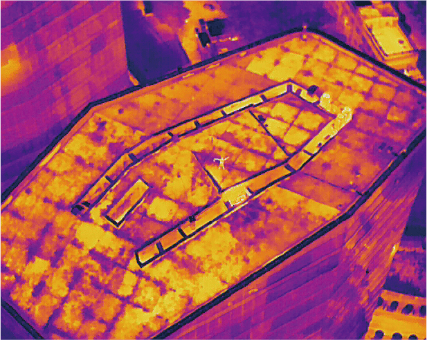
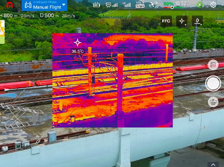
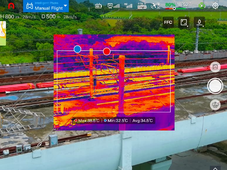
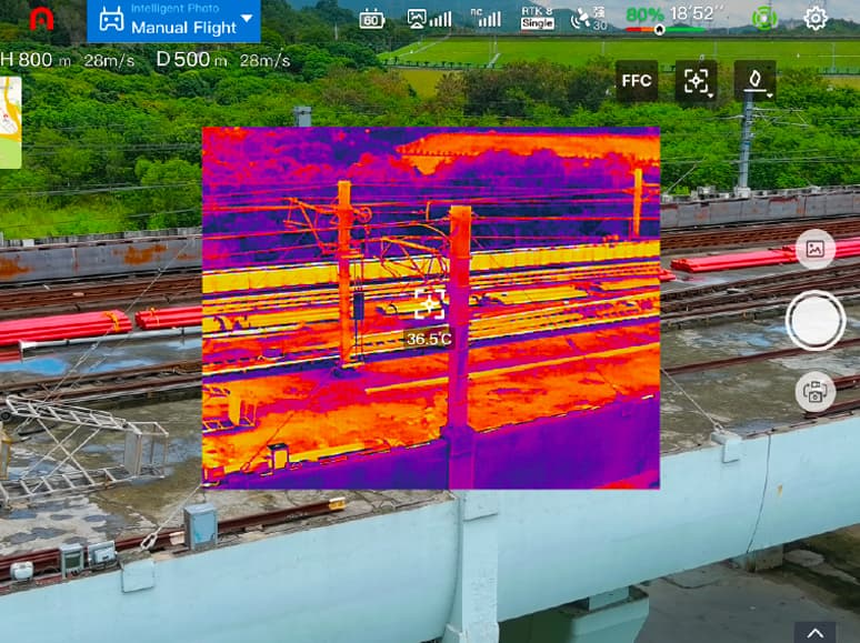
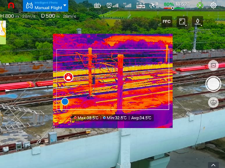
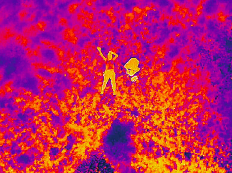
Accurate Object
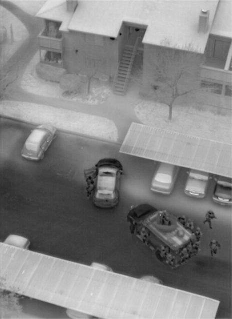
Identification And TrackingBased on Autel's AI recognition technology, the EVO Max 4T can automatically identify and lock onto different types of targets such as heat sources, moving people, or vehicles and achieve high-altitude tracking and data collection for law enforcement.
Autonomous Path
Finding
Finding
Autel's Autonomy Engine collects surrounding environmental data
and
plans 3D flight paths through complex environments such as
mountains,
forests, and buildings. Use cases include rapid 3D scene
reconstruction,
public safety overwatch, industrial inspection, and land
surveying.
Navigation In GNSS
Denied Environments
Denied Environments
Advanced sensors allow the EVO Max 4T to navigate within
hardened
structures, underground, or in environments without GNSS.
Accurate Object
Identification And Tracking
Identification And Tracking
Based on Autel's AI recognition technology, the EVO Max 4T can
automatically identify and lock onto different types of targets
such as
heat sources, moving people, or vehicles and achieve
high-altitude
tracking and data collection for law enforcement.
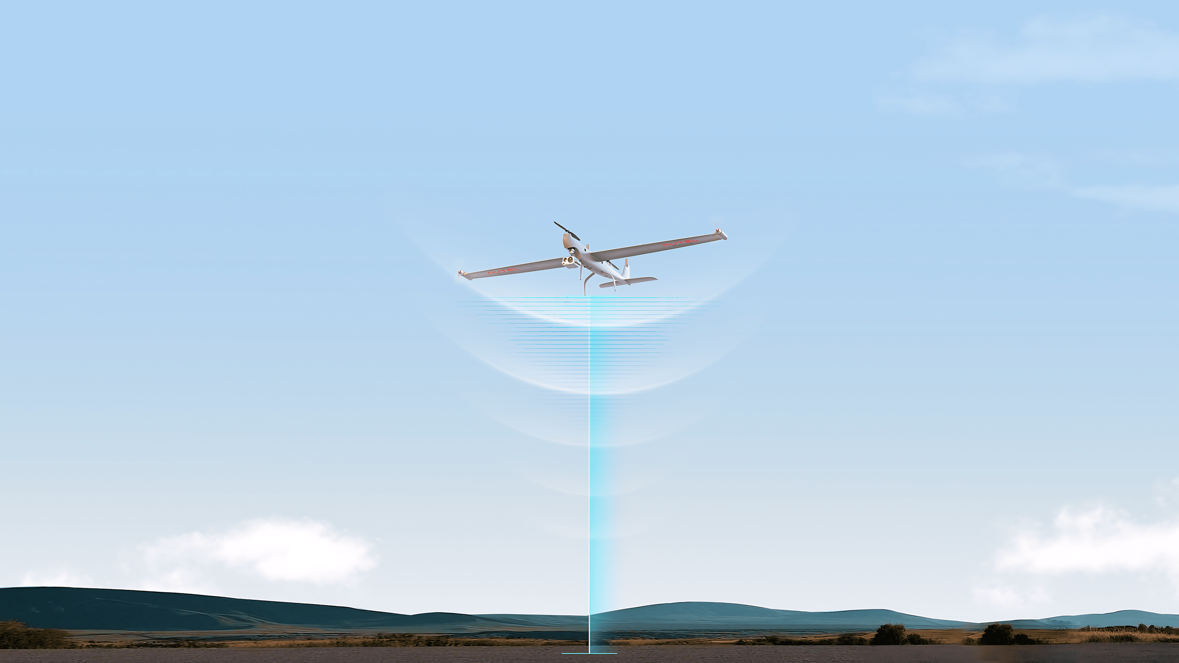
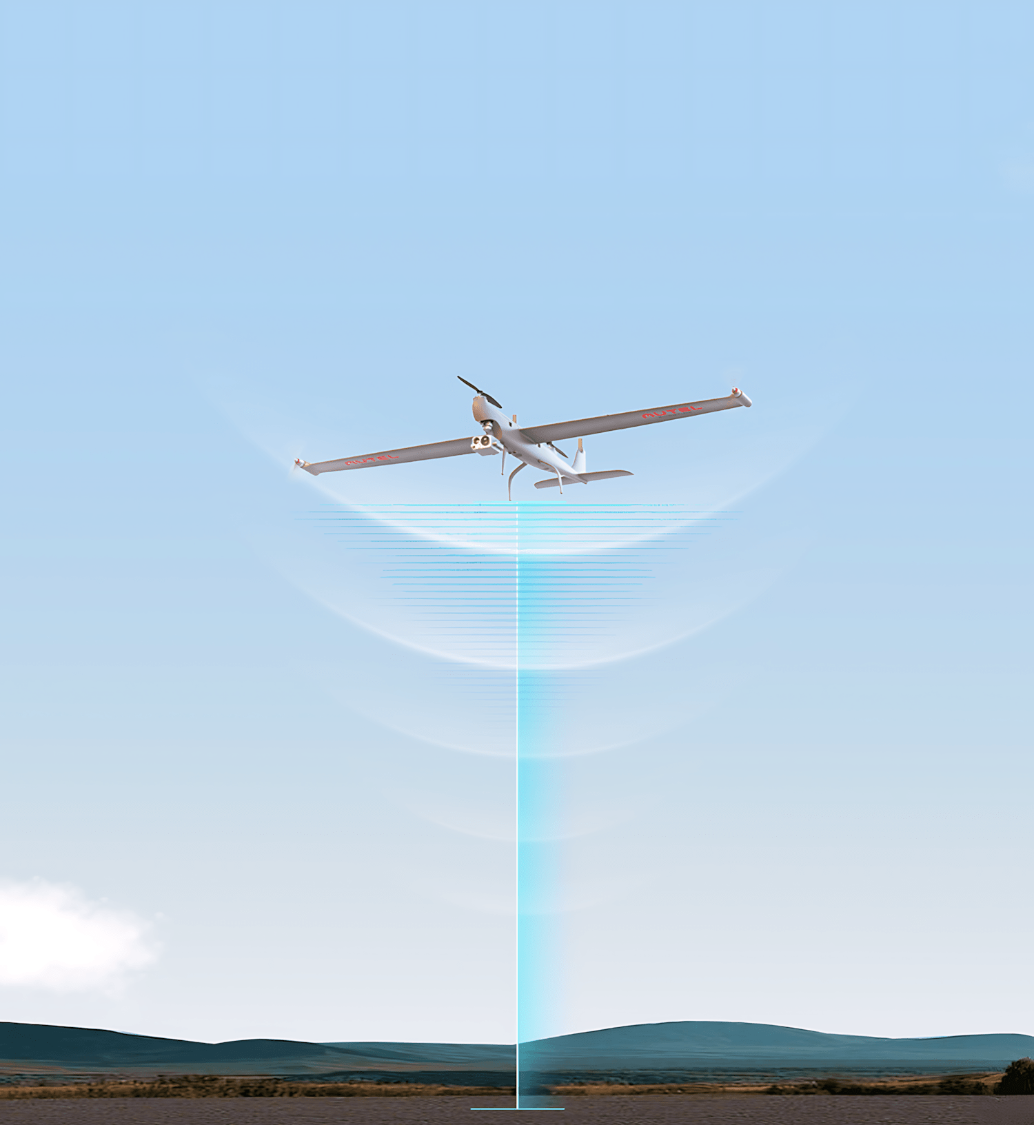
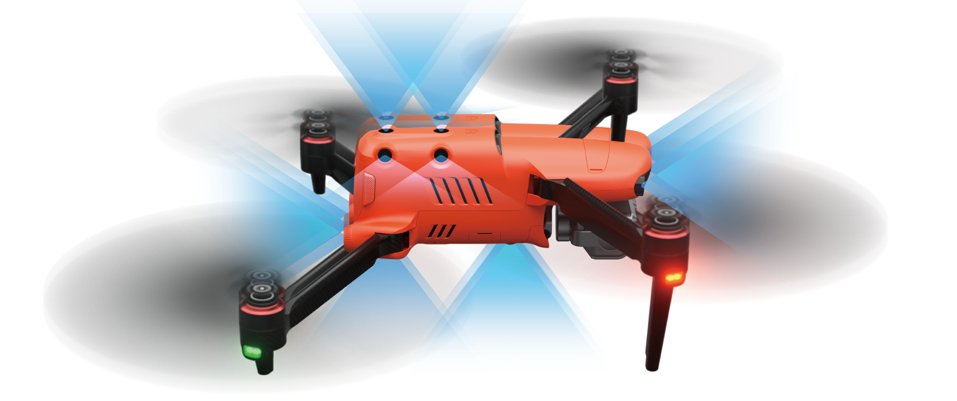
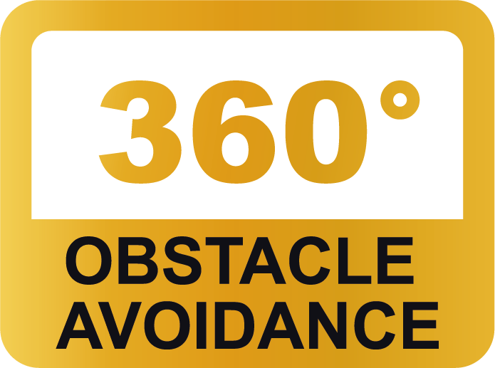
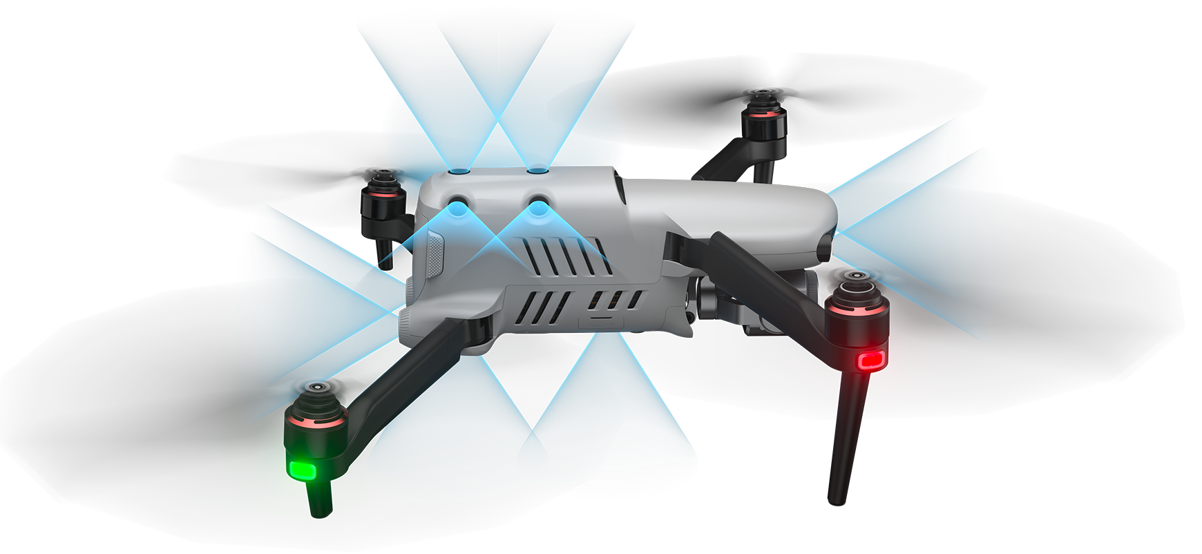
No Blind Spots
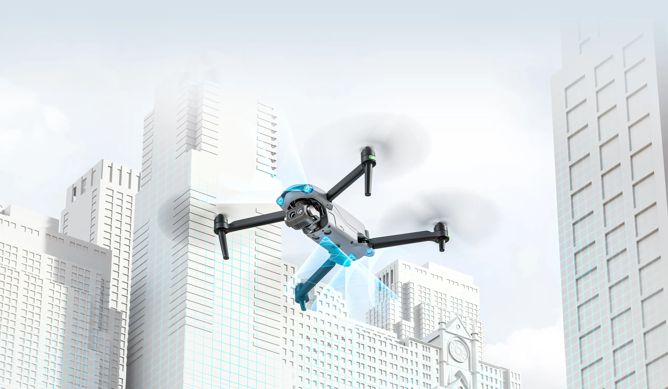
Ultimate Obstacle Avoidance
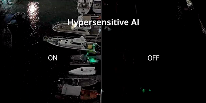
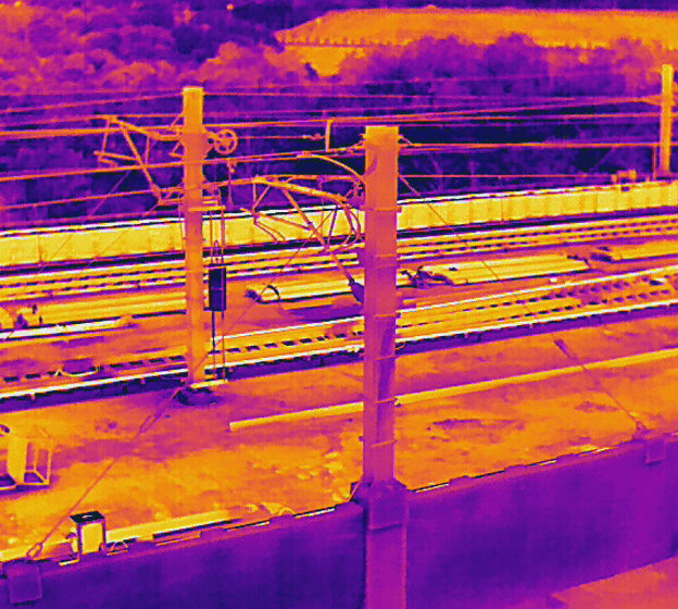
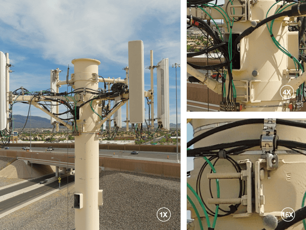
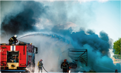
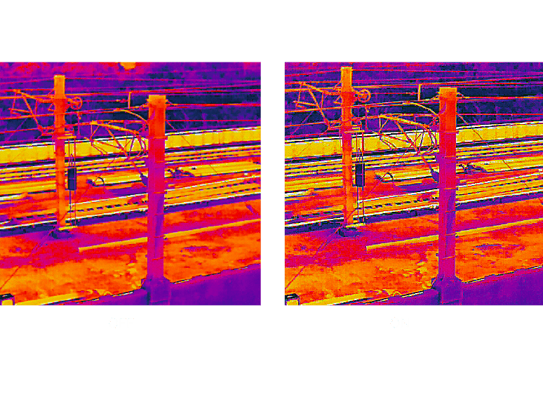
The EVO Max 4T is the commercial drone that combines traditional binocular vision systems with millimeter wave radar technology. This allows the onboard Autel Autonomy Engine to perceive objects down to 0.5 inches, eliminating blind spots and enabling operation in low light or rainy conditions.
Superior Anti-interference
Superior Anti-interference
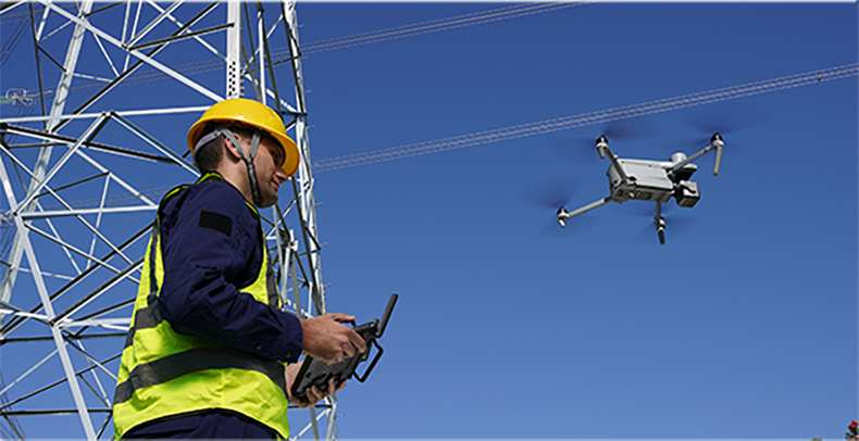
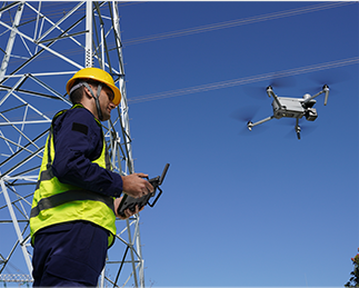
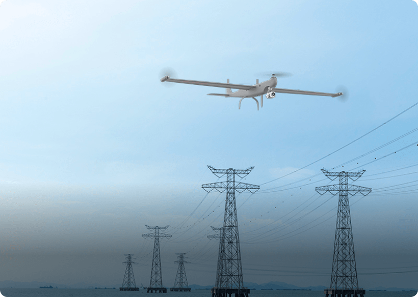
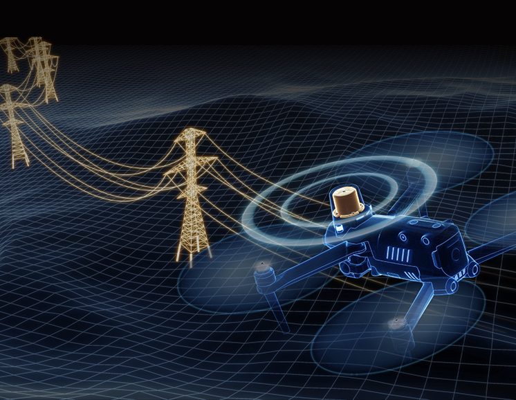
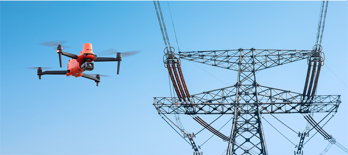
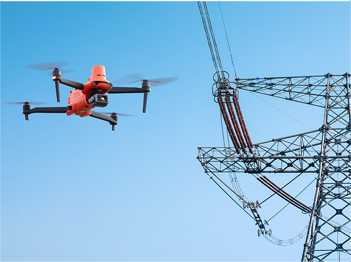
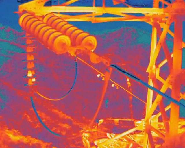
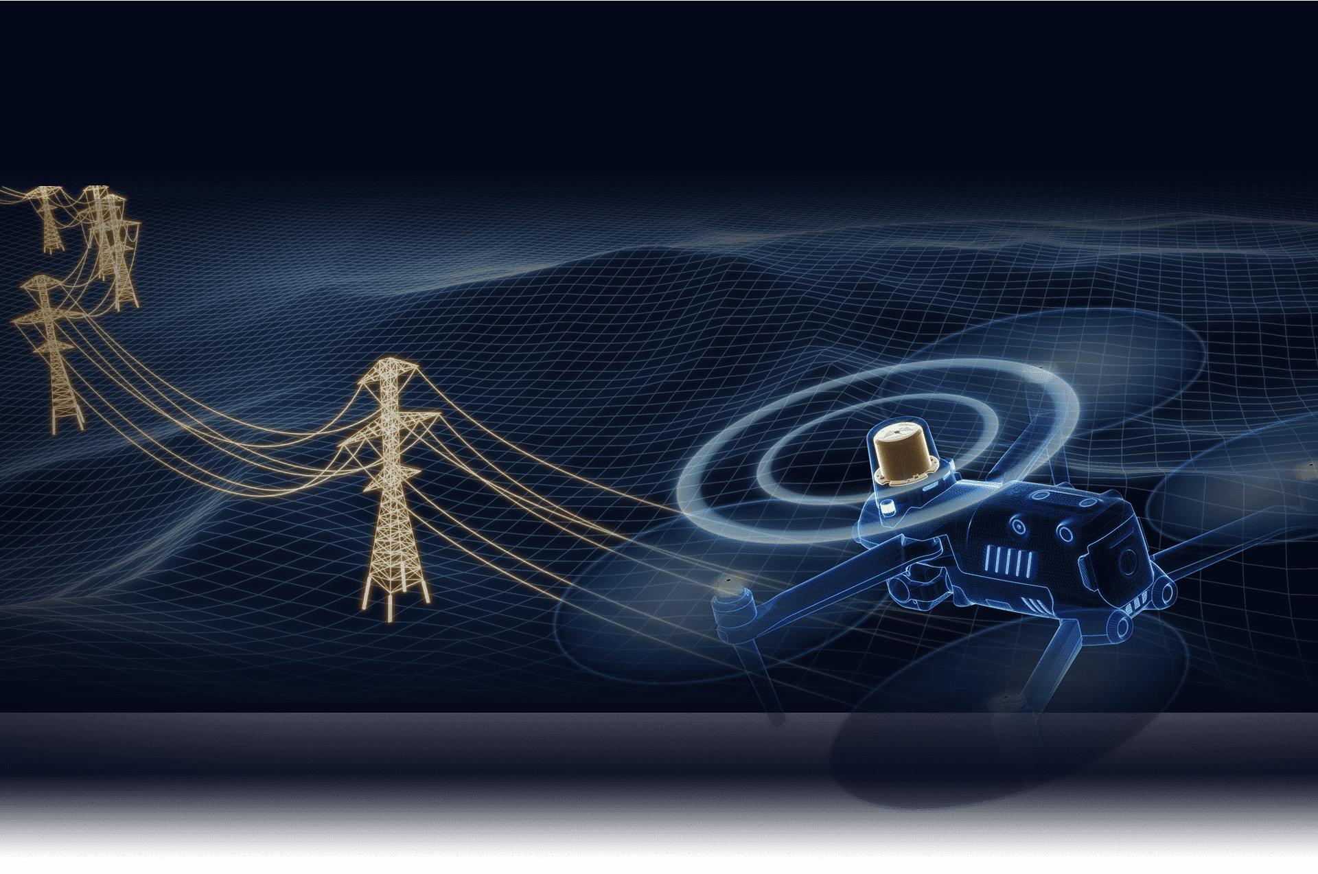
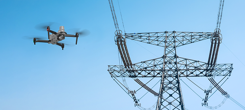
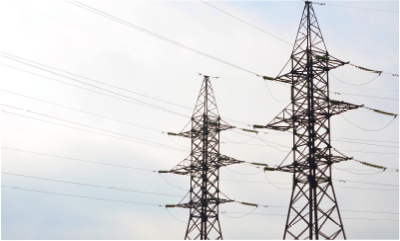
The EVO Max 4T uses advanced flight control modules and algorithms that can identify flight control interference signals and satellite positioning interference signals. This enables the EVO Max 4T to fly confidently near power lines, critical structures, and in complex areas.
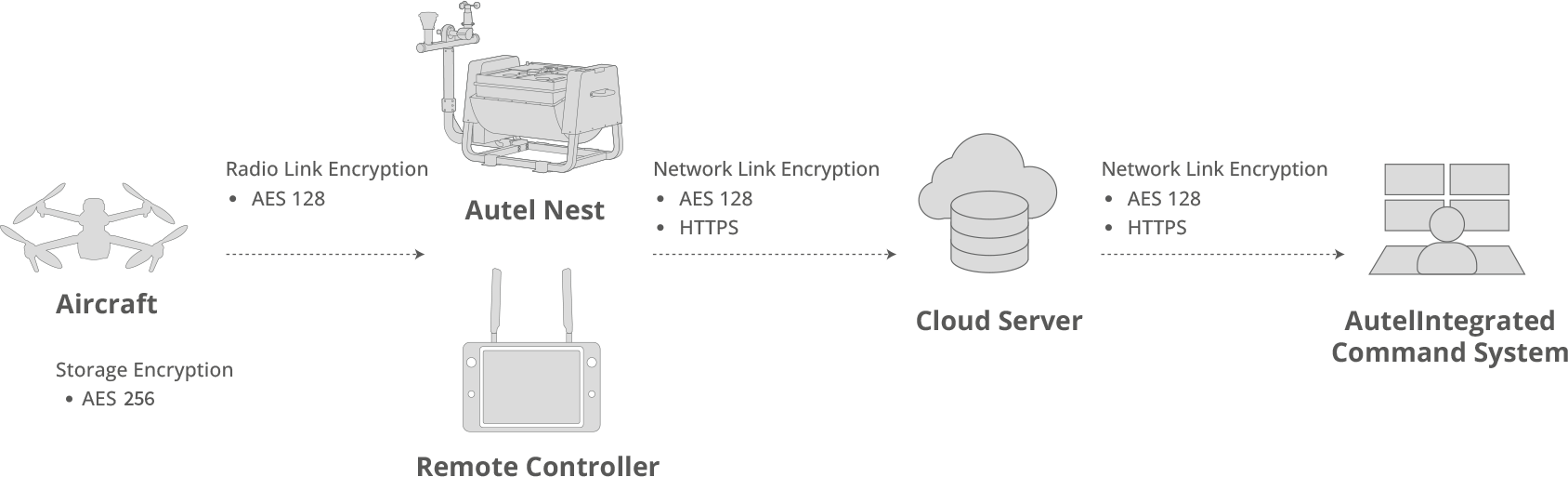
Autel SkyLink 3.0
The EVO Max 4T SkyLink 3.0 system comes with 6 antennas, 4 frequency bands, AES-256 encryption, and optional 4G integration to provide users with the most advanced flight capabilities ever in an EVO.
The EVO Max 4T SkyLink 3.0 system comes with 6 antennas, 4 frequency bands, AES-256 encryption, and optional 4G integration to provide users with the most advanced flight capabilities ever in an EVO.
15 km
Image Transmission Distance
1080P@30FPS
Real-Time Image Quality
900MHz/2.4GHz /5.2GHz/5.8GHz*
Frequency Bands
< 150 ms
Latency
* Some frequencies are only available in some regions or for indoor use only.
Check local laws and regulations for details.
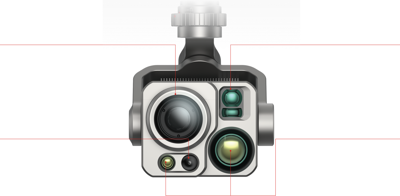
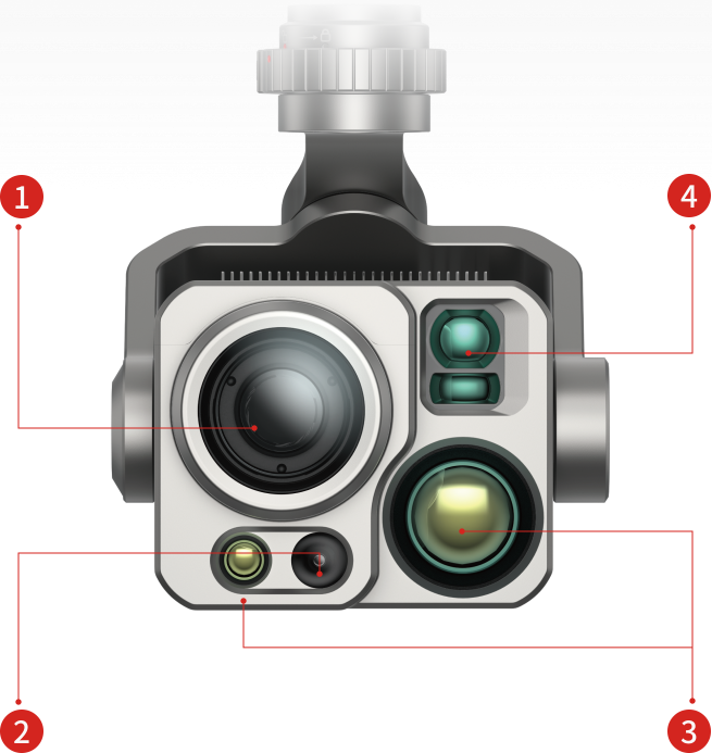
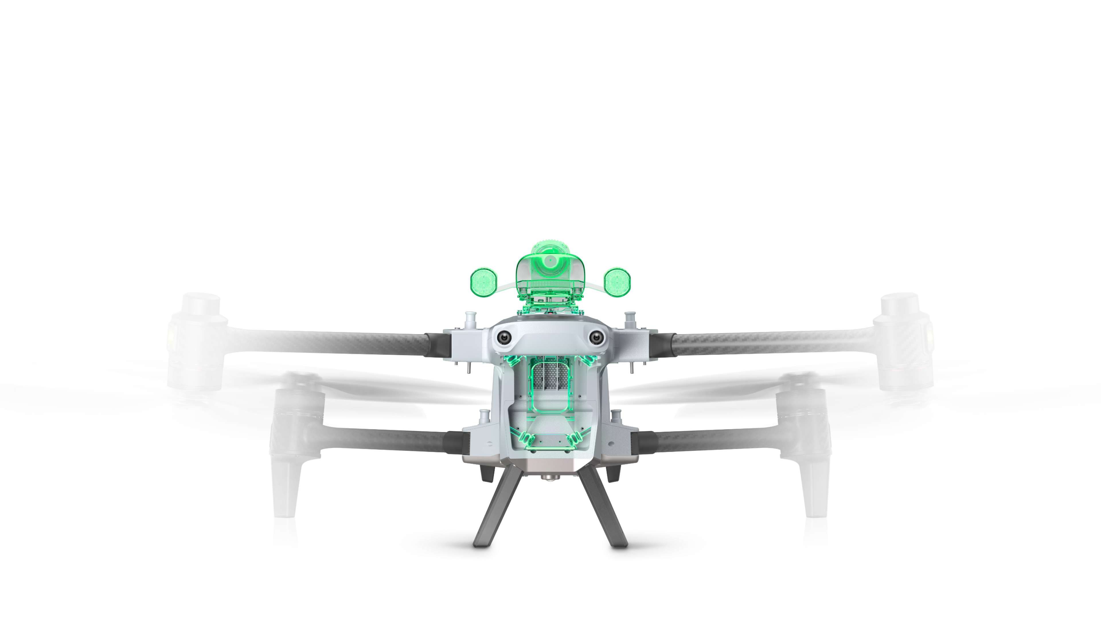
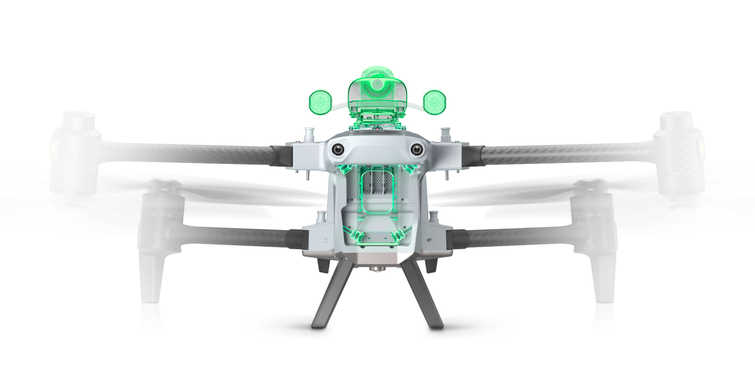
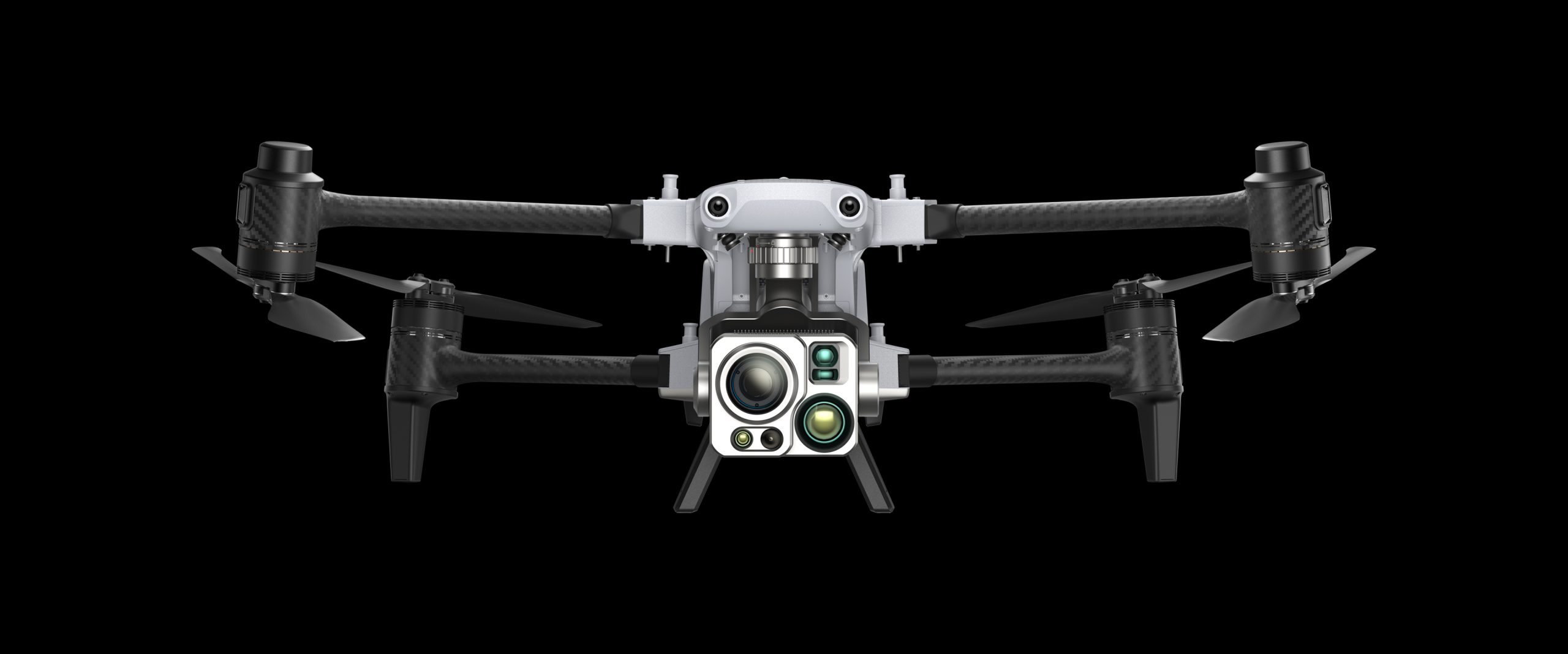
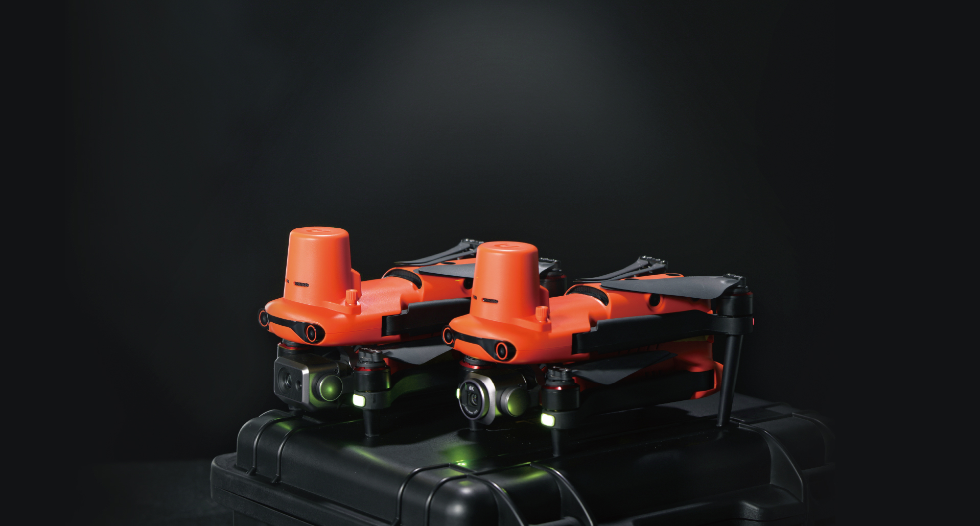
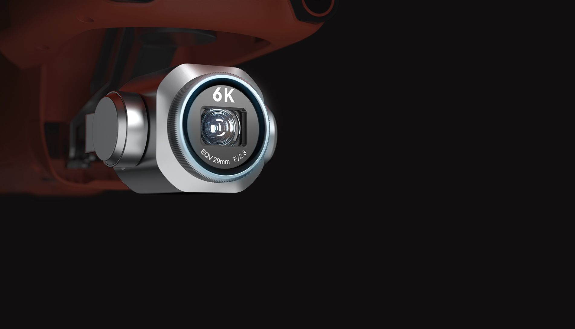
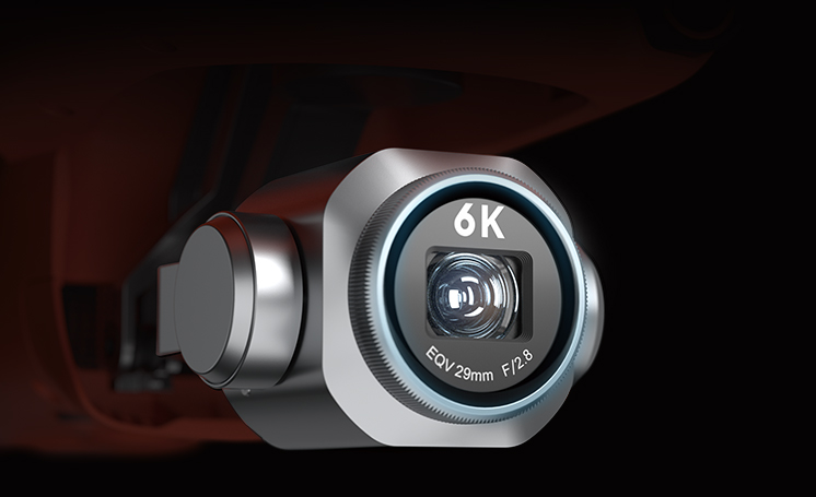
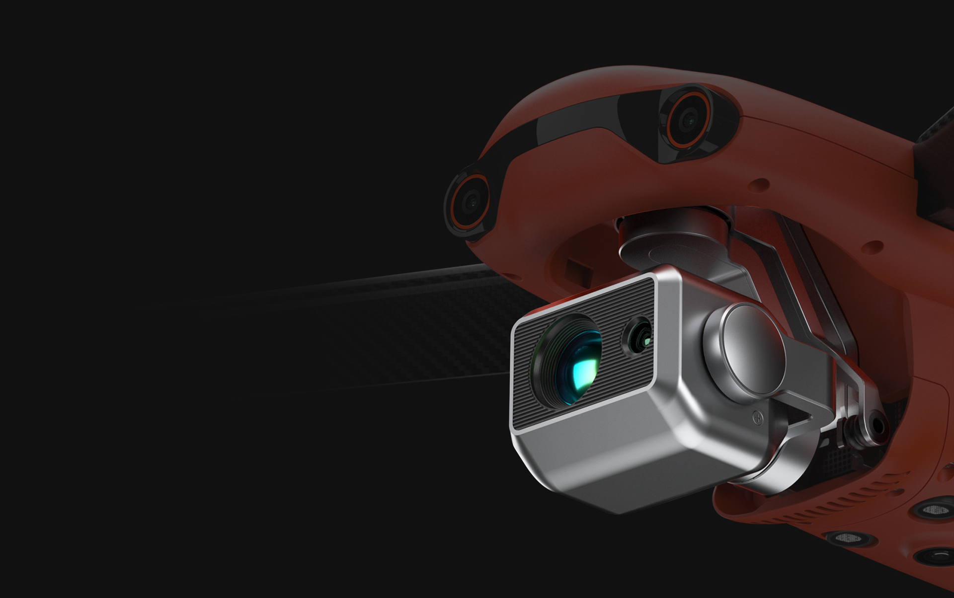
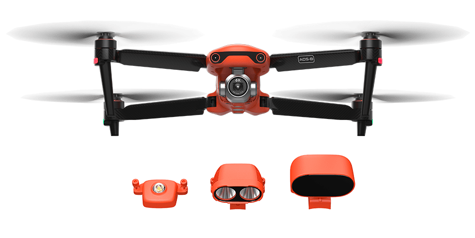
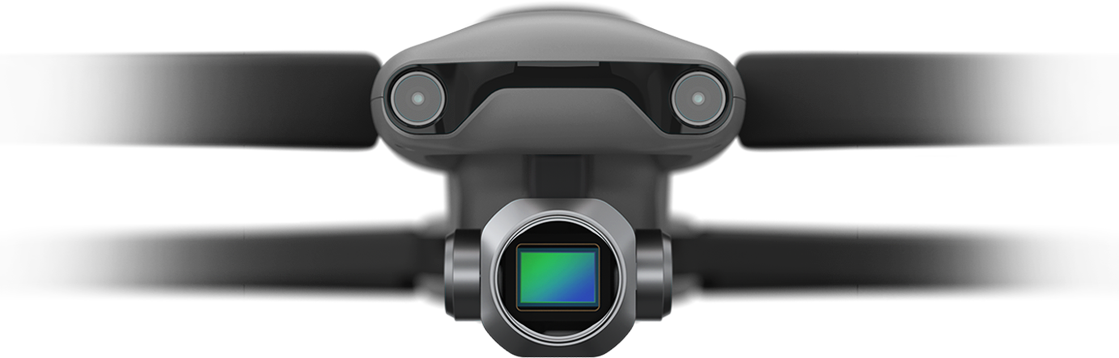
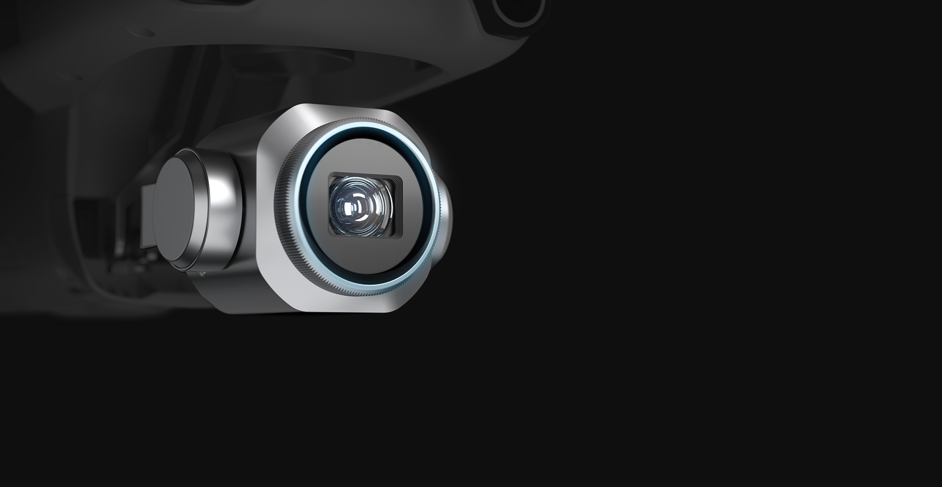
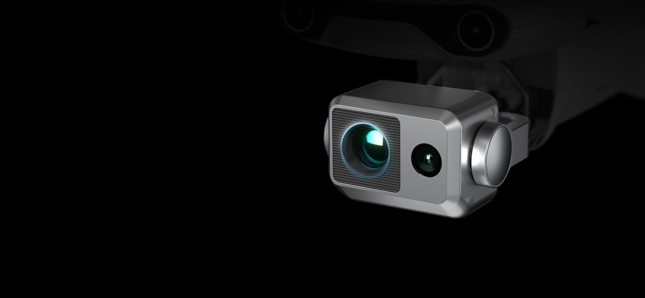
Mission Ready Payload
Fusion 4T
Chase the Heat
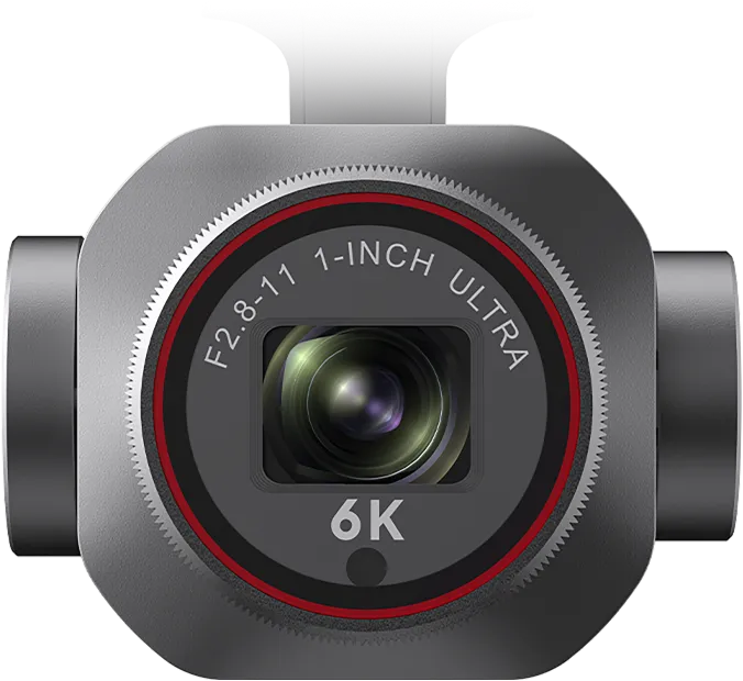
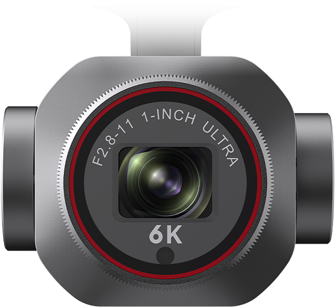
Zoom Camera
48MP
10x Optical Zoom
160x Max. Hybrid Zoom
Aperture: f/2.8–f/4.8
Video Resolution: 4000x3000 30P
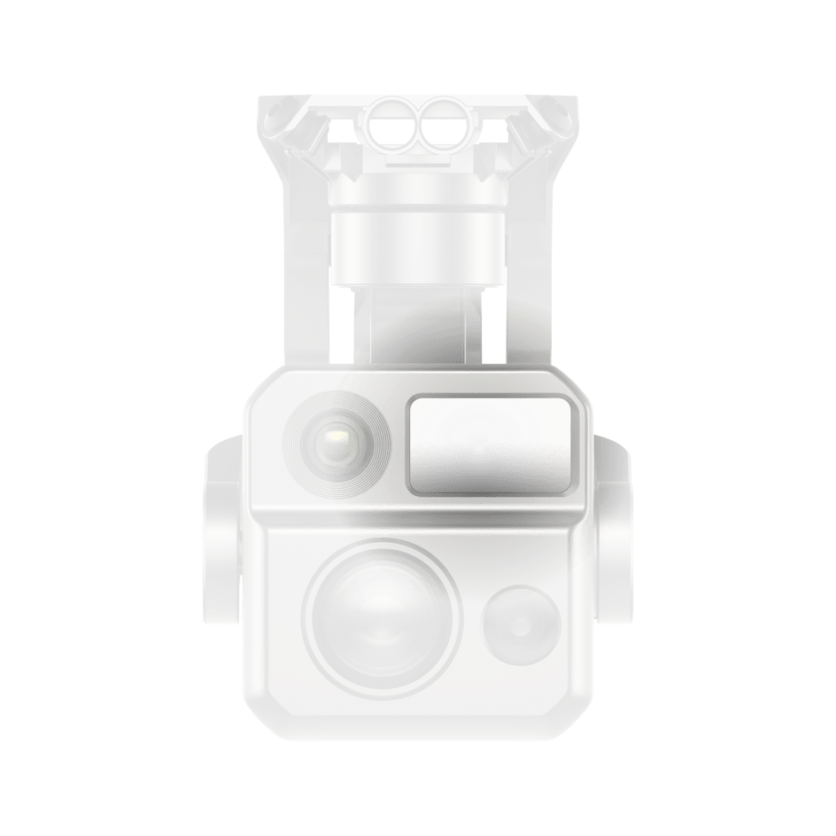
Wide-Angle Camera
50MP
1/1.28" CMOS
Aperture: f/1.9
DFOV: 85°
Equivalent: 23 mm
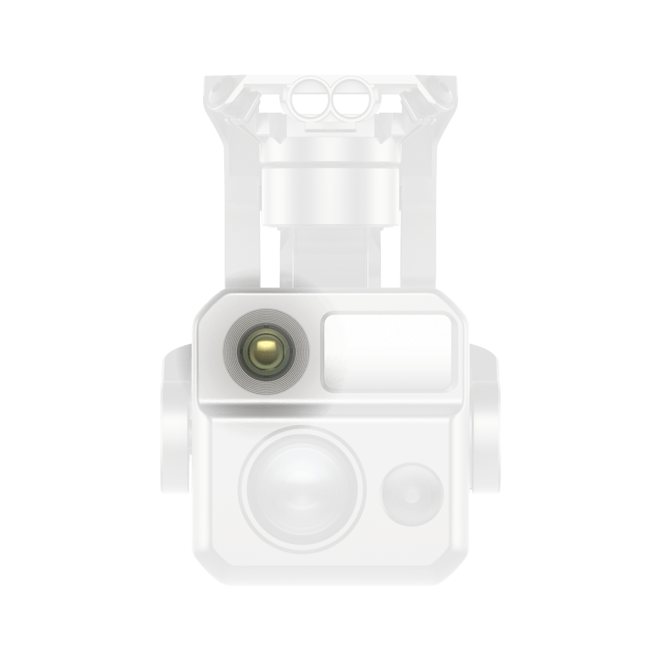
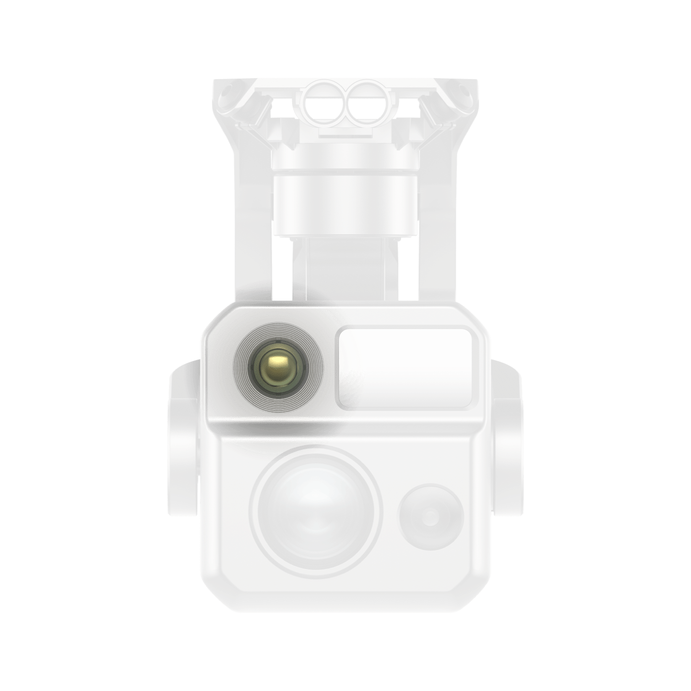
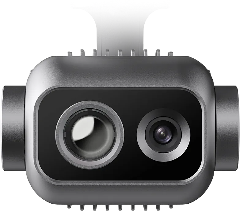
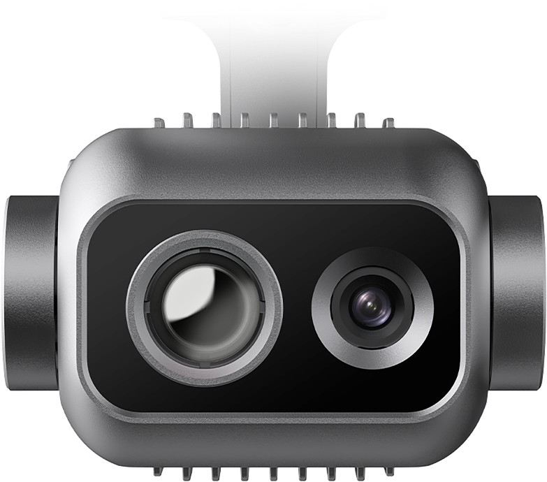
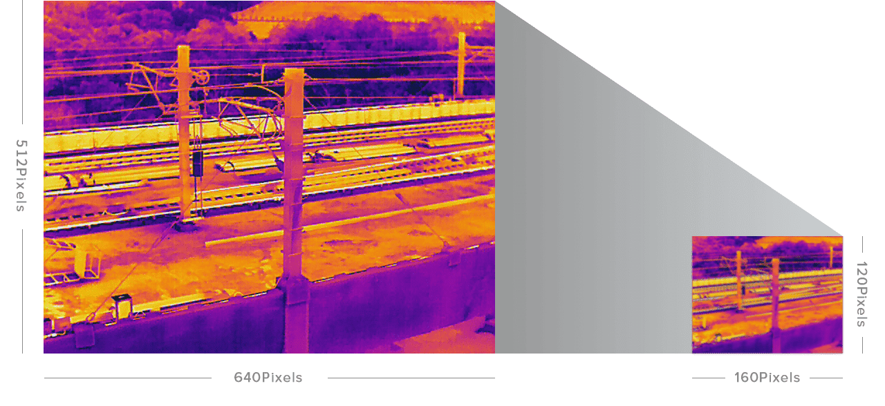
Thermal Camera
640x512
Focal Length: 13 mm
16x Digital Zoom
Range: -4 ℉ to 1022 ℉
Laser Rangefinder
Measuring Range: 5-1200m (16.4–3737 ft)
Measurement Accuracy: ± (1 m + D×0.15%)
*Where D is the distance to a vertical reflecting plane
Fusion 4T XE / Fusion 4T V2
Chase the Heat
Zoom Camera
48MP
10x Optical Zoom
160x Max. Hybrid Zoom
Aperture: f/2.8–f/4.8
Video Resolution: 4000x3000 30P
Super-Sensitive Wide-Angle Camera
48MP
1/2" CMOS
Aperture: f/2.8
DFOV: 83.4°
Equivalent: 24 mm
Thermal Camera
640x512
Focal Length: 9.1 mm
16x Digital Zoom
Range: -4 ℉ to 1022 ℉
Laser Rangefinder
Measuring Range: 5-1200m (16.4–3737 ft)
Measurement Accuracy: ± (1 m + D×0.15%)
*Where D is the distance to a vertical reflecting plane
EVO Max 4T
Chase the Heat
- Zoom Camera
- Super-Sensitive Wide-Angle Camera
- Thermal Camera
- Laser Rangefinder
EVO Max 4T XE
Chase the Heat
- Zoom Camera
- Super-Sensitive Wide-Angle Camera
- Thermal Camera
- Laser Rangefinder
Chase the Heat
Chase the Heat

- Super Zoom
- Super-sensitive Imaging
- Superior Infrared
- Precision Ranging
- Super Zoom
- Super-sensitive Imaging
- Superior Infrared
- Precision Ranging
Smart Features
Smart Features
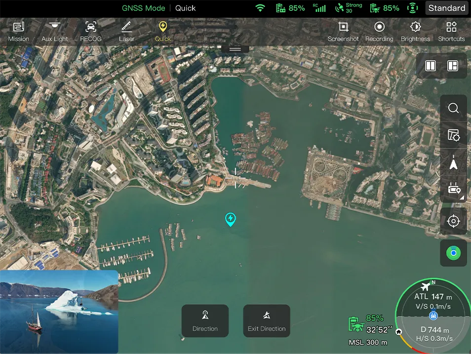
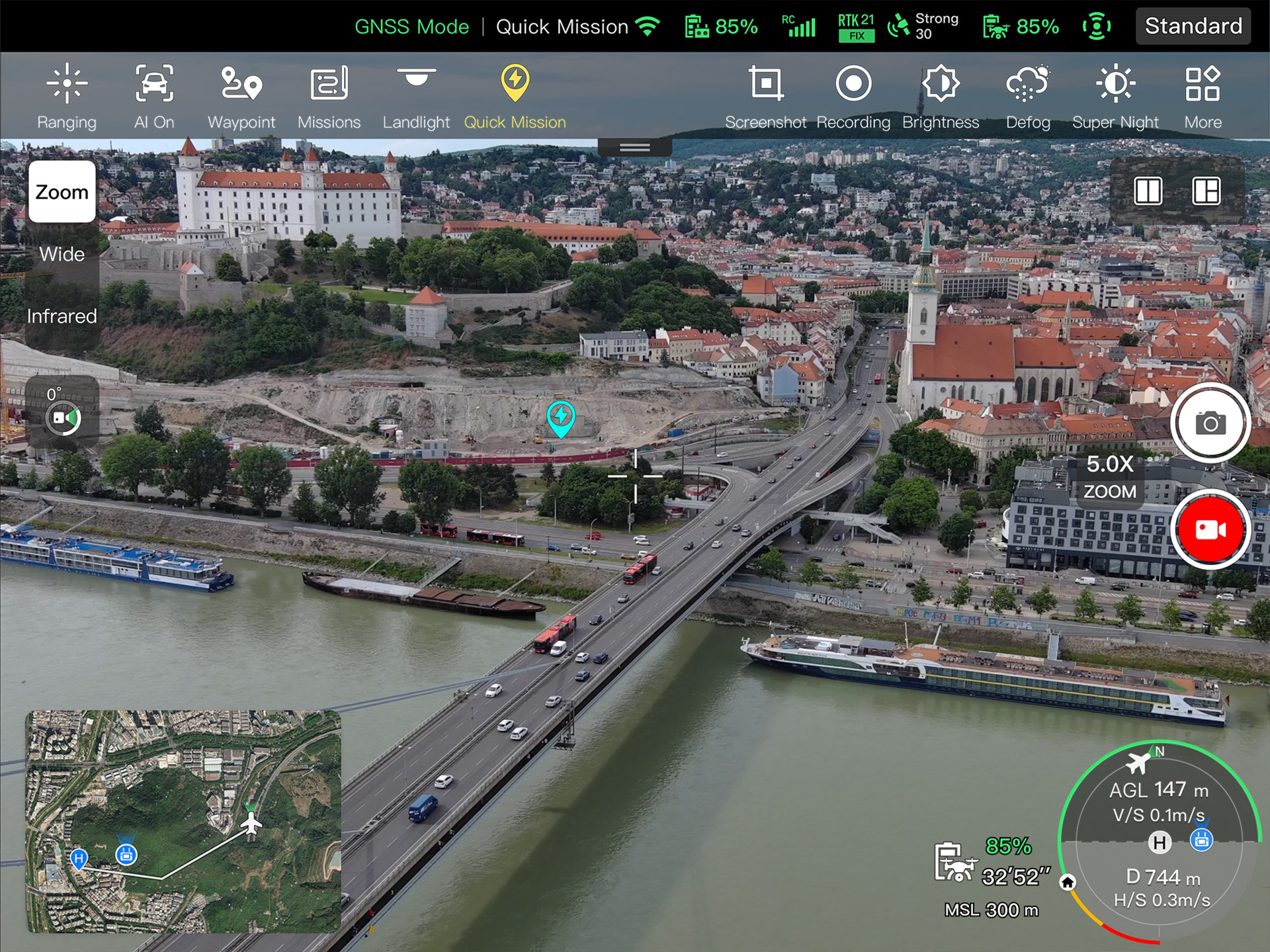
Quick Mission
Temporary quick missions can be created while executing other missions, and multiple sub-missions can be stacked for enhanced flexibility.
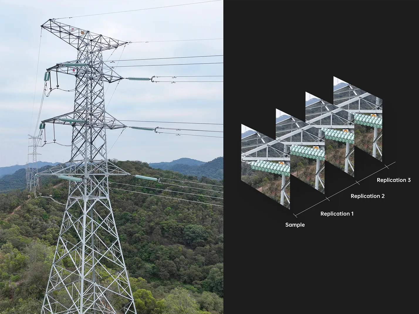
Mission Reproduction*
With this feature activated, fly a manual or semi-autonomous mission, or string multiple missions together. The EVO Max 4T will automatically record the camera angles and replicate the mission you just flew.
*This accessory will be launched later.
- Quick Mission
- Precise Repetition
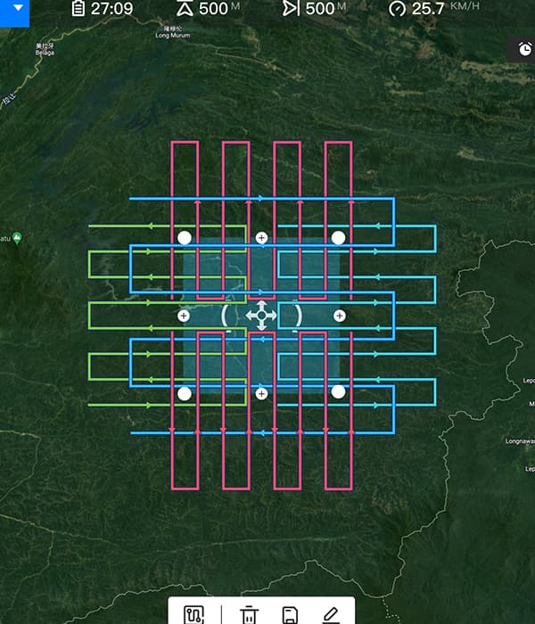
Multiple Mission Types
Multiple Mission Types
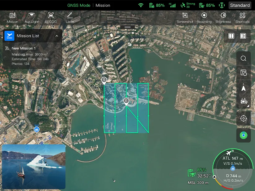
The Enterprise App provides various autonomous and semi autonomous mission planning for public safety, inspection, and surveying.
*This feature is pending future updates.
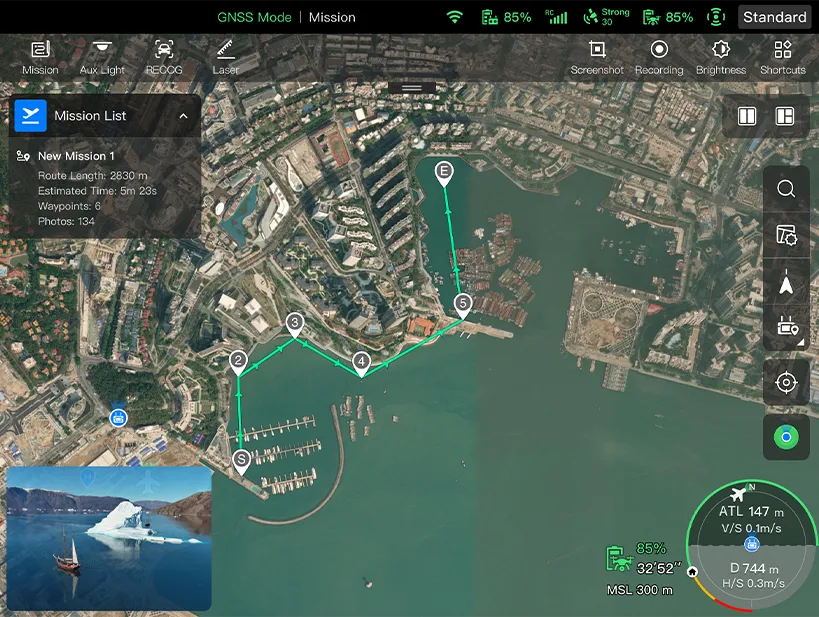
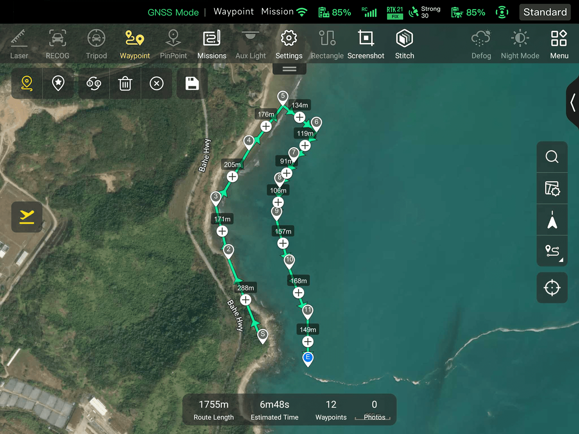
Waypoint Mission
Users can add waypoints for flexible, non-structured flight paths.
Automatic Mission Generation And Data Capture*
Automatically produce routes by adding regional boundary points through dots or importing KML files.
Polygon Mission
Supports one-click automatic generation of polygon flight areas.
Data Security
Data Security
Data involving user and aircraft information, including flight logs, locations, and account information can only be physically accessed via the aircraft locally. Supports AES encryption for photos, videos, and flight logs, are password-protected.
Enhanced Live-View
Enhanced Live-View
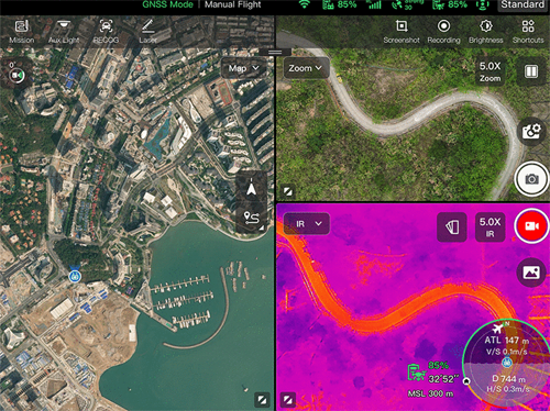
Multi-channel Projection Screen: Supports simultaneous output of RGB, infrared, and wide-angle images.
Operating Environment
-
IP43
Weather Rating*
-
-20℃ to 50℃
Operating temperature**
-
27 mph
Max. Wind Resistance
* Customization is supported
** Without load
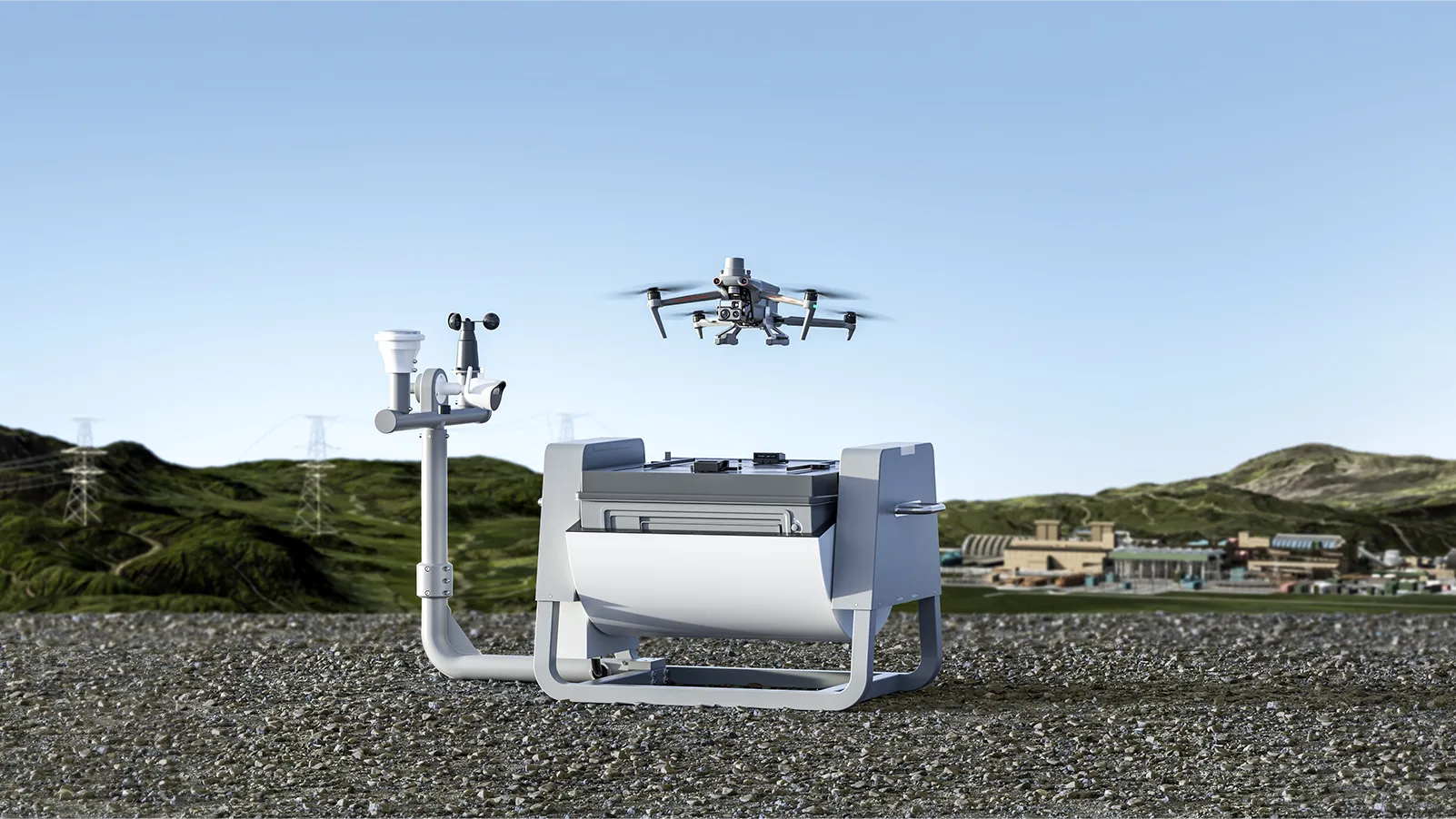
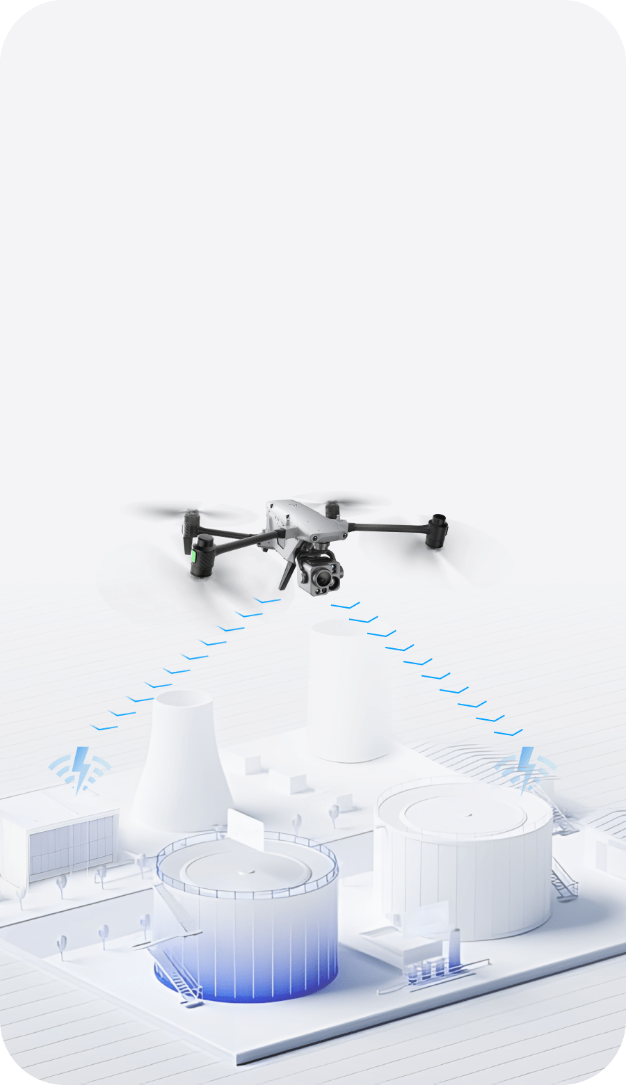
Complete Remote Operations System
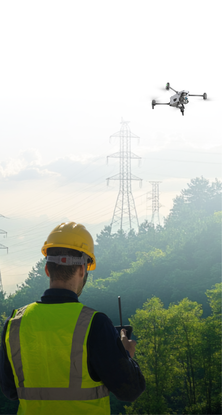
Used with the EVO Nest, the EVO Max 4T supports all-weather auto piloting for scenarios such as substations, industrial parks, and rooftops.
Autel SDK
The Autel SDK is open to the world, helping developers and partners reduce software and hardware development costs and jointly create a new industry ecosystem.
-


Mobile SDK / Payload SDK
Open UX SDK (iOS/Android) can directly call up the ready-made interactive interface.
Payload SDK: Unified interface standards support access to third-party mounts such as loudspeaker.
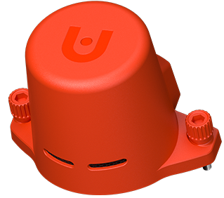
Accessories
Application
EVO Max 4N
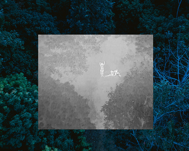
See the Unseen
The Max 4N combines best-in-class night time starlight vision camera with the advanced capabilities of the Max series UAV platform for advanced nightime operations.

No Blind Spots

Superior Anti-
Interference Capability

High-Precision Visual Navigation

A-Mesh
Networking

Starlight Vision
Camera

5 km Night Vision
Reconnaissance

AI Target Recognition

Hot-Swappable Battery

15 km
Transmission Range

42 min
Max. Flight Time
Explore the Night

2.3 MP
LUX: 0.0001
ISO: 440000
Equivalent: 41.4 mm
50 MP
1" CMOS
Aperture: f/1.9
Equivalent: 23 mm
640 × 512
Focal Length: 9.1 mm
16x Digital Zoom
Range: -4℉ to 1022℉
Measuring Range:
16.4–3737 ft
16.4–3737 ft
Measurement Accuracy:
± (1 m + D×0.15%)
± (1 m + D×0.15%)
Starlight Vision Camera
Wide-Angle Camera
Thermal Camera
Laser Rangefinder
2.3 MP
LUX: 0.0001
ISO: 440000
Equivalent: 41.4 mm
50 MP
1" CMOS
Aperture: f/1.9
DFOV: 85°
Equivalent: 23 mm
640 × 512
Focal Length: 9.1 mm
16x Digital Zoom
Range: -4℉ to 1022℉
Measuring Range:
16.4–3737 ft
16.4–3737 ft
Measurement Accuracy:
± (1 m + D×0.15%)
± (1 m + D×0.15%)
Temperature
Glass
Detection Range
Stealth
Target Positioning
Communication

Unlock New Night Time Capability

No Blind Spots
Ultimate Obstacle Avoidance
The EVO Max series is the commercial drone that combines traditional binocular vision systems with millimeter wave radar technology. This allows the onboard Autel Autonomy Engine to perceive objects down to 0.5 inches, eliminating blind spots and enabling operation in low light or rainy conditions.
Anti Interference
The EVO Max 4N uses advanced flight control modules and algorithms that can identify flight control interference signals and satellite positioning interference signals. This enables the EVO Max 4N to fly confidently near power lines, critical structures, and in complex areas.
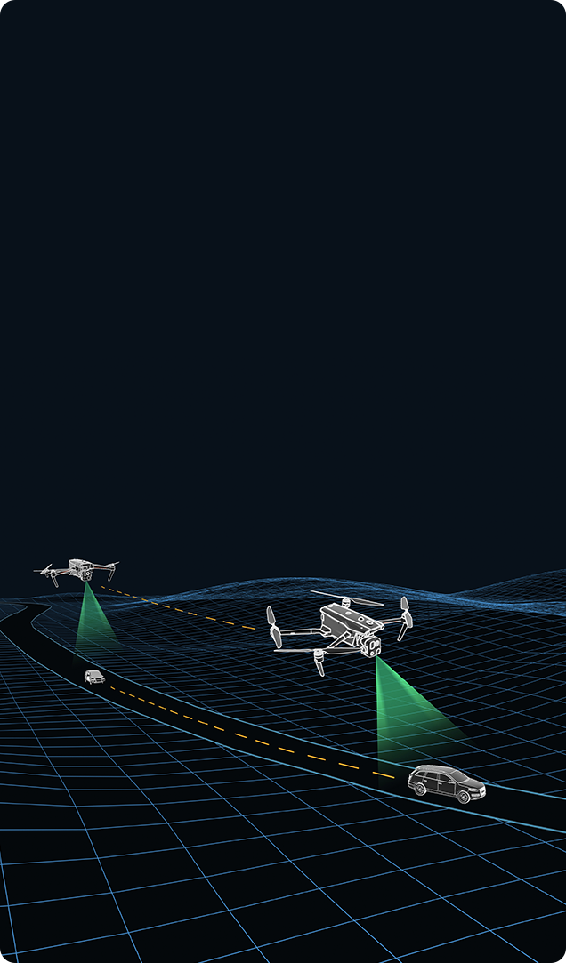
A-Mesh Networking Solution
EVO Max series features the new A-Mesh system, enabling drone-to-drone autonomous communication, connection, and collaboration.
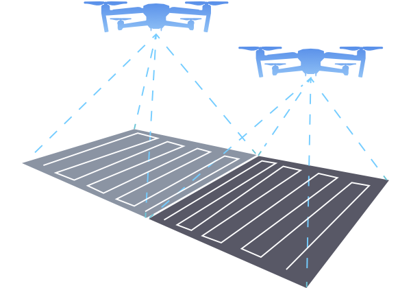
Zonal Operations
Supports dual-controller operation with two aircraft, enabling zonal UAV missions to enhance flight efficiency. It also allows collaborative obstacle avoidance between networked UAVs, ensuring flight safety.
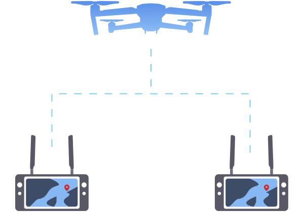
Information Sharing
Within the network, both remote controllers can simultaneously view the UAV’s live feed. The AI target recognition function used on the primary remote controller is also synchronized on the secondary remote controller. Additionally, both controllers support PinPoint positioning.
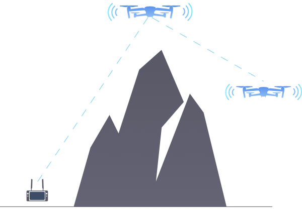
Relay Operations
In scenarios with signal obstructions or weak signals, such as mountainous terrain or remote areas, a UAV can be rapidly deployed as a mobile relay communication node, providing reliable signal support for another mission UAV operating at a distant location, effectively expanding communication coverage.
Zonal Operations
Information Sharing
Relay Operations
Applications
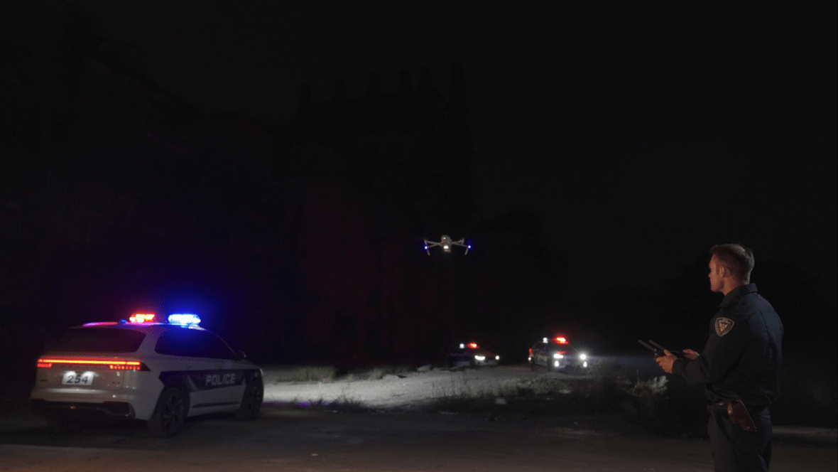
Law Enforcement
Security Patrol
Emergency Search & Rescue
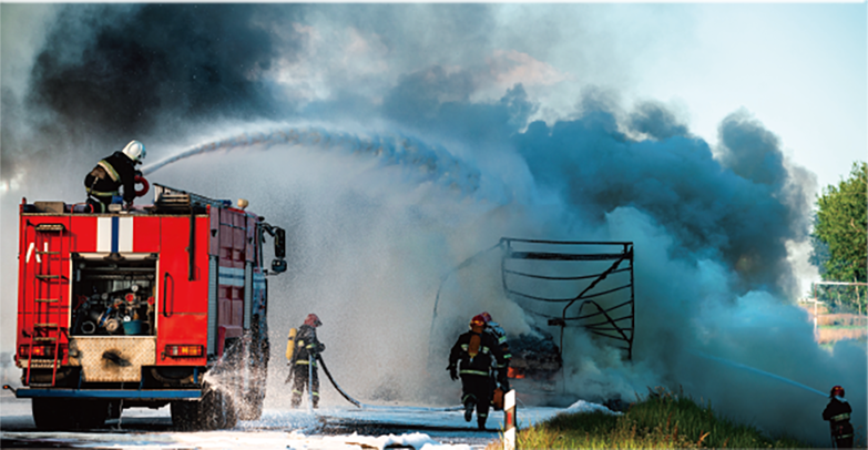
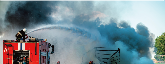
Firefighting & Rescue
Dragonfish Series

Dragonfish Series
Next-Gen Multi Mission eVTOL
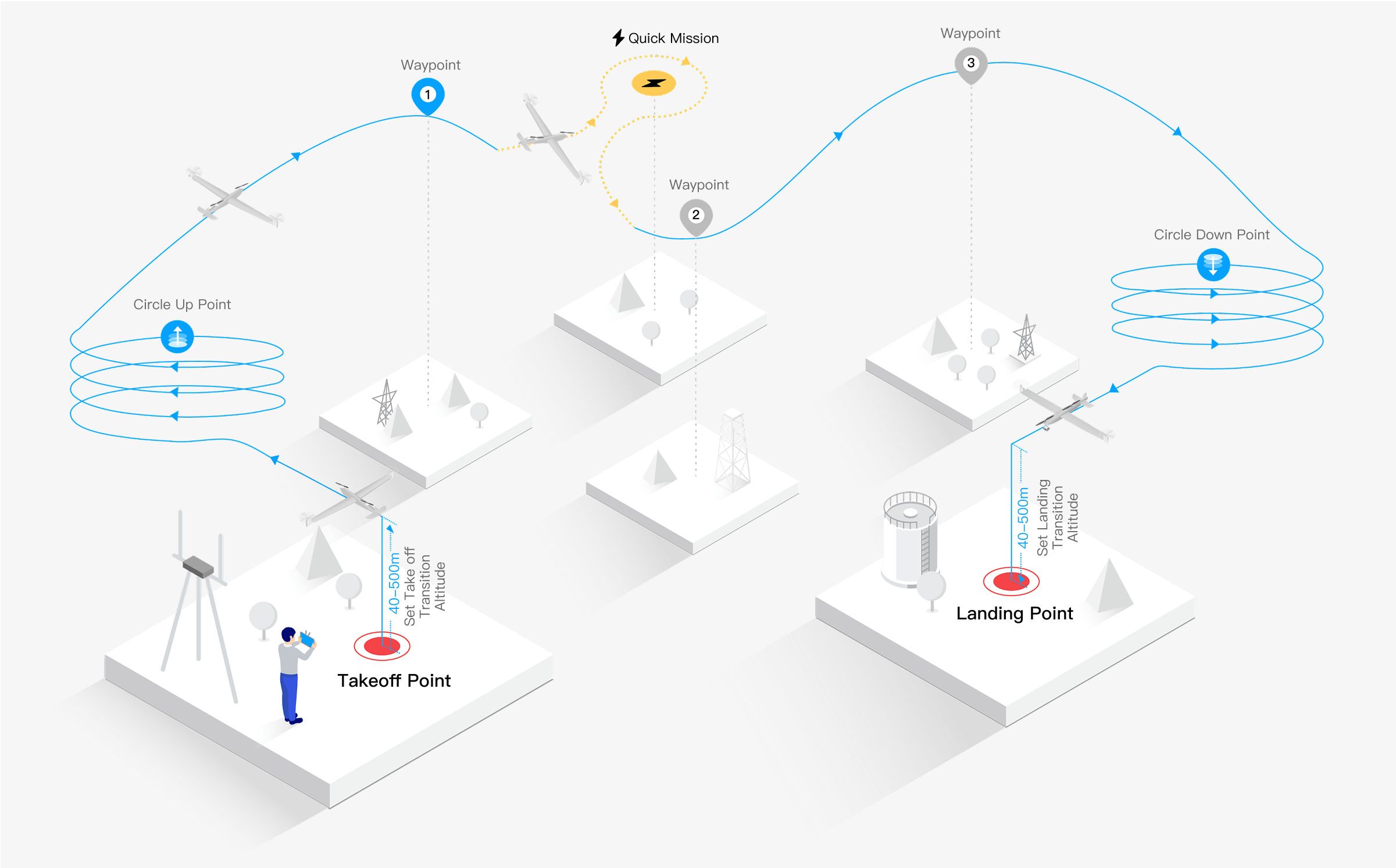
The Dragonfish Series UAV is a vertical takeoff and landing (eVTOL), tiltrotor aircraft used to provide multi-sensor intelligence, surveillance, and reconnaissance (ISR) Services. The Dragonfish is ultraportable, runway independent, and assembles within 5 minutes from case to takeoff. The Dragonfish does not require any additional launch equipment or recovery equipment and can take off and land automatically or manually. Delivering up to 179 minutes of flight time, and a range of up to 45km*, or extended indefinitely with repeaters the system offers class leading performace in endurance and capability. The Dragonfish features a quick release for rapid payload changes, with multiple class leading EO/MWIR sensor options. Industry leading flight control and tracking algorithms make the Dragonfish system operable by a single operator with minimal training necessary.
Superior Anti-Interference
Runway Independent
5 Min Rapid Deployment
1-2 Person Portable
Silent Flight
Intelligent and User-Friendly
5-Second Self-Check
Maximum Flight Speed: 108 km/h
Longest Flight Time: 179 minutes
Transmission Distance: 45 km*
Dragonfish Workflow
IP-rated integrated transport case, sturdy and reliable, designed to be carried and transported by a single person over both short and long distances.
Complete assembly within 5 minutes, system self-check in 5 seconds,
Tap on the remote controller screen to quickly generate and create flight paths.
Set flight routes and waypoints to adapt to various mission requirements.
Simple Target Tracking Select the target to enter intelligent tracking mode.
With zoom and laser ranging, achieve efficient and accurate target locking.
Use infrared mode to improve search efficiency.
Fully Automated Flight: From takeoff to mission execution, fully autonomous, without the need for manual
intervention.
Single Operator: Optimized workflow, one operator can complete complex missions.
Switch to manual mode at any time when needed to ensure operational safety.
Easily return to home via the Home button. Convenient Storage: Quickly organize after flight, easy to
store and ready for the next use.
1
Easy and Secure Transportation
2
5 Min case to takeoff
3
Intuitive Mission Planning
4
Simple Target Tracking
5
Efficient Execution and Control
6
Emergency Manual Switch
7
One-Button Return
Flight Logic Diagram
Superior Anti-Interference
In complex environments, the UAV maintains exceptional communication and video transmission performance, featuring strong anti-interference capabilities and stable, reliable transmission.
Quick Assembly
The Dragonfish Series features tooless assembly with a 5-second rapid self-check and the ability to take off within 5 minutes.
Smart Operations
Autel Robotics' advanced flight control technology and AI intelligence offers unparalled ease of use and precision.
Intelligent Tracking
Tap-to-Fly
AI Target Recognition and Positioning
Quick Mission
PinPoint Function
Offsite Landing
Temporary Mission
Terrain Avoidance
Mobile Platform Takeoff and Landing
One-Tap Self-Check
The UAV can lock on to its targets and flexibly adjust its flight path. Supports multiple tracking modes.
Tap on the target in the remote control and the UAV will fly directly to the target area. No sticks required
Built-in AI algorithms supports recognition and positioning of a multitude of assets and targets.
Quick missions deviate from the preplanned flight route for changing mission demands.
Pinpoint areas for temporary observation points, quick missions, or precise emergency landings.
In response to low battery or special situations, the UAV can accurately select offsite landing points.
Supports quick switching to new waypoint missions during flight.
Built-in terrain data allows the DF to maintain minimal AGL over changing terrain.
Supports takeoff and landing on moving platforms.
Automatically performs a system check before takeoff, ensuring every flight is safe and reliable.
120m
Silent Flight
The Dragonfish achieves ultra-silent flight through its exceptional propulsion system and innovative noise-reduction design. Barely audible above 400 ft (120m) AGL*, the DF significantly reducing the risk of detection while ensuring operational secrecy.
Multiple Redundancies, Ensuring Mission Safety
Made from high-strength composite materials with powerful propulsion, it confidently handles wind resistance up to Level 6* with ease.
*Wind resistance level applies to fixed-wing flight mode.
Fault warning, full system self-check to detect potential issues in time.
The battery, IMU, barometer, compass, RTK, and positioning system all feature redundant designs to ensure maximum flight safety.
Powered by Autel Robotics' exceptional flight control technology, ensuring stable and reliable flight performance.
Real-time monitoring of airspeed indicator status.
Dual-redundant CAN bus communication enables real-time monitoring of control surfaces and motor status, ensuring seamless command execution and robust electromagnetic interference resistance.
In fixed-wing flight mode, when affected by complex environments, the flight control system will automatically switch to multirotor mode for assisted flight.
1
Made from high-strength composite materials
Made from high-strength composite materials with powerful propulsion, it confidently handles wind resistance up to Level 6* with ease.
*Wind resistance level applies to fixed-wing flight mode.
2
All feature redundant designs to ensure
The battery, IMU, barometer, compass, RTK, and positioning system all feature redundant designs to ensure maximum flight safety.
3
Exceptional flight control technology
Powered by Autel Robotics' exceptional flight control technology, ensuring stable and reliable flight performance.
4
Multirotor mode for assisted flight
In fixed-wing flight mode, when affected by complex environments, the flight control system will automatically switch to multirotor mode for assisted flight.
5
Dual-redundant CAN bus communication
Dual-redundant CAN bus communication enables real-time monitoring of control surfaces and motor status, ensuring seamless command execution and robust electromagnetic interference resistance.
6
Real-time monitoring of airspeed indicator status
Unaffected by wind, rain, or icing.
7
Fault warning
full system self-check to detect potential issues in time.
Safety Mechanisms
GNSS Loss Protection
When operating in non-GNSS environments, the UAV activates landing protection, automatically descending from its current position to ensure safety.
Low-Battery Return
Users can customize the expected landing battery level. The UAV calculates the optimal return timing in real-time based on current battery levels and flight status, ensuring it lands with a battery level close to the user-defined threshold.

Lost-Signal Return
If signal between the UAV and the ground station is interrupted, the loss-of-connection protection activates. If GNSS signals are available, the UAV initiates automatic return-to-home.
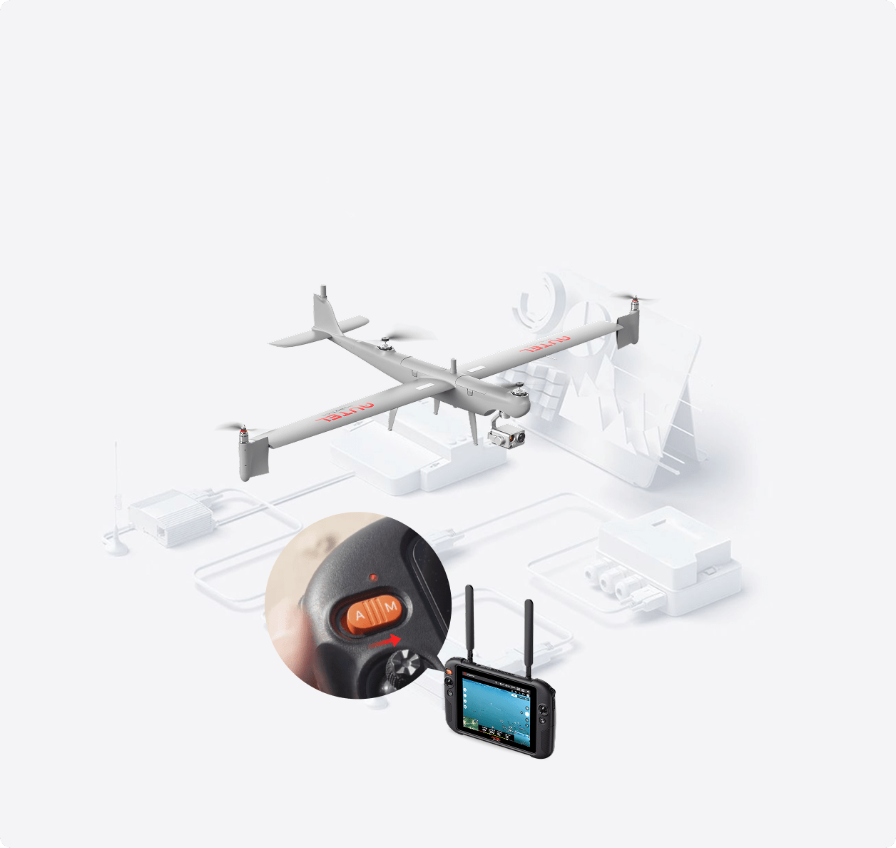
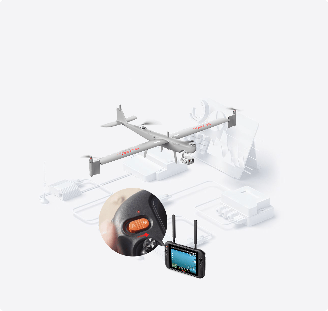
Emergency Manual Override
In case of an emergency, you can switch the remote controller to M mode at any time to immediately take manual control, ensuring flight safety.
DG-L20T
The Dragonfish Series can be equipped a range class leading EO/MWIR payloads such as the the DG-L20T,
1/2" CMOS
Effective pixels: 12MP
Max. video resolution: 3840×2160@30FPS
Max. photo size: 4000×3000
1/2.5" CMOS
Effective pixels: 8MP 4K 20x optical zoom
Max. video resolution: 3840×2160@30FPS
Max. photo size: 3840×2160
640*512 Resolution
Temperature range: -20℃~150℃ / 0℃~550℃
Temperature measurement accuracy: ±3℃ or ±3% of reading
Measurement range: ≤400m: ±1m; >400m: ±0.4%
Measuring range: 10-1200m
Size Comparison
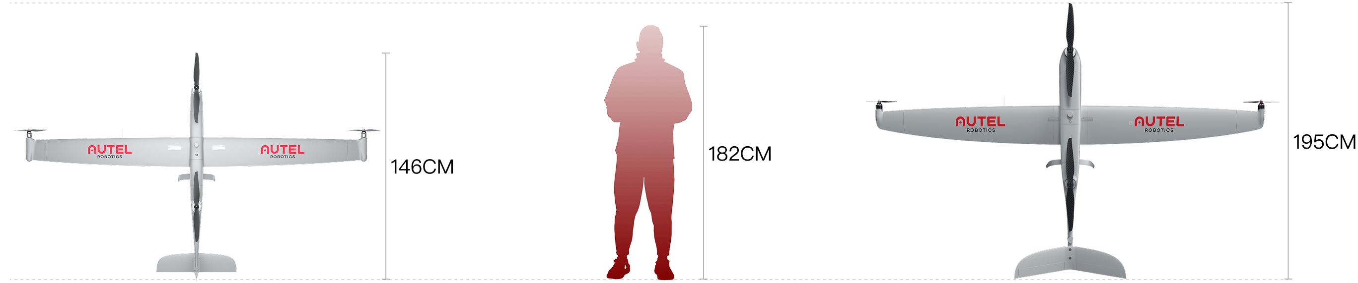
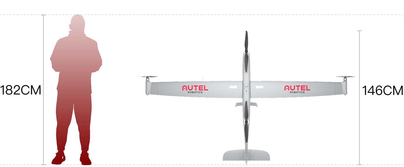
Dragonfish Standard
7.5 kg(16.53lb) | 2.49 m wingspan
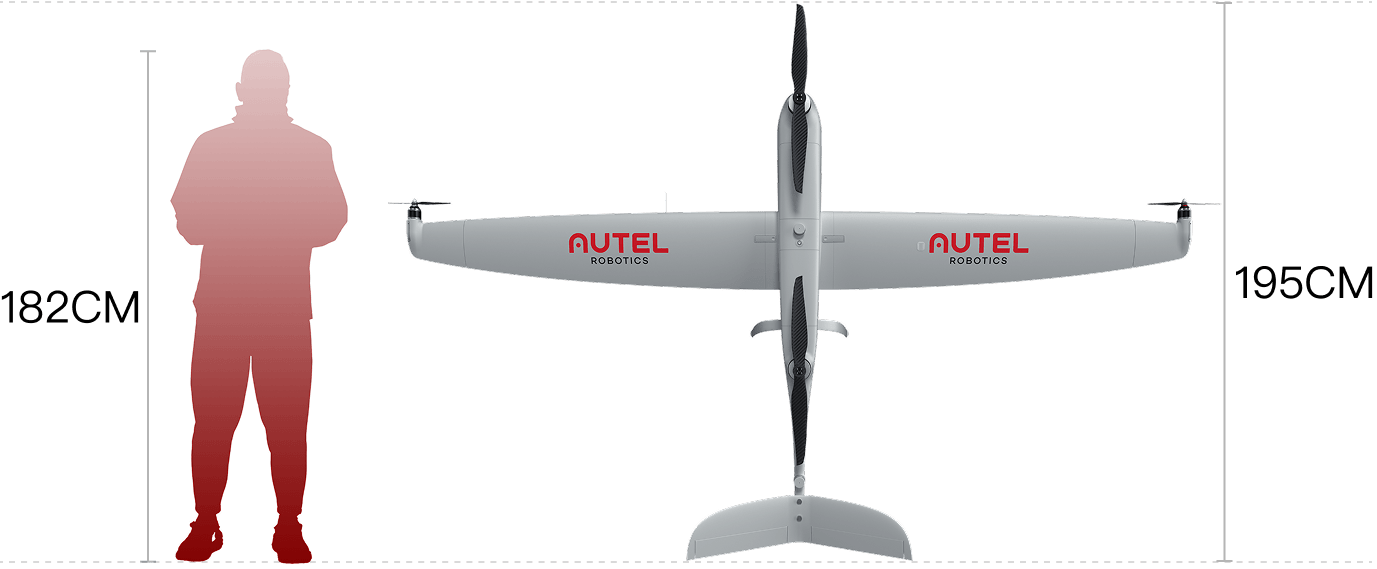
Dragonfish Pro
14.5 kg(31.97lb) | 3.29 m wingspan
Accessories
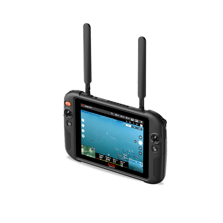
Remote Controller (Standard)
Display: 9.7-inch screen,1000-nit maximum brightness,2048x1536 resolution.
Battery Life: 4.5 hours.
Storage: Built-in 256GB storage.
Environmental Adaptability: Operating temperature range from -20°Cto 50°C.
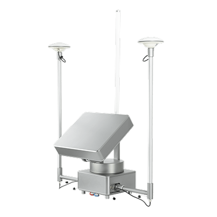
Autel Smart Antenna Transmission (ASAT) (Optional)
The Autel Smart Antenna Transmission integrates directional and omnidirectional antennas, a base station motherboard, and an RTK antenna, enabling up to 45 km* ultra-long transmission with enhanced anti-interference performance.
More+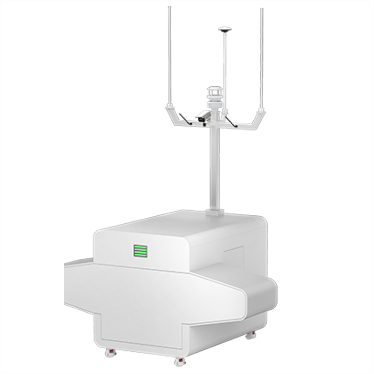
Autel Dragonfish Nest (Optional)
The Autel Dragonfish Nest is an unattended platform with automatic takeoff, landing, battery swapping, and all-weather monitoring,
enabling remote mission management and large-scale UAV inspections to enhance efficiency.
More+
Dragonfish Repeater (Optional)
The Dragonfish Repeater integrates antennas, a relay base, 4G module, and solar UPS system, enabling long-range operations and 24/7 remote management. Paired with the Nest, it supports ultra-long-range transmission and power-free deployment.
More+Applications
The Dragonfish, with its powerful flight performance and robust software and hardware platform, redefines productivity tools. It empowers fields such as security and inspection, paying tribute to the future with technological excellence.
Coastal Anti-Smuggling
Police Enforcement
Forest Fire Prevention
Power Line Inspection

Traffic Inspection
Energy Inspection

Autel Alpha
Autel Alpha
Beyond The Frontiers
Autel Alpha is an intelligent industrial drone for multi-purpose. Boasting significant enhancements in autonomous flight capabilities, anti-interference capabilities, obstacle avoidance capabilities, video transmission technology, and battery systems, it injects robust performance into the flight platform. With a foldable design and IP55-rating level, it tackles challenging environments. The built-in RTK dual-antenna system ensures precise control within millimeters when carrying out the missions.Paired with the next-gen DG-L35T gimbal, it integrates a 560x hybrid zoom camera, dual thermal imaging cameras, a visible light wide angle camera, and a laser rangefinder. The dual thermal imaging cameras meet the needs of both short-range overview and long-range detail observation, achieving distant operation scenarios with unobstructed personnel recognition within an 8-kilometer range, providing more professional and comprehensive solutions for applications such as public safety, energy inspection, and emergency management.

Superior Anti-interference

High-precision Visual Navigation

AI Target Recognition and Positioning

56x Dual Thermal Camera

4K 35x Optical Zoom

IP55 Rating

Hot-swappable Battery

Wire-Level Obstacle Avoidance and Pathfinding

15 Kilometers Video Transmission Range

Flexible Payload Expansion
Insight Beyond Limits
Autel DG-L35T Gimbal integrates dual thermal imaging cameras (short/long focal length), 4K 35x Optical Zoom Camera, a wide angle camera and a laser rangefinder.
Zoom Camera
8 MP
4K 35x optical zoom
560x hybrid zoom Ultra-sensitive ISO
supports up to a maximum of 160,000
Wide Angle Camera
48 MP
Aperture: F/2.8
DFOV: 84°
Equivalent focal length: 24mm
Dual Thermal Camera
640*512
56x hybrid zoom
13mm focal length wide angle thermal imaging
45mm focal length long range thermal imaging
Laser Rangefinder
Measurement range: 10-2000 meters
Measurement accuracy: <400m: +1m;
>400m: D×0.3%
* where D represents the distance from the vertical
reflecting surface
Exceptional Anti-Interference Capability
Exceptional Anti-Interference Capability,Autel Alpha's high-precision visual positioning capabilities, adaptive frequency-hopping and SLAM navigation technology empowers resistance from interference and enables the drone to fly confidently near powerlines, critical structures and in complex areas.
Autonomous Flight
Autel's Autonomy Engine is continuously improving, enabling functions such as global path planning and 3D scene reconstruction in complex environments. It ofers various obstacle avoidance capabilities, including return-to-home, manual contro, and mision planning, providing a more professional solution for industries such as security, inspection, and surveying.
* This feature is pending future updates.
No Blind Spots,Ultimate Obstacle Avoidance
By integrating multi-source sensor fusion technology, including 5-direction dual fisheye vision + 6-direction millimeter-wave radar, the drone is equipped with wire-level obstacle avoidance and pathfinding capabilities. It can detect minor obstacles like glass, poles, and powerlines. Additionally, it supports nighttime obstacle avoidance for flight safety.
Platform Capabilities
Redefines proficiency with its robust platform and all weather design.
Protection Rating: IP55
Wind Resistance: 12m/s
Maximum Flying Altitude: 4500 meters
Operation Temperature: -20℃ to 50℃
*With high-altitude propeller
Multiple Payload Capability
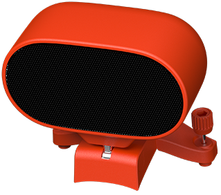
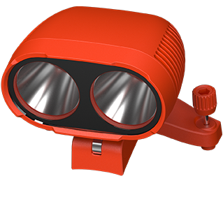
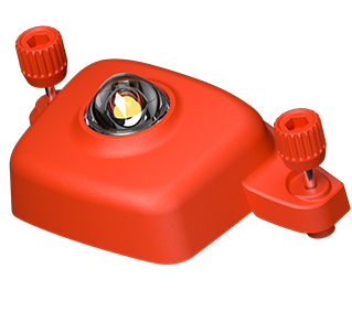
The aircraft features multiple mounting interfaces: mounting interfaces. The Autel PSDK developer platform is open for creating a new industry ecosystem such as searchlights, loudspeakers, and more.
Hot-Swappable Batteries
Adopting a dual-battery redundant design, the flight time reaches 40 minutes, supporting hot-swappable batteries for seamless, efficient operations.

High-definition Transmission,
Performance Upgrade
With Autel Skylink 3.0, the system comes with 4 antennas, 4 Frequency bands, enabling a transmission distance of up to 15 kilometers. It supports auto frequency hopping on 900M/2.4GHz/5.2GHz/5.8GHz*, automatically selecting the optimal channel based on electromagnetic interference for robust anti-interference capabilities, featuring a high transmission of 64Mbps and low transmission latency.
15 kilometers
Image Transmission Distance
1080P/30FPS
Real Time Video Quality
900 MHz/2.4 GHz/5.2GHz/5.8 GHz
Frequency Bands*
* Some frequencies are only available in some regions or for indoor use only. Check local laws and regulations for details.
Autel Enterprise App Platform
The Autel Enterprise App is built from the ground up for industrial applications and features a brand-new interface for simple, efficient operation. Additional features and semi-autonomous modes maximize the Autel Alpha' mission capability.
Quick Mission
Temporary quick missions can be created while executing other missions, andmultiplesub-missions can be stacked for enhanced flexibility.
Waypoint Mission
Users can add waypoints for flexible, non-structured flight paths.
Polygon Mission
Supports one-click automatic generation of polygon flight areas
AI Target Recognition
Based on Autel's AI recognition technology, the Autel Alpha can automatically identify and lock onto different types of targets such as human, boat or vehicles through zoom, wide, or infrared cameras, projecting the target's location onto the map.
Laser Ranging
Click on the remote controller screen, it will show the target latitude, longitude, height, and other information swiftly.

Tripod
The gimbal locks onto the target, and follows the target's movement while hovering, ensuring the target remains at the center of the frame.
AI Target Recognition
Based on Autel's AI recognition technology, the Autel Alpha can automatically identify and lock onto different types of targets such as human, boat or vehicles through zoom, wide, or infrared cameras, projecting the target's location onto the map.
Laser Ranging
Click on the remote controller screen, it will show the target latitude, longitude, height, and other information swiftly.
Tripod
The gimbal locks onto the target, and follows the target's movement while hovering, ensuring the target remains at the center of the frame.
Data Security
Privacy protection: Data involving user and aircraft information, including flight logs, locations, and account information can only be physically accessed via the aircraft locally.Encrypted Data Storage: It supports AES encryption for photos, videos, and flight logs, requiring a password input for access.


Autel SDK
"The Autel SDK is open to the world, helping developers and partners reduce software and hardware development costs and jointly create a new industry ecosystem.
Mobile SDK / Payload SDK*
A well-designed software and hardware architecture enables developers to get started with ease, offering simplicity and convenience, and empowering the creation of exceptional UAV mobile application experiences.
Autel Alpha Tracer
UAV Pilot Positioning Solution
The UAV pilot positioning solution aims to address the challenge of detecting UAV pilots in scenarios without broadcast protocols (Drone ID and Remote ID). By mounting high-precision radio direction-finding equipment on UAVs, it horizontally and vertically triangulates the target signal source (UAV controller) in the air, determining potential target areas and displaying them on a map.
More+
Accessories
Autel Smart Controller V3
Daylight Readable display: 7.9 inches, 2000nit maximum brightness, 2048*1536 resolution.
SuperDownload: Download footage from drone to mobile device at a maximum rate of 20MB/s.
Functional interface: HDMI ports allow connection to 3rd party displays or monitors. The USB interface allows for 4G module expansion.
Ultra-long battery life: Up to 4.5 hours of continuous operation. 2 hours fast charging.
Local storage: Built-in 128G storage space allows 3rd party apps and mission media storage.

Loudspeaker And Spotlight Combo (optional)
Dimension: 196×129×78mm
Weight: 250g
Electrical Interface: PSDK Interface
Installation Method: Standard quick release mount
Working Temperature: -10 ℃ to 50 ℃
Speaker: Power @10W; Sound pressure 114db@1 meter; Broadcasting Distance≥300 m
Spotlight: Follow gimbal pitch; Brightness level adjustment; 30° to -90° controllable
Tracer Air Radio Detection Device (optional)
Size: 130×120×68 mm
Weight: 745g (holding bracket excluded); 808 g (holding bracket included)
Detection bands: 2.4G / 5.2G / 5.8G
Detection number: Up to 6 target sources at the same time
Detection range: 3km
Basic function: Pilot positioning / interference source positioning
Introduction: By mounting high-precision radio direction-finding equipment on UAVs, it horizontally and vertically triangulates the target signal source (UAV controller) in the air, determining potential target areas and displaying them on a map. Visual searching of target areas combined with AI recognition assists in discovering UAV pilots.
Applications
Public Safety
Powerline Inspection
Search & Rescue
EVO Lite Enterprise Series


Lightweight Yet Mighty
Video

The EVO Lite Enterprise Series, by Autel Robotics, offers multiple advantages such as a lightweight and portable design, rapid deployment, and simple control for industrial applications. The AI target recognition feature enables the aircraft to easily identify and map various target objects automatically. The three-way binocular vision obstacle avoidance provides a safe flying experience. The EVO Lite 640T Enterprise features a dual gimbal system, with a visible-light camera providing clear and detailed images, while the thermal-imaging camera aids in decision-making during operations. The EVO Lite 6K Enterprise is equipped with a 1-inch CMOS visible-light camera, offering outstanding sensitivity for excellent image quality. Paired with the Autel Enterprise professional flight software, it offers easy operation, user-friendly interaction, flexible single-person deployment, and efficient application in scenarios such as public safety and emergency rescue.

Lightweight and
Portable

Simple Control

AI Target Recognition
and Positioning

6K Resolution

640*512 Infrared
Thermal Imaging

12km Video
Transmission Range

Three-Way Binocular
Vision Obstacle Avoidance

40-Minute
Flight Endurance
Lightweight and Portable
The EVO Lite Enterprise Series aircraft weigh only 866 grams and have folded dimensions of just 210*123*95mm, making them easy to carry in a backpack. With a simple operation, they are ideal for efficient execution of missions by a single operator.
Autel Enterprise App
Autel Enterprise is a professional flight mission software designed for industry applications by Autel Robotics. It features an optimized interaction design for simple and efficient operation, an editable toolbar design for intuitive use, and integrates intelligent and professional functions to fully utilize the industry value of the EVO Lite Enterprise Series aircraft.
Split-Screen Display
Visible light, infrared, or map support dual-channel simultaneous output on the screen, providing comprehensive information through comparison.
Customizable Toolbar
Customize the menu toolbar in the app for quick access to frequently used functions, meeting personalized usage needs.
Offline Maps
Addresses the issue of map loading failures in no-network or weak-network environments by supporting offline maps, aiding in precise flight positioning.
AI Target Recognition and Positioning
Utilizing wide-angle or infrared lenses combined with intelligent AI algorithms and a self-learning system, the aircraft can automatically recognize and locate, including people, cars, and boats, projecting their positions on the map.
Data Security with Multiple Protections

Privacy Protection
Flight logs, locations, and other user privacy data require user consent to upload.
Encrypted Storage
Supports AES encryption for photos, videos, and flight logs, requiring a password for access.
Video Live Streaming
Supports RTMP and GB28181* protocols for live streaming, allowing for remote real-time viewing and analysis.
*The GB28181 video live streaming protocol feature is pending future updates.
EVO Lite 640T Enterprise
Equipped with a dual gimbal, the wide-angle visible-light camera offers a broad field of view with vivid high-definition images, while the infrared thermal-imaging camera integrates high-resolution thermal-imaging algorithms, providing clear and detailed thermal source identification.
Thermal Imaging Camera
640*512 resolution
9.1 mm focal length
16x digital zoom
Temperature measurement range:
-20°C to 150°C / 0°C to 550°C
Temperature accuracy: ±3°C or ±3%
of reading (whichever is greater)
Visible Light Camera
1/2 inch CMOS
48 million pixels
F2.8 aperture
16x digital zoom
Maximum photo size of 8000*6000
Maximum video resolution of 4K 30P
EVO Lite 640T Enterprise
Equipped with a dual gimbal, the wide-angle visible-light camera offers a broad field of view with vivid high-definition images, while the infrared thermal-imaging camera integrates high-resolution thermal-imaging algorithms, providing clear and detailed thermal source identification.
Thermal-Imaging Camera
Visible-Light Camera
640*512 resolution
9.1 mm focal length
16x digital zoom
Temperature measurement range: -20°C to 150°C / 0°C to 550°C
Temperature accuracy: ±3°C or ±3% of reading (whichever is greater)
1/2 inch CMOS
48 million pixels
F2.8 aperture
16x digital zoom
Maximum photo size of 8000*6000 Maximum video resolution of 4K 30P
EVO Lite 6K Enterprise
Equipped with a 6K visible-light camera, it can still capture high-definition, low-noise images in low-light environments, providing insights into targets and empowering police enforcement, patrol inspection, search, and rescue scenarios.
Visible Light Camera
1-inch CMOS sensor
20 million pixels
Adjustable aperture from F2.8 to F11
ISO support up to 48,000 (night mode)
16x digital zoom
Photo resolutions of 5472*3076 / 3840*2160
Maximum video resolution of 4K 30P
EVO Lite 6K Enterprise
Equipped with a 6K visible-light camera, it can still capture high-definition, low-noise images in low-light environments, providing insights into targets and empowering police enforcement, patrol inspection, search, and rescue scenarios.
Visible Light Camera
1-inch CMOS sensor
20 million pixels
Adjustable aperture from F2.8 to F11
ISO support up to 48,000 (night mode)
16x digital zoom
Photo resolutions of 5472*3648 / 5472*3076
Maximum video resolution of 4K 30P
High-Definition Video Transmission
Equipped with Autel SkyLink image transmission technology for a dual-signal, dual-reception system, the image transmission anti-interference capability improved, and the transmission distance reaches up to 12 kilometers. It supports 2.4GHz/5.2GHz/5.8GHz adaptive frequency hopping transmission, automatically selecting the best channel based on electromagnetic interference, providing strong anti-interference capability.
12 kilometers
image transmission
distance
distance
1080P/30FPS
real-time image
transmission quality
transmission quality
<200 milliseconds
latency
2.4GHz/5.2GHz/5.8GHz
frequency
band transmission
band transmission
* Some frequencies are only applicable in some regions or only used in door. Check local laws and regulations for details.
Visual Perception System
The drone is equipped with wide-angle vision sensors at the front, back, and bottom, ensuring reliable flight safety.
SDK Ecosystem


MSDK
The open Mobile SDK provides efficient, versatile, and easy-to-use control and service
interfaces, enhancing development efficiency and enabling the creation of custom
solution scenarios.
Flight Performance
Born small but mighty. The outstanding flight performance of the EVO Lite Enterprise Series drones effortlessly tackles various challenges across multiple scenarios, significantly enhancing the efficiency of single-person mission flights.
40 minutes
of endurance
18 meters per second
Maximum horizontal flight speed of
3000 meters
Maximum takeoff altitude of
Accessories
Autel Smart Controller SE V2
Display: 6 inches, maximum brightness of 800nits, 1440*720 resolution.
Battery life: Removable battery design, 1.5 hours of battery life, supports hot swapping for continuous operation.
Storage: Built-in 32G storage space, supports 128G microSD card to expand storage space.
Environmental adaptability: Operating temperature range from -10℃ to 40℃.
Autel Smart Remote Controller V3 (optional)
High-brightness display: 7.9 inches, maximum brightness of 2000 nits, resolution of 2048*1536.
Fast download: Up to 20MB/s maximum rate to download materials from the drone to mobile devices.
Functional interfaces: HDMI interface outputs live broadcast signal, USB interface expands 4G module.
Long battery life: Up to 4 hours of continuous work, fully charged in 2 hours.
Large storage: Built-in 128G of storage space, easily back up shooting materials.
Remote Controller Multi-Charging Kit (Optional)
The kit includes three remote controller batteries and one multi-port charger, meeting the needs of long-duration operations. The remote controller multi-port charger supports charging up to four remote controller batteries simultaneously.

EVO II RTK Series V2

Unrivaled Accuracy And Control
Watch the Video

Centimeter-level Positioning
The EVO II RTK Series integrates an entirely new RTK module, which provides real-time centimeter-level positioning data and supports Post-Processing Kinematic (PPK). The aircraft can record the original satellite observation data, camera exposure parameters, and various other data. The positioning system supports an A-RTK base station and RTK network, which help provide stable, accurate data acquisition in complex operation environments.

Centimeter-level, High-precision Positioning System

No Need for Ground Control Points

Omnidirectional Obstacle Avoidance

RTK Base Station

Dual Cameras
For Accurate Temperature Measurement
The EVO II Dual 640T RTK is equipped with a high resolution thermal imaging camera and 8K visible light camera, enabling you to capture highly detailed imagery to achieve optimal insights.

Precise Temperature Measurement
The EVO II Dual 640T RTK can accurately detect heat sources within a distance of 6-49 feet. By leveraging the compensation algorithm of infrared temperature measurement, the 640T RTK can regulate temperature deviations within 37 degrees Fahrenheit.
High-resolution Thermal Imaging Sensor
The EVO II Dual 640T RTK has a 13mm focal length combined with a 640x512 thermal imaging sensor, and an 8K ultra-high-definition visible camera. Together, these sensors provide you with dual vision to give you the crisp and clear imagery you need to accomplish your missions.
.png "未标题-2.png")
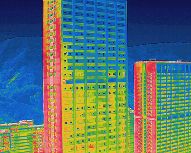
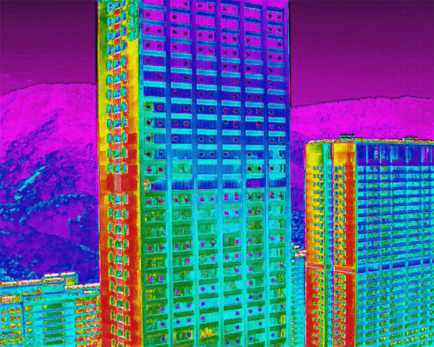
Multiple Color Modes
10 Color Schemes for More Vivid Scene Recognition


Whitehot
Cold and Hot
Rainbow
Enhanced Rainbow
Ironbow
Lava

Aurora

Scorch

Gradient

Heat Detection

Capture Every Detail
The EVO II Pro RTK has high dynamic range and powerful low-light performance, enabling users to capture clear imagery without missing any detailed information.
.png "2021081013451401.png")
6K Ultra HD Video
The 6K resolution ultra-high-definition lens, supported by a 1-inch sensor, makes it easy to achieve professional shooting results.
.png "2021081013453950.png")
High-resolution Camera
The 1-inch CMOS sensor coupled with 20 MP and f/2.8 - f11 aperture, gives you the versatility needed to capture the best images in a variety of mission scenarios.


Light. Efficient. Reliable.
The EVO II RTK Series inherits the foldable design of the original EVO II Series, making it compact, light, portable, and ready to fly in just a matter of seconds. Alongside a 5.5-mile maximum transmission range, the aircraft offers a flight time of up to 36 minutes and can reach a top speed of up to 45 mph, making it the perfect flying companion for your daily missions.
Max Flight Time
36Min
Max Transmission Range
5.5 miles
Max Speed
45mph
Mission Execution With Advanced Intelligence
The EVO II RTK Series provides users with a full range of intelligent features and solutions to suit a variety of mission needs. Using advanced flight control and the latest AI technology, the aircraft can significantly improve mission workflows and help reduce operating costs.
Mission Planning

After creating a flight route, the EVO II RTK can fly on the designated flight path autonomously, enabling a smoother, more efficient flight.
- Waypoint Mission
- Rectangular Mission
- Polygon Mission
- Oblique
Photo Replication
For repeatable data acquisition missions, you can record the drone’s previous shooting positions. All the gimbals, camera, and aircraft movements will be replicated, thus producing a full record of the entire mission.

Omnidirectional Sensing & Obstacle Avoidance
EVO II RTK Series comes built in with a 6-directional sensing system that provides the aircraft with obstacle avoidance capabilities in all directions to enable a safer flight.
*For specific details on obstacle avoidance performance, please refer to the manual
No Need for Ground Control Points
The EVO II RTK Series leverages a high precision RTK module, supports PPK and time synchronization, and is not limited by communication links or network coverage.
- High Precision RTK Module
- Support PPK
RTK / PPK
The Evo II RTK Series supports third party base stations with NTRIP capability.
RTK High-precision GNSS Base Station
The EVO II RTK Series supports RTK high-precision GNSS base station to obtain real-time differential data, which makes it possible to obtain the accurate coordinates of the designated target point.
Application Field
- Powerline Inspection
- Public Safety
- Firefighting
- Photogrammetry
EVO II Dual 640T V2

Power. Efficiency. Reliability.
The Most Compact and Advanced Thermal Drone

A New Generation Of Thermal Sensor
The 640x512 sensor provides greater resolution than any camera in its class, enabling pilots to see deep detail in dark environments.
The new generation of the Autel Robotics thermal imaging sensor has a resolution of up to 640x512@30 fps. It also comes standard with a 13mm lens, 16x digital zoom, and is capable of recognizing subjects at up to 100 m away.

640x512 Resolution30Hz Refresh
RatePicture-in-Picture Mode 10 Thermal Color Palettes
Maximum Efficiency In All Viewing Conditions
EVO II Dual 640T supports up to 10 thermal palettes, enabling pilots to cope with a variety of complex shooting environments and mission scenarios.
Picture-in-Picture Mode
(For Enhanced Situational Awareness)
Visual and thermal imagery are combined to help users quickly interpret data and aid in critical decision making.


Capture And Preserve Even The Smallest Of Details

8K Video, Unmatched Clarity
EVO II Dual 640T records in resolutions up to 7680x4320. With 4 times more pixels than 4K (and 16 times more than HD), 8K videos redefine image clarity and depth.
48MP Camera
The 48MP sensor captures every forensic-relevant detail to assist in precise evidence capture. Both thermal and RGB images are provided with embedded metadata, making the EVO II Dual 640T the ultimate public safety tool.
4x Lossless Zoom
The high resolution provides the ability to zoom deep into a scene and crop an image or video to 4K without any loss in quality. Capture a scene, zoom in, and reframe your shots with ease.
4K HDR For Greater Dynamic Range
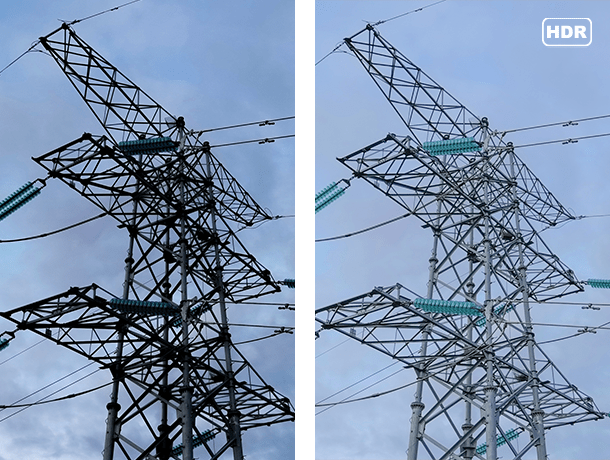
4K HDR offers greater detail in highlights and shadows, providing higher-quality images from the most demanding environments.


360° Obstacle Avoidance

Omnidirectional Obstacle Avoidance With 12 Visual Sensors
Equipped with 19 groups of sensors — including 12 visual sensors, the main camera, ultrasound, and dual IMUs — the EVO II Dual 640T can easily build three-dimensional maps and plan paths through complex terrain in real time.
*Please refer to the manual for the specific details of obstacle avoidance performance
Dynamic Track 2.0
The EVO II Dual 640T can model the location and speed of targets simultaneously, predict their trajectory accurately, and track them continuously while identifying up to 64 objects at the same time.
Watch the Video
Applications
-
Line Inspections: Reduce costs, increase safety, and improve inspection workflow.
-
Firefighting: Locate hotspots, patrol for forest fires, and shorten response times.
-
Law Enforcement: Perform patrols, accident scene reconstruction, forensics, and crowd monitoring.
-
Search & Rescue: Identify subjects, reduce response times, and optimize search area with automated mission planning.
-
Chemical: Inspect plants more efficiently while improving work safety and lowering inspection costs.
-
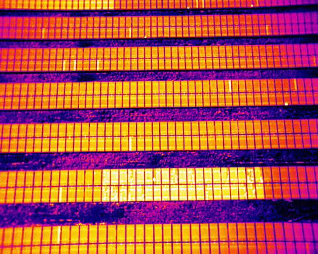
Solar: Reduce field time by using automated mission planning to streamline the inspection process, allowing operators or third party software to discover defects or faulty hardware using the thermal payload.
Modular Design
Unlimited Expansion
Modular Design
Unlimited expansion
Interchangeable Payloads Offer Expansion Capability
Payload Capacity 2lbs (900g)
Live Video Streaming
LiveDeck enables pilots to share live aerial video across public or private networks,
sharing data with command posts, stakeholders, or online viewers.
Open SDK
Create customized services,
Maximum Performance, Endless Possibilities
38min


38 Minute Flight Time

5.5 Mile Video Transmission Range

12m/s Maximum Wind Speed Resistance

45mph Max Flight Speed

Magnesium Alloy Structure

GB4943 Certification
Accessories
EVO II Enterprise V2
EVO II Enterprise
Work Like Never Before

Work Like Never Before
Optimize your workflow with our toughest EVO II yet, bulked up with new accessories and camera features to meet the demands of professionals in every industry from firefighting to construction. With a foldable design that can be deployed in seconds and easy-to-use controls that can be operated with a single hand, the EVO II Enterprise provides a surefire way to increase efficiency without increasing stress.

-

16x Digital Zoom
-

8-mile HD Transmission
-

Modular Accessories
-

Centimeter-level Positioning with RTK
-

360° Obstacle Avoidance
High-resolution Imaging
EVO II Pro Enterprise
20MP 1"CMOS Sensor
3x Optical 16x Digital Zoom Capability
Adjustable Aperture Range of f2.8 to f11
Dual Camera
EVO II Dual 640T Enterprise
640*512 Thermal Imaging Sensor
48MP Visual Camera
Multiple Display Modes: Visual, Thermal, Picture-in-Picture
Applications
-

Public Safety
Assess threats from a safe distance or patrol an area during an investigation, freeing up manpower for other tasks. -

Firefighting
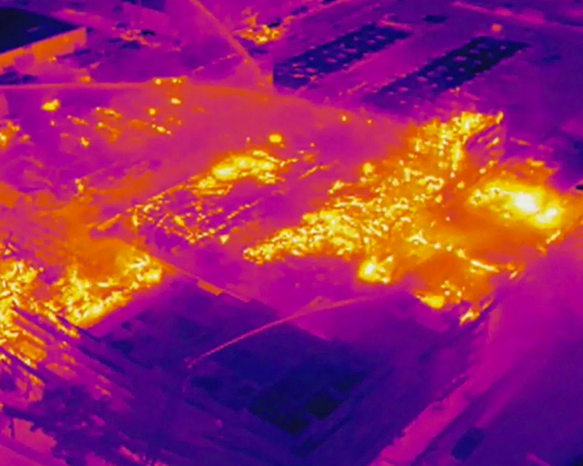
Soar above the flames to identify hotspots, locate victims, and monitor changing conditions, reducing the risk for crew members on the ground.
-

Traffic Supervision
Monitor traffic flow over a larger area and crack down on traffic violations to improve safety for everyone on the road. -

Search and Rescue
Quickly locate missing persons by using automated mission modes to cover larger search areas in situations where every second counts.
-

Power Inspection
Zip between power lines to quickly spot structural damage or overheating electrical elements, saving time and labor costs. -

Mapping
Create cost-effective 3D maps of an area using high-resolution images captured during steady, consistent flight.
Multiple Temperature Measurement Modes
EVO II Dual 640T Enterprise has built-in infrared sensors and high-speed processors, provides a variety of temperature measurement functions, easy to interpret temperature data
- Spot Temperature Measurement
- Regional Temperature Measurement
- Temperature Alarm
- Central Temperature Measurement
- Isotherm
- Image Enhancement

Displays the temperature of a selected object with just a tap of the screen.

Allows the user to adjust image brightness, contrast, and image details in real time.
.png "z139.png")
Displays the temperature in the center area of the screen.

Alerts the user when the temperature of an area reaches a predetermined threshold.

Detects any objects within a specified temperature range.

Allows the user to adjust image brightness, contrast, and image details in real time.
Powerful Telephoto Zoom
Collect high-definition images from a safe distance with 16x digital zoom that supports 4x lossless zoom (EVO II Dual 640T Enterprise) or 3x lossless zoom (EVO II Pro Enterprise).
Mission Versatility
With an expanded selection of accessories at its disposal, the EVO II Enterprise can evolve from a simple imaging tool to a multifunctional flight platform that can adapt to different scenarios.
Accessories
Loudspeaker
Enables more effective on-site communication through long-distance telephony and audio loops.
Spotlight
Beams a powerful, long-distance aerial light when searching or shooting at night.
Strobe
Indicate the location of the aircraft at night to avoid air traffic accidents.
RTK Module(Optional)
Provides centimeter-accurate positioning data and reduces electromagnetic interference.
360° Obstacle Avoidance
Easily maneuver around obstacles, plan paths through complex terrain, or build three-dimensional maps using the 19 sets of sensors covering the airframe.
Predictive Target Tracking
Lock on to an object moving at high speed and predict its trajectory with ease, or use the eye in the sky to identify up to 64 objects at once.
Reliable Data Encryption
Protect sensitive information through encrypted internal and external storage, allowing users to work with confidence.

Superior Flight Performance
The EVO II Enterprise's flight performance has been fully optimized thanks to its new power system and carbon fiber structural design. Equipped with an industry-leading dual-frequency image transmission system, the unit also provides stronger anti-interference capabilities and stable transmission of high-definition images up to 1080p.
42min
-

42Min Max Flight Time
-

8miles(13km) Max Transmission Range
-

44mph(72km/h) Max Speed
-

27mph(12m/s) Max Wind Resistance
EVO II Pro V3

Leader In Picture Quality And Flight Intelligence
Exceptional Image Quality
With Sony's new 20 megapixel 1-inch CMOS image sensor, the EVO
II Pro V3 supports up to 6K video with greater dynamic range, stronger noise suppression,
and higher frame rates. The f/2.8-f/11 adjustable aperture and 44000 maximum ISO gives
photographers enhanced creative control.
-
1-InchCMOS
-
20MPPhoto
-
6K/30FPSVideo
-
F2.8~F11Aperture
Moonlight Algorithm 2.0
Excell in night photography with EVO II Pro V3's 6K 1" CMOS
and Autel Robotics' Moonlight Algorithm 2.0.

4K HDR Video
The EVO II Pro V3 pairs the brilliance of 4K clarity with the
brightness,
color and detail of HDR. Previously hidden areas of shadow and sunlight are now full of
clarity and detail.


-

Post-Production Flexibility With 12-Bit DNG
The EVO II Pro V3 can take 12-bit DNG photos and is capable of recording up to 68.6 billion colors with 64 times the color rendering power of 10-bit, allowing greater flexibility in post-production. -

Hyper-Lapse Photography In 6K
You can enjoy your favorite moments at any time, free from post-processing as 6K mobile time-lapse as video can be exported right after recording, and JPEG/RAW format are also supported.
SkyLink 2.0 Video Transmission
The EVO II Pro V3 is upgraded with Autel's all new SkyLink 2.0
Video Transmission technology.
9+ Miles
Fly farther with HD video transmission up to 9 miles.
QHD
Get on-screen QHD video within 0.6 mile. Obtain critical details with a
resolution of 2560 x 1440 for a total of 3,686,400 pixels–about 1.8x the pixels of an
FHD monitor.
2.4GHz / 5.8GHz / 900MHz
Supports tri-band communication and can automatically frequency hop for
maximum anti-interference capability.
*900MHz is only applicable for FCC countries.
360° Obstacle Avoidance
Equipped with 19 groups of sensors including 12 visual
sensors,the main camera, ultrasound, IMUs and other sensors enable building of
three-dimensional maps and path planning in real time.
*Please refer to the manual for details on obstacle avoidance
and its limitations, which may or may not work in limited lighting environments, under
direct strong sunlight, or across thin tree branches or wires.
Maximum Performance Endless Possibilities

-
37-39 minutes(*No RTK)
34 minutes(RTK)Maximum Flight Time -
9.3miles (10600m)
Maximum Transmission Range -
27mph (12m/s)Maximum Wind Speed Resistance
-
27mph (12m/s)Maximum Flight Speed
Autel Smart Controller SE
Smart Controller SE comes with a 6.4-inch OLED touch screen
and latest gen 8-core processor for HD image transmission. SkyLink 2.0 Transmission
technology guarantees long-distance operations from up to 10km away and enhances
anti-interference abilities with triple band frequency hopping. The customized Android
system allows for additional flexibility with 3rd party Apps and an IP43 rating ensures
all weather performance.
-

6.4-Inch OLED Screen
-

9.3 Miles Transmission Range
-

Removable Battery
-

3rd Party Apps
-

14°F to 104°F Operating Temperature
EVO II RTK Series V3

Unrivaled Accuracy And Control
Centimeter-Level Positioning
The EVO II RTK Series V3 introduces a brand-new RTK module, which
provides real-time centimeter-level positioning data, and supports Post-Processing Kinematic
(PPK). The aircraft can record the original satellite observation data, camera exposure
parameters and more. The positioning system supports an RTK base station and NTRIP RTK
network, which help to achieve accurate and stable data acquisition in complex operation
environments.
-
 RTK Horizontal Positioning Accuracy: 1cm+1ppm
 -
 RTK Vertical Positioning Accuracy: 1.5cm+1ppm
-
No GCP Required
EVO II RTK Series V3 can connect to an NTRIP network and does not need GCPs to provide centimeter-grade accuracy.
-
3rd Party Base Station Support
EVO II RTK Series V3 supports all NTRIP-compatible base stations.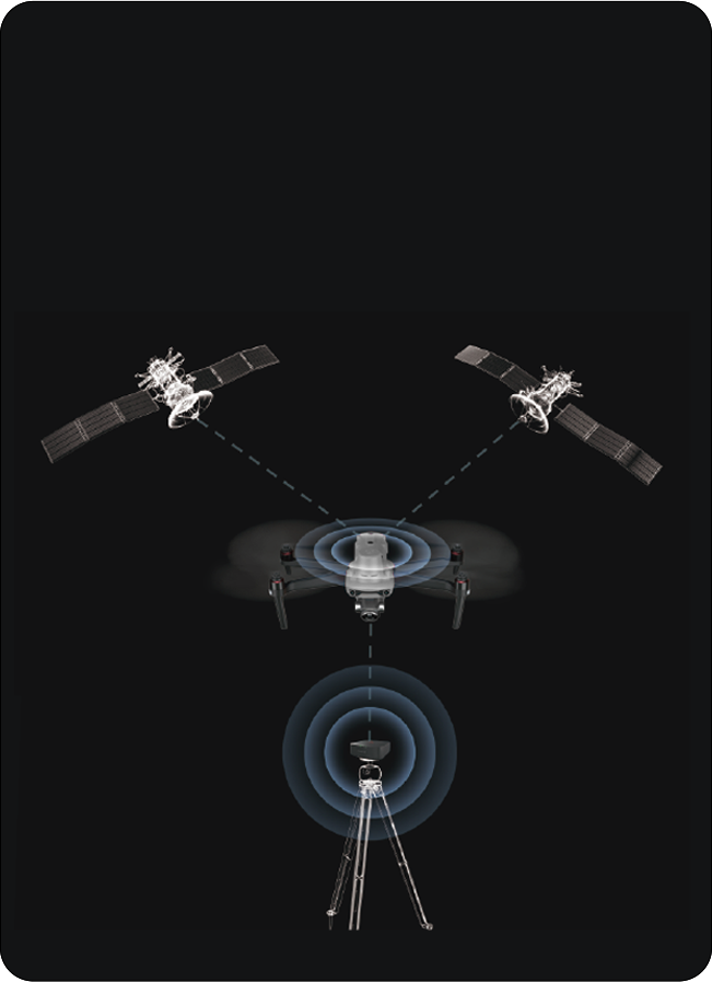
Autel Explorer For Mapping

Multi-NTRIP Profile Saving

Photo Replication

Multi-Battery Missions
Advanced Feature Sets
-
 Create Rectangular or Polygon Missions
 -
 Supports Double grid mapping for additional angle customizable
 -
 Have complete manual control over camera settings
 -
 Non stop turning on corners saves time and battery life
 -
 Customizable course headings to meet orientation requirements

Capture Every Detail
EVO II Pro RTK V3 has high dynamic range and
powerful low light performance, enabling users to capture clear detail sets with minimal
distortion and noise.
1-Inch Ultra-Sensitive Sensor
The EVO II Pro RTK V3 comes with a NEW updated 1-inch 6K CMOS
image sensor with a maximum of 20 megapixels. Thanks to the ultra-sensitive algorithm,
you can still shoot clean, detailed, low-noise data sets under twilight or night
conditions.
f/2.8 ~ f/11 Adjustable Aperture
Adapt to lighting changes by adjusting the lens aperture size,
giving the pilot more shutter speed control.
-
Zoom In For The Details
EVO II Pro RTK V3 has optimized its datasets to be easily adjusted with post processing software applications.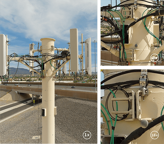
-
Optimized For Software Image Correction
EVO II Pro RTK V3 has optimized its datasets to be easily adjusted with post processing software applications.

Dual Cameras, Accurate Temperature Measurement
The EVO II Dual 640T RTK V3 is equipped with a
high-resolution thermal imaging camera and an all new Sony .8" 50 megapixel RYYB sensor.
High-Resolution Thermal Imaging Sensor
Equipped with a 640x512 high-resolution thermal imaging camera
featuring a 13mm focal length lens and 16x digital zoom, it is easy to observe distant
targets. The system uses a new image processing algorithm, making thermal imaging
details clearer and more discernible than the competition with the similar resolution
and hardware.
Precise Temperature Measurement
The EVO II Dual 640T RTK V3 can accurately detect heat sources
within a distance of 2-20 meters. By leveraging the compensation algorithm of infrared
temperature measurement, the 640T RTK can regulate temperature deviations within 3
degrees Celsius.
-
New Image Processing Algorithm
The V3 system uses a brand new image processing algorithm, making thermal imaging details sharper and more discernible than competition with the similar resolution and hardware. -
30hz Refresh Rate For Videogrammetry
The EVO II RTK Dual V3 provides high refresh rates for accurate and detailed 3D thermal maps. -
Zoom In For The Details
Focus in on critical areas with the EVO II RTK V3's 4x lossless zoom and 16x digital zoom. -
Multiple Color Palettes
White Hot | Cold and Hot | Rainbow | Enhanced Rainbow | Ironbow | Lava | Arctic | Searing | Gradation | Heat Detection
SkyLink 2.0 Video Transmission
SkyLink 2.0 is built into the EVO II Series
V3 chipset, expanding the possibilities for your most critical workflows.
9+ Miles
Do more because you can fly further away.
QHD
Incredible video resolution within a mile, meeting most common use cases.
2.4GHz / 5.8GHz / 900MHz
Supports tri-band communication with automatic frequency hopping for maximum anti-interference capabilities.
*900MHz is only applicable for FCC countries.

360° Obstacle Avoidance
Equipped with 19 groups of sensors including 12 visual
sensors,the main camera, ultrasound, IMUs and other sensors enable building of
three-dimensional maps and path planning in real time.
*Please refer to the manual for details on obstacle
avoidance and its limitations, which may or may not work in limited lighting environments,
under direct strong sunlight, or across thin tree branches or wires.
Portable and Easy to Use
-

Compact Design
The EVO II RTK Series V3 folds up for ease of transport and deployment. -

Trouble Free Daily Workflows
The EVO II RTK Series V3 only takes 45 seconds from setup to takeoff.
Safe and Sturdy

27mph Max Wind Resistance
EVO II's Smaller Cross Section and powerful motors allows greater stability and control in all windy conditions.- -
- -

No Fly Zones*
EVO II RTK Series V3 does not have any no fly zones and will not prevent the pilot from taking off.

38 Minutes Flight Time
Enjoy up to 38 minutes of flight time - 20%~30% more than the next leading competitor for more area coverage and longer missions.- -
- -

No Forced Updates**
EVO II RTK Series V3 does not need to be on the latest hardware or app version in order to take off unlike other competitors.
*Please fly safely and consult your local laws and
regulations. Autel Robotics is not liable for any unauthorized flights.
**It’s required to update the latest firmware and app to enjoy comprehensive warranty. More information please refer to warranty policy.
**It’s required to update the latest firmware and app to enjoy comprehensive warranty. More information please refer to warranty policy.
Autel Smart Controller V3
The Smart Controller V3's
7.9-inch, 2000 nits high-brightness screen is clearly visible under direct sunlight. SkyLink 2.0 Transmission technology guarantees long-distance operations from over 9 miles away and enhances anti-interference abilities with triple band frequency hopping. The customized Android system allows for additional flexibility with 3rd party apps and an IP43 rating ensures all weather performance.
-
 9+ Miles Transmission Range
 -
 Maximum 2000 nits Brightness
 -
 4.5 Operating Hours
 -
 IP43 Resistance
Applications
-
 Powerline Inspection
 -
 Photogrammetry
-
 Law Enforcement
 -
 Firefighting
EVO II Dual 640T V3

Power. Efficiency. Reliability.

640x512 25Hz New Thermal Imaging Sensor
Equipped with a 640 x 512 high-resolution thermal imaging camera
featuring a 13mm focal length lens and 16x digital zoom, it is easier than ever to observe
distant targets. The system uses a new image processing algorithm, making thermal details
clearer and more discernible than other options with similar resolution and hardware.
DRI Ranges
See a specific subject's identity, activity, or personal items.

Person |

SUV |

Truck |
|
|---|---|---|---|
| Dimension | 1.8*0.5m | 4.2*1.8m | 6*4m |
| Detection | 542m | 1661m | 2889m |
| Recognition | 135m | 415m | 722m |
| Identification | 68m | 208m | 361m |
• Detection:Detect if an object is present.
• Recognition:See what type of object it is (i.e. person, vehicle, airplane).
• Identification:Determine subject affiliation and intent.
Multiple Temperature Measurement Modes
-

Central, Spot, And Regional Temperature Measurement
Central temperature measurement: View real-time display of the temperature in the center area of the screen.
Spot temperature measurement: Tap the screen, and the temperature of the selected object will be displayed in real time.
Regional temperature measurement: Get a dynamic view of the average temperature, maximum temperature, and minimum temperature displayed in a selected area.
-

10 Thermal Color Palettes
White Hot | Cold and Hot | Rainbow | Enhanced Rainbow | Ironbow | Lava | Arctic | Searing | Gradation |Heat Detection -

Picture-in-Picture Display Mode
Visual and thermal imagery are combined to help users quickly interpret data and aid in critical decision making.
-

Temperature Alarm With Isotherm And Image Enhancement
Temperature alarm: Monitors the screen temperature in real time. The system prompts the user when the temperature reaches a set threshold.
Isotherm: Set a temperature range and the system will detect any objects within the temperature range specified.
Image enhancement: Supports real-time adjustment of image brightness, contrast, and image details. The system will highlight any objects within the temperature target.
-

Powerful Infrared Thermal Analysis Tool
IRPC TOOL: This free temperature measurement analysis tool is developed specifically for the 640T, and enables users to quickly import images, edit and analyze temperature measurements, and generate detailed reports for sharing and collaboration.
50MP Ultra-Sensitive Camera
The EVO II Dual 640T V3's RYYB sensor features the Moonlight Algorithm
2.0 that provides excellent noise reduction in limited lighting conditions, further enhancing
its 50 megapixel camera to give users more detail for better forensics and analysis.
0.8" Sensor Size
The EVO II Dual 640T V3's 0.8" RYYB CMOS offers up to 144%~233% more surface
area when compared to 1/2" or 1/2.3" competitors for maximum details in high-contrast
lighting conditions.
RYYB Sensor Technology
RYYB sensor technology moves away from RGB cameras by offering up to 40% more
light sensitivity in low light scenarios.
PDAF+CDAF Autofocus System
Never lose sights of your subjects with a combination of PDAF (Phase Detection
Auto Focus) and CDAF (Contrast Detection Auto Focus) technology for fast and accurate
tracking.
-
Get The Full Scene
The system supports 16x digital zoom and 4x lossless zoom, providing long-distance image acquisition and detailed insight into scenes safely. -
4K HDR For Greater Dynamic Range
4K HDR automatically balances overexposure and underexposure when shooting scenes with too much contrast, producing clearer images with more layers.
SkyLink 2.0 Video Transmission
SkyLink 2.0 is built into the EVO II V3 chipset,
expanding the possibilities for your most critical workflows.
9+ Miles
Do more because you can fly further away.
QHD
Incredible video resolution within a mile, meeting most common use cases.
2.4GHz / 5.8GHz / 900MHz
Support tri-band communication with automatic frequency hopping for maximum
anti-interference capabilities.
* 900MHz is only applicable for FCC countries.
360° Obstacle Avoidance
Equipped with 19 groups of sensors including 12 visual sensors,the
main camera, ultrasound, IMUs and other sensors enable building of three-dimensional maps
and path planning in real time.
Practical And Convenient Features
-
Deploy Rapidly
Deploy in under a minute. The EVO II 640T V3 can go from its case to the air in 45 seconds. - -
- -
-
No Fly Zones*
EVO II Dual 640T V3 does not have any no fly zones and will not prevent the pilot from taking off.

-
No Forced Updates**
EVO II Dual 640T V3 does not need to be on the latest hardware or app version in order to take off unlike other competitors. - -
- -
-
Non-ITAR
More export freedoms as the EVO II Dual 640T V3 is not under US's International Traffic in Arms Regulations.
*Please fly safely and consult your local laws and
regulations. Autel Robotics is not liable for any unauthorized flights.
**It’s required to update the latest firmware and app to enjoy comprehensive warranty. More information please refer to warranty policy.
**It’s required to update the latest firmware and app to enjoy comprehensive warranty. More information please refer to warranty policy.
Industry Leading Performance

-
38minutesMaximum Flight Time
-
9.3miles (15km)Maximum Transmission Range
-
27mph (12m/s)Maximum Wind Speed Resistance
-
45mph (20m/s)Maximum Flight Speed
-
2lbs (920g)Maximum Lift Capability
Autel Smart Controller V3
Smart Controller V3's 7.9-inch, 2000 nit high-brightness
screen is clearly visible even under direct sunlight. SkyLink 2.0 Transmission
technology guarantees long-distance operations from up to 9 miles away and enhances
anti-interference abilities with triple-band frequency hopping. The customized Android
system allows for additional flexibility with 3rd party apps and an IP43 rating ensures
all weather performance.
-
 7.9-Inch HD Touch Screen
 -
 -4 °F to 104 °F Temperature Range
 -
 2000 nits Maximum Brightness
 -
 IP43 Resistance
Application
-
Line Inspections
Reduce costs, increase safety, and improve inspection workflow. -
Firefighting
Locate hotspots, provide overwatch, and shorten response times. -
Security
Perform overwatch, conduct forensics, accident reconstruction and crowd monitoring. -

Search & Rescue
Identify subjects, reduce response times, and optimize search area with mission planning. -

Chemical
Inspect plants more efficiently while improving work safety and lowering costs. -

Solar
Streamline the inspection process, discover defects or faulty hardware using the thermal payload.
EVO II Enterprise V3

COMPACT. VERSATILE. POWERFUL.
Compact. Versatile. Powerful.
An improved high-quality imaging system, upgraded 9.3 miles
image transmission range, and additional modular accessories help you meet a variety of
use cases including inspection, search and rescue, situation overwatch, and more.
-
 SkyLink 2.0 Transmission
 -
 360° Obstacle Avoidance
 -
 Moonlight Algorithm 2.0
 -
 Modular Accessories
 -
 Centimeter-level Positioning with RTK

640 x 512 30Hz Thermal Imaging Sensor
Equipped with a 640 x 512 high-resolution thermal imaging
camera featuring a 13mm focal length lens and 16x digital zoom, it is easy to observe
distant targets with incredible detail. With the new image processing algorithm, thermal
details are incredibly crisp and clear.
0.8" RYYB CMOS Sensor
The
0.8-inch RYYB CMOS sensor and Moonlight Algorithm 2.0 suppress image noise
in
limited-lighting conditions, making target detection, identification, and classification
easier than ever. Paired with the 50 megapixel camera, users can expect extremely high
quality photo capture at all times of the day.

All New 6K 1" CMOS Camera
See clearer with Sony's
new 20 megapixel 1-inch CMOS image sensor, supporting up to 6K video resolution with
greater dynamic range and higher frame rates.
Aperture Range Of f/2.8 To f/11
The lens's
adjustable aperture range of f/2.8 to f/11 and a maximum ISO of 44000 enables the
photographer to enhance their image control and creative freedom.
-
Embrace The Night
Autel's Moonlight Algorithm 2.0 brings you additional noise reduction processing. Paired with the upgraded CMOS, the EVO II Enterprise V3 succeeds in night-time operations. -
Zoom With Confidence
The payloads feature 3x lossless zoom and 16x digital zoom. Fly at safer distances while still getting high-fidelity imagery. -
Accident Reconstruction
Rapidly reconstruct scenarios with precision, using built-in mission planning and third-party compatibility including Pix4D, DroneDeploy, and SkyeBrowse. -
Greater Dynamic Range With 4K HDR
4K HDR offers greater detail in highlights and shadows, providing higher- quality images from the most demanding environments.
Multiple Temperature Measurement Modes
- Spot Temperature Measurement
- Regional Temperature Measurement
- Central Temperature Measurement
- Temperature Alarm
- Isotherm
- Image Enhancement
Displays the temperature of a selected object with just a tap of the screen.
Displays the maximum, minimum, and average temperature of a selected area.
Displays the temperature in the center area of the screen.
Alerts the user when the temperature of an area reaches a predetermined threshold.
Detects any objects within a specified temperature range.
Allows the user to adjust image brightness, contrast, and image details in real time.
Zoom In From Safety
EVO II Dual 640T Enterprise V3 supports 4x lossless zoom and 16 times digital zoom. Obtain clear intel from farther away without suspicion.
SkyLink 2.0 Video Transmission
SkyLink 2.0 is built into the EVO II V3 chipset,
expanding the possibilities for your most critical workflows.
9+ Miles
Do more because you can fly further away.
QHD
Incredible video resolution within a mile, meeting most common use
cases.
2.4GHz / 5.8GHz / 900MHz
Supports tri-band communication with automatic frequency hopping for
maximum anti-interference capabilities.
*900MHz frequency band is only applicable for FCC
countries.

Advanced Airframe Built For Enterprise

-
42 Minutes of Flight Time
Large propellers and revised flight algorithms provide the longest flight time in its category. -

Extended Thermal Vents
Additional thermal vents for additional heat dissipation, prolonging battery life. -
Longer Carbon Fiber Arms
Carbon fiber arms and longer propellers provide additional rigidity and flight stability.
360° Obstacle Avoidance
Equipped with 19 groups of sensors, including 12 visual
sensors, the main camera, ultrasound, and IMUs, the EVO
II Enterprise V3 can build three-dimensional maps and plan paths in real time. Fly
through complex environments without fear as the EVO II Enterprise
V3 will automatically stop near obstacles.
*Please refer to the manual for details on obstacle
avoidance and its limitations, which may or may not work in limited lighting
Mission Versatility
With an expanded selection of accessories at its disposal,
the EVO II Enterprise V3 can evolve from a simple imaging tool to a multifunctional
flight platform that can adapt to different
scenarios.
Spotlight
Beams a powerful, long distance aerial light when searching or shooting at night.
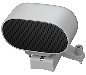
Loudspeaker
Enables effective on-site communication through long-distance live broadcasts and prerecorded audio loops.
Strobe
Indicate the location of the aircraft at night to avoid air traffic accidents.
Autel Smart Controller V3
The Smart Controller V3's
7.9-inch, 2000 nits high-brightness screen is clearly visible under direct sunlight.
SkyLink 2.0 transmission technology guarantees long-distance operations from over 9
miles away and
enhances anti-interference abilities with triple band frequency hopping. The
customized Android system allows for additional flexibility with 3rd party apps and
an IP43 rating ensures
all-weather performance.
-
7.9-Inch HD Touch Screen
-
-4 °F to 104 °F Temperature Range
-
2000 nits Maximum Brightness
-
IP43 Resistance
Applications
-
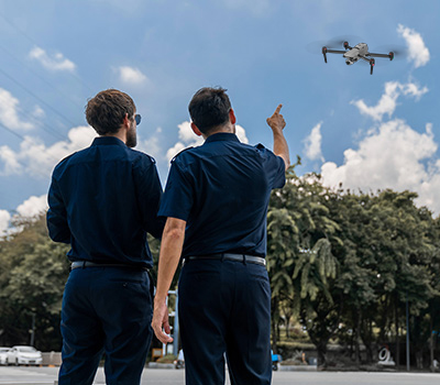
Public Safety
Assess threats from a safe distance, patrol an area during an investigation, or gather intelligence.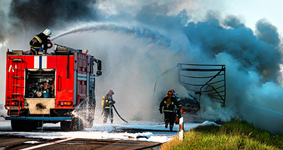
Firefighting
Soar above the flames to identify hotspots, locate victims, and monitor changing conditions, reducing the risk for crew members on the ground. -

Traffic Supervision
Monitor traffic flow over a larger area and crack down on traffic violations to improve safety for everyone on the road.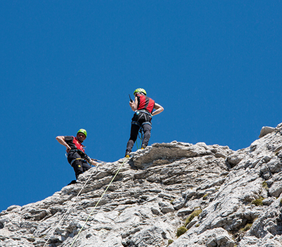
Search and Rescue
Quickly locate missing persons by using automated mission modes to cover larger search areas in situations where every second counts. -

Power Inspection
Zip between transmission towers to quickly spot structural damage or overheating electrical elements, saving time and labor costs.
Mapping
Create cost-effective 3D maps of an area using high-resolution images up to 2cm GSD* with an vertical accuracy of 1cm and a horizontal accuracy of 1.5cm.